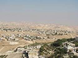
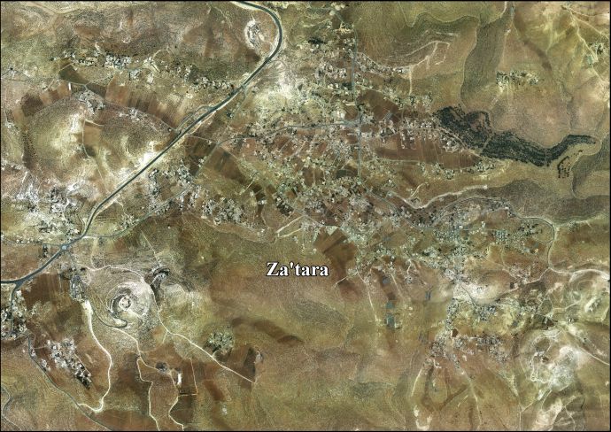
Za'atara
Za'atara (Arabic: زعتره) is a Palestinian town located eleven kilometers southeast of Bethlehem. The town is in the Bethlehem Governorate central West Bank. According to the Palestinian Central Bureau of Statistics, the town had a population of over 6,289 in 2007.[1]
Za'atara | |
|---|---|
Municipality type C | |
| Arabic transcription(s) | |
| • Arabic | زعتره |
 Za'atara | |
 Za'atara Location of Za'atara within Palestine | |
| Coordinates: 31°40′32″N 35°15′20″E | |
| State | State of Palestine |
| Governorate | Bethlehem |
| Government | |
| • Type | Municipality |
| Population (2007) | |
| • Total | 6,289 |
History
In the wake of the 1948 Arab–Israeli War, and after the 1949 Armistice Agreements, Za’atara came under Jordanian rule.
In 1961, under Jordanian rule, the population of Za'atara was 1,003.[2]
Post−1967
Since the Six-Day War in 1967, Za'atara has been held under Israeli occupation. The population in the 1967 census conducted by the Israeli authorities was 1,282.[3]
After the 1995 accords, 0.9% of Za'atara land was classified as Area A, 44% classified as Area B, and 32.6% classified as Area C, while the remaining 22.5% is defined as "nature reserves".[4] Israel has confiscated 20 dunams of village land for the Israeli settlement of El David and 10 dunams for an Israeli Military Base.[5]
References
- 2007 PCBS Census Palestinian Central Bureau of Statistics. p.118.
- Government of Jordan, Department of Statistics, 1964, p. 23
- Perlmann, Joel (November 2011 – February 2012). "The 1967 Census of the West Bank and Gaza Strip: A Digitized Version" (PDF). Levy Economics Institute. Retrieved 24 June 2016.
- Za'tara Town Profile p. 16
- Za'tara Town Profile p. 17
Bibliography
- Government of Jordan, Department of Statistics (1964). First Census of Population and Housing. Volume I: Final Tables; General Characteristics of the Population (PDF).
External links
- Welcome To Za'tara
- Za’atara, Welcome to Palestine
- Za'tara town (fact sheet), Applied Research Institute–Jerusalem (ARIJ)
- Za'tara town profile, ARIJ
- Za'tara aerial photo, ARIJ
- The priorities and needs for development in Za'tara town based on the community and local authorities' assessment, ARIJ
| Cities |  | |
|---|---|---|
| Municipalities | ||
| Villages |
| |
| Religion | ||
| Refugee camps | ||
| Other | ||