Al-Masara
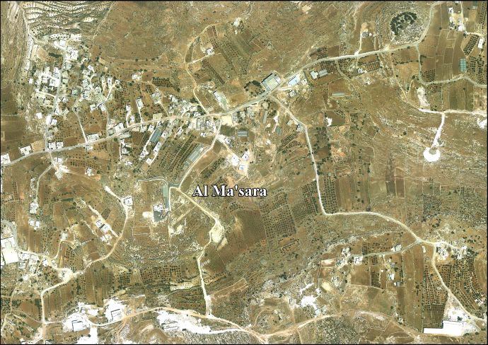
Al-Masara (Arabic: المعصرة, pronounced al-Ma'sara; translation: "the press") is a Palestinian village in the central West Bank, 6.2 km southwest of Bethlehem, part of the Bethlehem Governorate. It is surrounded by a number of smaller Palestinian villages, including Khallet al-Haddad to the east.[2] The population was 803 in the 2007 census by the Palestinian Central Bureau of Statistics (PCBS).[1]
Al-Masara | |
|---|---|
Local Development Committee | |
| Arabic transcription(s) | |
| • Arabic | المعصرة |
| • Latin | Al-Ma'sara (official) |
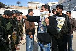 Protest in al-Masara | |
| State | State of Palestine |
| Governorate | Bethlehem |
| Founded | 1930 |
| Government | |
| • Type | Local Development Committee |
| • Head of Municipality | Mahmoud Alaeddin |
| Area | |
| • Total | 973 dunams (1.0 km2 or 0.4 sq mi) |
| Population (2007[1]) | |
| • Total | 803 |
| • Density | 800/km2 (2,100/sq mi) |
| Name meaning | "the press" |
History
Its name, which translates as "the press", derives from the Byzantine Empire-era olive press still located in al-Ma'sara.[2] In 1883 the PEF's Survey of Western Palestine (SWP) noted "heaps of stones and cisterns" at Khurbet Marsia.[3]
The modern town was founded in 1930 by members of the Arab al-Zawahra and at-Ta'mirah tribes.[2]
Modern era
After the Six-Day War in 1967, Al-Masara has been under Israeli occupation.
A seven-member local development committee was established by the Palestinian National Authority (PNA) to administer the village, most which is located in Area B giving the PNA jurisdiction over al-Ma'sara's civil affairs.[2] The head of the committee is Mahmoud Alaeddin.[4]
There is one mosque, al-Ma'sara Mosque, and a primary and secondary school in the village. Agriculture accounts for 70% of al-Ma'sara's economic activity, while the civil sector makes up 16%. The total land area is 973 dunams, of which 42 dunams are designated built-up. Most of the remainder is arable land, 505 dunams of which are cultivated.[2]
References
- 2007 PCBS Census. Palestinian Central Bureau of Statistics. p.117.
- Al-Ma'sara Village Profile. Applied Research Institute-Jerusalem (ARIJ). 2010.
- Conder and Kitchener, 1883, SWP III, p. 359
- Masara Profile. Jerusalem Media and Communications Center (JMCC). 2007-02-09.
Bibliography
- Conder, C.R.; Kitchener, H.H. (1883). The Survey of Western Palestine: Memoirs of the Topography, Orography, Hydrography, and Archaeology. 3. London: Committee of the Palestine Exploration Fund.
- Palmer, E. H. (1881). The Survey of Western Palestine: Arabic and English Name Lists Collected During the Survey by Lieutenants Conder and Kitchener, R. E. Transliterated and Explained by E.H. Palmer. Committee of the Palestine Exploration Fund. (p. 400)
External links
- Welcome To Kh. al-Ma'sara
- Al Ma'sara Village (Fact Sheet), Applied Research Institute–Jerusalem, ARIJ
- Al Ma’sara Village Profile, ARIJ
- Al Ma’sara aerial photo, ARIJ
- Survey of Western Palestine, Map 21: IAA, Wikimedia commons
| Cities |  | |
|---|---|---|
| Municipalities | ||
| Villages |
| |
| Religion | ||
| Refugee camps | ||
| Other | ||