Wooldridge, Missouri
Wooldridge is a village in Cooper County, Missouri, United States. The population was 61 at the 2010 census.
Wooldridge, Missouri | |
|---|---|
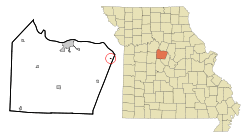 Location of Wooldridge, Missouri | |
| Coordinates: 38°54′23″N 92°31′13″W | |
| Country | United States |
| State | Missouri |
| County | Cooper |
| Area | |
| • Total | 0.06 sq mi (0.16 km2) |
| • Land | 0.06 sq mi (0.16 km2) |
| • Water | 0 sq mi (0 km2) |
| Elevation | 604 ft (184 m) |
| Population | |
| • Total | 61 |
| • Estimate (2016)[3] | 62 |
| • Density | 1,000/sq mi (380/km2) |
| Time zone | UTC-6 (Central (CST)) |
| • Summer (DST) | UTC-5 (CDT) |
| ZIP code | 65287 |
| Area code(s) | 660 |
| FIPS code | 29-81016[4] |
| GNIS feature ID | 0729414[5] |
History
Wooldridge was laid out in 1901.[6] The village was named for Dr. Wooldridge, the original owner of the town site.[7] A post office called Wooldridge has been in operation since 1902.[8]
Geography
Wooldridge is located at 38°54′23″N 92°31′13″W (38.906460, -92.520346).[9]
According to the United States Census Bureau, the village has a total area of 0.06 square miles (0.16 km2), all land.[1]
Demographics
| Historical population | |||
|---|---|---|---|
| Census | Pop. | %± | |
| 1910 | 119 | — | |
| 1920 | 160 | 34.5% | |
| 1930 | 157 | −1.9% | |
| 1940 | 178 | 13.4% | |
| 1950 | 137 | −23.0% | |
| 1960 | 100 | −27.0% | |
| 1970 | 97 | −3.0% | |
| 1980 | 79 | −18.6% | |
| 1990 | 54 | −31.6% | |
| 2000 | 47 | −13.0% | |
| 2010 | 61 | 29.8% | |
| Est. 2016 | 62 | [3] | 1.6% |
| U.S. Decennial Census[10] | |||
2010 census
As of the census[2] of 2010, there were 61 people, 32 households, and 15 families living in the village. The population density was 1,016.7 inhabitants per square mile (392.6/km2). There were 39 housing units at an average density of 650.0 per square mile (251.0/km2). The racial makeup of the village was 96.7% White, 1.6% Native American, and 1.6% from other races. Hispanic or Latino of any race were 11.5% of the population.
There were 32 households of which 21.9% had children under the age of 18 living with them, 25.0% were married couples living together, 15.6% had a female householder with no husband present, 6.3% had a male householder with no wife present, and 53.1% were non-families. 50.0% of all households were made up of individuals. The average household size was 1.91 and the average family size was 2.80.
The median age in the village was 42.8 years. 18% of residents were under the age of 18; 13.2% were between the ages of 18 and 24; 19.7% were from 25 to 44; 46% were from 45 to 64; and 3.3% were 65 years of age or older. The gender makeup of the village was 47.5% male and 52.5% female.
2000 census
As of the census[4] of 2000, there were 47 people, 18 households, and 10 families living in the village. The population density was 761.3 people per square mile (302.4/km²). There were 21 housing units at an average density of 340.1 per square mile (135.1/km²). The racial makeup of the village was 97.87% White, and 2.13% from two or more races.
There were 18 households out of which 38.9% had children under the age of 18 living with them, 44.4% were married couples living together, 11.1% had a female householder with no husband present, and 38.9% were non-families. 27.8% of all households were made up of individuals and 5.6% had someone living alone who was 65 years of age or older. The average household size was 2.61 and the average family size was 3.18.
In the village, the population was spread out with 27.7% under the age of 18, 10.6% from 18 to 24, 34.0% from 25 to 44, 25.5% from 45 to 64, and 2.1% who were 65 years of age or older. The median age was 32 years. For every 100 females, there were 113.6 males. For every 100 females age 18 and over, there were 100.0 males.
The median income for a household in the village was $45,000, and the median income for a family was $45,938. Males had a median income of $25,000 versus $22,500 for females. The per capita income for the village was $13,781. There were 15.4% of families and 29.6% of the population living below the poverty line, including 42.1% of under eighteens and none of those over 64.
References
- "US Gazetteer files 2010". United States Census Bureau. Archived from the original on February 20, 2011. Retrieved 2012-07-08.
- "U.S. Census website". United States Census Bureau. Retrieved 2012-07-08.
- "Population and Housing Unit Estimates". Retrieved June 9, 2017.
- "U.S. Census website". United States Census Bureau. Retrieved 2008-01-31.
- "US Board on Geographic Names". United States Geological Survey. 2007-10-25. Retrieved 2008-01-31.
- "Cooper County Place Names, 1928–1945 (archived)". The State Historical Society of Missouri. Archived from the original on 24 June 2016. Retrieved 24 September 2016.
- Eaton, David Wolfe (1916). How Missouri Counties, Towns and Streams Were Named. The State Historical Society of Missouri. pp. 281.
- "Post Offices". Jim Forte Postal History. Retrieved 24 September 2016.
- "US Gazetteer files: 2010, 2000, and 1990". United States Census Bureau. 2011-02-12. Retrieved 2011-04-23.
- "Census of Population and Housing". Census.gov. Retrieved June 4, 2015.
Municipalities and communities of Cooper County, Missouri, United States | ||
|---|---|---|
| Cities |  Map of Missouri highlighting Cooper County | |
| Villages | ||
| Townships | ||
| Unincorporated communities | ||