Woodmore, Maryland
Woodmore is an unincorporated area and census-designated place (CDP 86710) [1] in Prince George's County, Maryland, United States, located within the boundaries of Route 193 (Enterprise Road) to the west, Church Road to the east, Route 214 (Central Avenue) to the south and Route 50 to the north. Woodmore Road runs east and west through the center.[2] The population of Woodmore (defined by CDP 86710) was 3,936 at the 2010 census.[3] It contains a large gated community and country club (see Country Club at Woodmore) on the north side of Woodmore Road, and the developments of Woodmore Meadows and Woodmore South on the south side, as well as various other custom built homes and farmland. Off Enterprise Road sits the development of Kingsford. It is contiguous with the year 2010 Mitchellville, Maryland CDP, and historically had a Mitchellville mailing address, for many years served by the South Bowie/Mitchellville Post Office with zip code 20721 and has been considered part of Mitchellville. The Woodmore and Mitchellville community is notable as one of the most affluent predominantly African-American communities in the United States.[4]
Woodmore, Maryland | |
|---|---|
| Nickname(s): Mitchellville Area | |
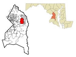 Location of Woodmore, Maryland (2000 map) | |
| Coordinates: 38°56′5″N 76°46′42″W | |
| Country | |
| State | |
| County | |
| Area | |
| • Total | 6.6 sq mi (17.1 km2) |
| • Land | 6.6 sq mi (17.0 km2) |
| • Water | 0.08 sq mi (0.2 km2) |
| Elevation | 164 ft (50 m) |
| Population (2010) | |
| • Total | 3,936 |
| • Density | 600/sq mi (230/km2) |
| Time zone | UTC−5 (Eastern (EST)) |
| • Summer (DST) | UTC−4 (EDT) |
| FIPS code | 24-86710 |
| GNIS feature ID | 0598278 |
The gated community "Woodmore" is centered on a country club; the community is planned to consist of 398 single-family homes on 799 acres (3.2 km2).[5]
Six Flags America is within the boundaries of the CDP.[6][7]
History
The first colonial owner of the Woodmore site was Thomas Spriggs, who in 1698 acquired 500 acres (2.0 km2) of what was then known as the forest of Prince George's County in the Crown Colony of Maryland.
The first house in the area was a two-story brick house named Pleasant Prospect (still standing at 12806 Woodmore Road).,[8] built c. 1798 by Dr. Isaac Ducket, the husband of Spriggs' granddaughter. He also doubled the size of the estate to over 1,000 acres.
Pleasant Prospect was inherited by Ducket's son-in-law, John Contee, and then by his son, also John Contee, who became indebted and sold the estate to the Bowies, then the Washington D.C. lumber magnates the Walkers. Although the Walker family sold the house in 1982,[9] Walker descendants also continued to own land and farm on the south side of Woodmore Road, part of which farmland was sold to create Woodmore Meadows.
In 1981 the Country Club at Woodmore was redesigned and the gated community planned, a process which took 15 years as the seven area homeowner associations eventually merged.[5]
In 2010 the U.S. Census Bureau redefined northern parts of the Woodmore CDP as the new Fairwood CDP.[10][11]
Geography
Woodmore is located at 38°56′5″N 76°46′42″W (38.934861, −76.778202).[12]
According to the United States Census Bureau, the CDP has a total area of 6.6 square miles (17.1 km2), of which 6.6 square miles (17.0 km2) is land and 0.08 square miles (0.2 km2), or 0.96%, is water.[13]
Gated community
The Woodmore gated community has about 400 houses, including single family and townhouses. About 33% of the residents of the gated community are members of the Country Club at Woodmore; the two are, as described by Keisha Stewart of the Washington Post, "intertwined".[14] Stewart described the Woodmore gated community as "one of Prince George's County's premier subdivisions" that "represents prestige and accomplishment for some, while for others it is a serene haven."[14]
In 2005 the range of residences was from $400,000 to $2 million, with townhouses cheaper than single family houses. According to Stewart, in 2005, "$1 million houses [were] not uncommon in Woodmore."[14]
Demographics
| Historical population | |||
|---|---|---|---|
| Census | Pop. | %± | |
| 1990 | 2,874 | — | |
| 2000 | 6,077 | 111.4% | |
| 2010 | 3,936 | −35.2% | |
| source:[3][15] | |||
As of the census[16] of 2000, there were 6,077 people, 1,977 households, and 1,646 families residing in the CDP.[17] The population density was 503.0 people per square mile (194.2/km²). There were 2,019 housing units at an average density of 167.1/sq mi (64.5/km²). The racial makeup of the CDP was 64.9% African American, 28.8% White, 3.0% Asian,0.9% from other races, 0.1% Native American, <0.1% Pacific Islander, and 2.4% from two or more races. Hispanic or Latino of any race were 2.0% of the population.
There were 1,977 households out of which 45.0% had children under the age of 18 living with them, 68.1% were married couples living together, 11.4% had a female householder with no husband present, and 16.7% were non-families. 12.7% of all households were made up of individuals and 1.2% had someone living alone who was 65 years of age or older. The average household size was 3.07 and the average family size was 3.37.
In the CDP, the population was spread out with 28.7% under the age of 18, 6.9% from 18 to 24, 29.9% from 25 to 44, 29.9% from 45 to 64, and 4.6% who were 65 years of age or older. The median age was 38 years. For every 100 females, there were 91.3 males. For every 100 females age 18 and over, there were 86.9 males.
The median income for a household in the CDP was $97,270, and the median income for a family was $103,438. Males had a median income of $65,638 versus $55,324 for females, making it one of the wealthiest majority black jurisdictions in the country. The per capita income for the CDP was $37,734. About 2.0% of families and 3.5% of the population were below the poverty line, including 2.6% of those under age 18 and 6.0% of those age 65 or over.
As of the census of 2012 for CDP 86710,[18] there were 3,936 people of whom 10.5% identified as White, 82.7% as African American or Black, and 3.5% Hispanic or Latino of any race, and 3.4% as more than one race.
Government
Prince George's County Police Department District 2 Station in Brock Hall CDP, with a Bowie postal address, serves the community.[19]
Education
Woodmore CDP is zoned to schools in the Prince George's County Public Schools.[11]
The majority of the 2010-defined CDP is zoned to Woodmore Elementary School, with small sections zoned to Kingsford and Pointers Ridge elementary schools.[20] Most of the CDP is zoned to Ernest Everett Just Middle School, with portions zoned to Benjamin Tasker Middle School.[21] Most of the CDP is zoned to Charles Herbert Flowers High School, with portions zoned to Bowie High School.[22] The gated community is zoned to Woodmore, Just, and Flowers.[14]
Some areas defined as Woodmore CDP in the 1990 and 2000 census are zoned to:[11] Woodmore and Glenn Dale elementary schools,[20] Thomas Johnson, Samuel Ogle, and Tasker middle schools,[21] and DuVal and Bowie high schools.[22]
References
- "Census Geo Map" (PDF).
- "Woodmore Census Designated Place 2010" (PDF). Retrieved 29 June 2014.
- "Profile of General Population and Housing Characteristics: 2010 Demographic Profile Data (DP-1): Woodmore CDP, Maryland". United States Census Bureau. Retrieved December 23, 2011.
- U.S. Geological Survey Geographic Names Information System: Woodmore, Maryland
- Woodmore.org: About Woodmore Archived 2007-09-28 at the Wayback Machine
- "2010 CENSUS - CENSUS BLOCK MAP (INDEX): Woodmore CDP, MD." U.S. Census Bureau. Retrieved on January 13, 2017 Detail map p6.
- "Directions to the Park". Six Flags America. Retrieved June 2, 2015. "13710 Central Avenue, Upper Marlboro, MD 20721."
- (PDF) http://msa.maryland.gov/megafile/msa/stagsere/se1/se5/018000/018800/018893/pdf/msa_se5_18893.pdf. Retrieved 29 June 2014. Missing or empty
|title=(help) - Smith, Delos. "Historic American Buildings Survey, Pleasant Prospect Written Historical and Descriptive Data" (PDF). Historic American Buildings Survey, Engineering Record, Landscapes Survey. Library of Congress. Retrieved 9 December 2015.
- "2010 CENSUS - CENSUS BLOCK MAP: Fairwood CDP, MD." U.S. Census Bureau. Retrieved on August 28, 2018.
- "2010 CENSUS - CENSUS BLOCK MAP (INDEX): Woodmore CDP, MD." U.S. Census Bureau. Retrieved on August 28, 2018. Pages: 1, 2, 3 4 5, and 6. The Census Bureau previously defined the CDP as having a larger area: "CENSUS 2000 BLOCK MAP: WOODMORE CDP." The 1990 Prince George's County map (index map) shows Woodmore CDP on pages 15 and 19.
- "US Gazetteer files: 2010, 2000, and 1990". United States Census Bureau. 2011-02-12. Retrieved 2011-04-23.
- "Geographic Identifiers: 2010 Demographic Profile Data (DP-1): Woodmore CDP, Maryland". United States Census Bureau. Retrieved December 23, 2011.
- Stewart, Keisha (2005-04-02). "On Par With the Good Life in Mitchellville". Washington Post. Retrieved 2018-09-04.
- "CENSUS OF POPULATION AND HOUSING (1790-2000)". U.S. Census Bureau. Retrieved 2010-07-18.
- "U.S. Census website". United States Census Bureau. Retrieved 2008-01-31.
- "year 2000".
- (PDF) http://planning.maryland.gov/msdc/census/cen2010/sf1/sumyprof/profile/CDP/cdp_86710.pdf. Retrieved 29 June 2014. Missing or empty
|title=(help) - "District 2 Station - Bowie." Prince George's County Police Department. Retrieved on September 9, 2018. "District 2 Station - Bowie 601 SW Crain Highway Bowie, MD 20715 ". Beat map. 2010 U.S. Census Bureau index map of Brock Hall CDP as well as the detail on Page 1.
- "NEIGHBORHOOD ELEMENTARY SCHOOLS AND BOUNDARIES SCHOOL YEAR 2018-2019." Prince George's County Public Schools. Retrieved on August 26, 2018.
- "NEIGHBORHOOD MIDDLE SCHOOLS AND BOUNDARIES SCHOOL YEAR 2018-2019." Prince George's County Public Schools. Retrieved on August 26, 2018.
- "NEIGHBORHOOD HIGH SCHOOLS AND BOUNDARIES SCHOOL YEAR 2018-2019." Prince George's County Public Schools. Retrieved on August 26, 2018.
External links
| Wikimedia Commons has media related to Woodmore, Maryland. |
