Winya, Queensland
Winya is a rural locality in the Somerset Region, Queensland, Australia.[2] In the 2016 census, Winya had a population of 72 people.[1]
| Winya Queensland | |||||||||||||||
|---|---|---|---|---|---|---|---|---|---|---|---|---|---|---|---|
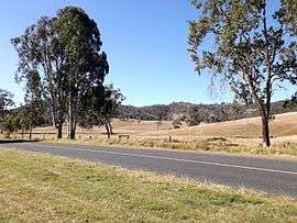 Mount Kilcoy Road, 2015 | |||||||||||||||
 Winya | |||||||||||||||
| Coordinates | 26.9555°S 152.5747°E | ||||||||||||||
| Population | 72 (2016 census)[1] | ||||||||||||||
| • Density | 3.103/km2 (8.04/sq mi) | ||||||||||||||
| Postcode(s) | 4515 | ||||||||||||||
| Area | 23.2 km2 (9.0 sq mi) | ||||||||||||||
| Time zone | AEST (UTC+10:00) | ||||||||||||||
| LGA(s) | Somerset Region | ||||||||||||||
| State electorate(s) | Nanango | ||||||||||||||
| Federal Division(s) | Blair | ||||||||||||||
| |||||||||||||||
Geography
Sandy Creeks marks a section of the eastern boundary and Kilcoy Creek aligns with some of the eastern border. In the south the locality protrudes into the waters of Somerset Dam when it is at full capacity. Kilcoy Weir straddles the boundary with Mount Kilcoy in the north.
The D'Aguilar Highway passes through Winya.
History
Kilcoy Homestead was established in Winya in the 1850s. Settlement in the area had begun as early as 1841.[3]
Economy
The Kilcoy Pastoral Company operates an abattoir in Winya. The facility exports beef to more than 20 countries and employs more than 750 workers making it one the five largest beef processors in the country.[4]
References
- Australian Bureau of Statistics (27 June 2017). "Winya (SSC)". 2016 Census QuickStats. Retrieved 20 October 2018.

- "Winya - locality in Somerset Region (entry 44931)". Queensland Place Names. Queensland Government. Retrieved 17 November 2019.
- "Kilcoy Homestead (entry 600638)". Queensland Heritage Register. Queensland Heritage Council. Retrieved 21 August 2015.
- Ally Marotti (16 December 2014). "Investor hopes to expand Chicago's oldest beef processor". Crain's Chicago Business. Crain Communication. Retrieved 21 August 2015.
External links
![]()