Winburn, Lexington
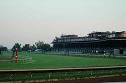
Winburn is a neighborhood in northeast Lexington, Kentucky, United States. Its boundaries are I-75/ I-64 to the north, Newtown Pike to the west, Citation Boulevard to the south, and Russell Cave Road to the east. The smaller Griffin Gate neighborhood is typically included as part of Winburn.[1]
Winburn | |
|---|---|
Neighborhood of Lexington, Kentucky | |
| Coordinates: 38.088°N 84.476°W | |
| Country | United States |
| State | Kentucky |
| County | Fayette |
| City | Lexington |
| Area | |
| • Total | 0.423 sq mi (1.10 km2) |
| • Water | 0.0 sq mi (0.0 km2) |
| Population (2000) | |
| • Total | 1,424 |
| • Density | 3,356/sq mi (1,296/km2) |
| Time zone | UTC-5 (Eastern (EST)) |
| • Summer (DST) | UTC-4 (EDT) |
| ZIP code | 40511 |
| Area code(s) | 859 |
Neighborhood statistics
- Area: 0.423 square miles (1.10 km2)
- Population: 1,424
- Population density: 3,356 people per square mile
- Median household income: $31,797[1]
References
- Winburn Neighborhood Profile Retrieved 2014-06-04.


This article is issued from Wikipedia. The text is licensed under Creative Commons - Attribution - Sharealike. Additional terms may apply for the media files.