Whatawhata
Whatawhata, previously also spelt Whata Whata, is a small town in the Waikato region on the east bank of the Waipa River, at the junction of State Highways 23 and 39, 12 km (7.5 mi) from Hamilton. Te Araroa Trail passes through Whatawhata.[1]

Whatawhata | |
|---|---|
Township | |
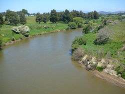 from SH23 bridge | |
 Whatawhata | |
| Coordinates: 37°48′S 175°09′E | |
| Country | New Zealand |
| Region | Waikato region |
| District | Waikato District |
| Elevation | 20 m (70 ft) |
| Population (2013 census) | |
| • Territorial | 2,475 |
| Time zone | UTC+12 (NZST) |
| • Summer (DST) | UTC+13 (NZDT) |
History and culture
Pre-European history
Whatawhata was a Ngāti Māhanga village[2] and there are still Te Papa-o-Rotu and Omaero maraes on the west bank of the river.[3] In early colonial times Whatawhata was one of many sites in Waikato with a flour mill.[4] It was built in 1855[5] and producing flour by the end of that year.[6] The area must have been suited to wheat, for there was another mill about 4 km (2.5 mi) downstream, at Karakariki, by 1860.[7]
European settlement
British troops arrived at Whatawhata over land and by river, as part of the Invasion of the Waikato, on 28 December 1863.[8] Whatawhata was described as having no end of peach trees, which the soldiers stripped of their fruit.[9] Within a year a telegraph line had been built.[10]
A 1915 guide described Whatawhata as, "six miles from Frankton Junction, along a good metalled road. Coaches run to and from Frankton Junction daily, the fares being 2/- single and 3/6 return. The principal industries are farming and dairying. There is one hotel in the township, also school, and post and telegraph office. Small steamers ply up and down the river from Huntly, the waters being navigable as far up as Pirongia. Whatawhata was in the early days an important Maori centre, having at one time a native population of over a thousand."[11]
Since then the post office has been replaced by a petrol station and dairy, the coach has become 4 per day and the river is rarely disturbed by any craft. Also the AgResearch hill-country research station at Whatawhata was started in 1949.[12]
Across the road from AgResearch, Campbell Coal Ltd developed a coal mine in 1920, was advertising for about 10 tons a day to be carried to Hamilton in 1921[13][14][15] and had it fully open by 1923.[16] It produced 9,272 tons in 1945 from a 10 ft (3.0 m) seam, employing 6 miners and 5 surface workers.[17] Hallyburton Johnstone said there was never a strike at the mine.[18] The coal was sub-bituminous with a fairly high calorific value, but was largely worked out by the 1970s,[19] when Hamilton gasworks closed.[20] 2.9m tons is estimated to be still recoverable.[21]
An 1880 guide said, "It is about ten miles distant from Hamilton, but a sum of money has been voted for making a direct road through a large swamp, which will bring the Hamilton station within six miles of the township. The road to Raglan crosses the, Waipa river here, and a bridge will shortly be built, when the ferry, which is now worked by natives, will be done away with. Heavy goods, such as timber, wire and manure, are brought up by the Waikato Steam Navigation Company's steamers. . . There is a convenient school in the township, where there is an average attendance of nearly forty children. The school-house and teacher's residence, erected a short time ago (1877) by the Board of Education, the settlers contributing largely towards them, are excellent buildings . . . two stores, a bakery, and comfortable hotel. Of this last Mr. G. T. M. Kellow is proprietor. He has good accommodation and stabling, and keeps excellent liquors . . . Mr,W. H. Bailey has a general store and bakery. . . convenient to the Raglan and Whatawhata bridge site. . . Mr. Day has a farm| of 1,000 acres . . . five acres in oats and the same in mangold . . . wheat thirty acres . . . a large dairy . . . pigs . . . trees are kahikatea and rimu, with a little matai . . . Whatawhata racecourse . . . runs right round the township"[22]
A post office opened in 1868, burnt down in 1913 and was rebuilt in 1915.[23]
Marae
Whatawhata has two marae, affiliated with the Waikato Tainui hapū of Ngāti Māhanga and Ngāti Hourua:[24] Omaero Marae and its Te Awaitaia meeting house, and Te Papa o Rotu Marae / Te Oneparepare Marae and its Papa o Rotu meeting house.[25]
Demographics
The Whatawhata area (which extends to the river, Te Kowhai, Hamilton and Ngāhinapōuri boundaries) had these census figures.[26]
| Year | Population | Households | Average income | NZ average | Waikato average |
|---|---|---|---|---|---|
| 2001 | 1,650 | 537 | $25,100 | $18,500 | $18,000 |
| 2006 | 2,064 | 678 | $32,200 | $24,400 | $24,100 |
| 2013 | 2,475 | 831 | $37,900 | $28,500 | $27,900 |
The 2018 census used different boundaries, with a 2018 population of 2,763 in Whatawhata East, up from 2,214 in 2013.[27] Whatawhata's village area had a 2018 population of 303 (of whom 111 were Māori), up from 273 in 2013.[28]
Education
Whatawhata School is a co-educational state primary school for Year 1 to 8 students,[29][30] with a roll of as of March 2020.[31]
See also
Neighbouring areas | |
|---|---|
References
- "Waipa Walk". www.teararoa.org.nz. Retrieved 12 June 2019.
- Boulton, Leanne (August 2011). "Hapu and Iwi Land Transactions with the Crown and Europeans in Te Rohe Potae Inquiry District, c. 1840 – 1865" (PDF). Waitangi Tribunal.
- Collins, Adelaide (2005). "Te Papa-O-Rotu Marae Management and Administration" (PDF). researchcommons.waikato.ac.nz. Retrieved 30 December 2018.
- "Journal of the Polynesian Society: Maori Flour Mills Of The Auckland Province, 1846–1860, By R. P. Hargreaves, P 227-232". www.jps.auckland.ac.nz. Retrieved 23 April 2017.
- "MAORI MILLS. (Maori Messenger : Te Karere Maori, 1855-03-01)". paperspast.natlib.govt.nz National Library of New Zealand. Retrieved 23 April 2017.
- "KORERO O TE POITINI TE KAI TITIRO I NGA MIRA MAORI. (Maori Messenger : Te Karere Maori, 1855-12-01)". paperspast.natlib.govt.nz National Library of New Zealand. Retrieved 23 April 2017.
- "THE ACQUISITION OF NATIVE LANDS. To the Editor of the Southern Cross. (Daily Southern Cross, 1860-02-14)". paperspast.natlib.govt.nz National Library of New Zealand. Retrieved 23 April 2017.
- "THE ADVANCE FROM NGARUAWAHIA TO WHATA WHATA. (Press, 1864-01-14)". paperspast.natlib.govt.nz. Retrieved 13 January 2018.
- "WHATA WHATA. (Press, 1864-01-30)". paperspast.natlib.govt.nz. Retrieved 13 January 2018.
- "ELECTRIC TELEGRAPH IN AUCKLAND (Daily Southern Cross, 1864-10-11)". paperspast.natlib.govt.nz. Retrieved 13 January 2018.
- The Raglan and Kawhia Districts: E. Bradbury & Co. 1915
- http://www.teara.govt.nz/en/waikato-region/page-9
- "The Geology of the Whatawhata District, South-West Auckland". Transactions of the Royal Society of New Zealand : Geology. 5 (5): 1. 21 July 1967.
- "Trouble Ahead". Waikato Times. 30 September 1920. p. 5. Retrieved 22 April 2018.
- "Page 14 Advertisements Column 1". Auckland Star. 3 July 1922. p. 14. Retrieved 22 April 2018.
- "Whatawhata Coal Mine". New Zealand Herald. 1923. p. 6. Retrieved 22 April 2018.
- "AtoJs Online — Appendix to the Journals of the House of Representatives — 1946 Session I — C-02 Page 52". atojs.natlib.govt.nz. Retrieved 22 April 2018.
- Representatives, New Zealand Parliament House of (1955). Parliamentary Debates.
- Kear, David (1967). "ECONOMIC GEOLOGY OF THE WAIKATO" (PDF).
- "Hamilton Gasworks". Waikato Regional Council. Retrieved 22 April 2018.
- Edbrooke, Steve. "Mineral Commodity Report 18 - Coal" (PDF). MBIE - Institute of Geological and Nuclear Sciences Ltd.
- DESCRIPTIVE HANDBOOK TO THE WAIKATO ITS CONDITION AND RESOURCES: 1880 WAIKATO TIMES page 18
- "WHATAWHATA POST OFFICE (Waikato Times, 1915-05-31)". paperspast.natlib.govt.nz National Library of New Zealand. Retrieved 18 June 2017.
- "Te Kāhui Māngai directory". tkm.govt.nz. Te Puni Kōkiri.
- "Māori Maps". maorimaps.com. Te Potiki National Trust.
- "2013 Census map – QuickStats about a place". www.stats.govt.nz. Retrieved 12 March 2016.
- "Story Map Series". statsnz.maps.arcgis.com. Retrieved 1 March 2020.
- "Age and sex by ethnic group (grouped total response), for census usually resident population counts, 2006, 2013, and 2018 Censuses (urban rural areas)". nzdotstat.stats.govt.nz. Retrieved 1 March 2020.
- "Official School Website". whatawhata.school.nz.
- "Ministry of Education School Profile". educationcounts.govt.nz. Ministry of Education.
- "Education Review Office Report". ero.govt.nz. Education Review Office.