Westmoreland, Tennessee
Westmoreland is a town in Sumner County, Tennessee. The population was 2,093 at the 2000 census and 2,206 at the 2010 census. The town name originates from the historic English county Westmorland, now part of Cumbria.[7]
Westmoreland, Tennessee | |
|---|---|
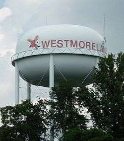 Watertower in Westmoreland | |
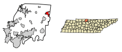 Location of Westmoreland in Sumner County, Tennessee. | |
| Coordinates: 36°33′41″N 86°14′50″W | |
| Country | United States |
| State | Tennessee |
| County | Sumner |
| Incorporated | 1901[1] |
| Named for | Westmorland, England[2] |
| Area | |
| • Total | 4.20 sq mi (10.87 km2) |
| • Land | 4.18 sq mi (10.83 km2) |
| • Water | 0.02 sq mi (0.05 km2) |
| Elevation | 925 ft (282 m) |
| Population (2010) | |
| • Total | 2,206 |
| • Estimate (2018)[4] | 2,421 |
| • Density | 579.19/sq mi (223.65/km2) |
| Time zone | UTC-6 (Central (CST)) |
| • Summer (DST) | UTC-5 (CDT) |
| ZIP code | 37186 |
| Area code(s) | 615 |
| FIPS code | 47-79420[5] |
| GNIS feature ID | 1304492[6] |
| Website | westmorelandtn.gov |
Geography
Westmoreland is located at 36°33′41″N 86°14′50″W (36.561306, -86.247123).[8]
According to the United States Census Bureau, the town has a total area of 3.8 square miles (9.8 km2), of which 3.8 square miles (9.8 km2) is land and 0.04 square miles (0.10 km2) (0.52%) is water.
Demographics
| Historical population | |||
|---|---|---|---|
| Census | Pop. | %± | |
| 1960 | 865 | — | |
| 1970 | 1,423 | 64.5% | |
| 1980 | 1,754 | 23.3% | |
| 1990 | 1,726 | −1.6% | |
| 2000 | 2,093 | 21.3% | |
| 2010 | 2,206 | 5.4% | |
| Est. 2018 | 2,421 | [4] | 9.7% |
| Sources:[9][10] | |||
At the 2000 census there were 2,093 people, 804 households, and 561 families in the town. The population density was 547.5 people per square mile (211.5/km2). There were 874 housing units at an average density of 228.6 per square mile (88.3/km2). The racial makeup of the town was 98.85% White, 0.55% African American, 0.24% Native American, 0.05% Asian, 0.05% Pacific Islander, 0.29% from other races, and 0.48% from two or more races. Hispanic or Latino of any race were 0.13%.[5]
Of the 804 households 34.7% had children under the age of 18 living with them, 54.4% were married couples living together, 11.3% had a female householder with no husband present, and 30.2% were non-families. 27.1% of households were one person and 14.6% were one person aged 65 or older. The average household size was 2.48 and the average family size was 3.01.
The age distribution was 25.3% under the age of 18, 8.3% from 18 to 24, 26.9% from 25 to 44, 22.5% from 45 to 64, and 17.0% 65 or older. The median age was 36 years. For every 100 females, there were 80.6 males. For every 100 females age 18 and over, there were 77.4 males.
The median household income was $28,958 and the median family income was $36,944. Males had a median income of $25,795 versus $19,366 for females. The per capita income for the town was $13,185. About 8.7% of families and 13.2% of the population were below the poverty line, including 13.7% of those under age 18 and 17.6% of those age 65 or over.
Gallery
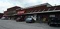 Business District of Westmoreland
 Another view of the Business District of Westmoreland
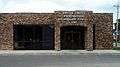 Post office in Westmoreland
References
- Tennessee Blue Book, 2005-2006, pp. 618-625.
- Nancy Capace, Encyclopedia of Tennessee (North American Book Distributors, 2000), p. 229.
- "2018 U.S. Gazetteer Files". United States Census Bureau. Retrieved February 23, 2020.
- "Population and Housing Unit Estimates". United States Census Bureau. June 27, 2019. Retrieved June 4, 2019.
- "U.S. Census website". United States Census Bureau. Retrieved 2008-01-31.
- "US Board on Geographic Names". United States Geological Survey. 2007-10-25. Retrieved 2008-01-31.
- "Westmoreland Community Profile". Retrieved 2008-08-12.
- "US Gazetteer files: 2010, 2000, and 1990". United States Census Bureau. 2011-02-12. Retrieved 2011-04-23.
- "Census of Population and Housing: Decennial Censuses". United States Census Bureau. Retrieved 2012-03-04.
- "Incorporated Places and Minor Civil Divisions Datasets: Subcounty Resident Population Estimates: April 1, 2010 to July 1, 2012". Population Estimates. U.S. Census Bureau. Retrieved 11 December 2013.
External links
Municipalities and communities of Sumner County, Tennessee, United States | ||
|---|---|---|
| Cities | Sumner County map | |
| Town | ||
| CDPs | ||
| Unincorporated communities | ||
| Footnotes | ‡This populated place also has portions in an adjacent county or counties | |
| Authority control |
|---|