Washington State Route 108
State Route 108 (SR 108, also known as the Old Olympic Highway)[3] is a state highway in Grays Harbor and Mason counties, of the U.S. state of Washington. It extends 20.67 miles (33.27 km) from SR 8 in the city of McCleary, east to an interchange with U.S. Route 101 (US 101) in Kamilche. The route serves as a bypass and connects McCleary with Shelton, and Port Angeles.
| ||||
|---|---|---|---|---|
| Old Olympic Highway | ||||
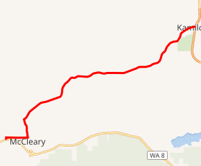
SR 108 highlighted in red | ||||
| Route information | ||||
| Auxiliary route of US 101 | ||||
| Defined by RCW 47.17.195 | ||||
| Maintained by WSDOT | ||||
| Length | 11.96 mi[1] (19.25 km) | |||
| Existed | 1964[2]–present | |||
| Major junctions | ||||
| West end | ||||
| East end | ||||
| Location | ||||
| Counties | Grays Harbor, Mason | |||
| Highway system | ||||
| ||||

The highway was Secondary State Highway 9D (SSH 9D) from 1937 until 1964, which ran from McCleary to Kamilche.
Route description
SR 108 runs 11.96 miles (19.25 km) east from SR 8 in McCleary to an interchange with US 101 in Kamilche. The route serves as a bypass and connects McCleary with Shelton, and Port Angeles.[4][5] WSDOT has found that more than 11,000 motorists utilize the road daily before the interchange with US 101 based on average annual daily traffic (AADT) data.[6]
SR 108 starts at an intersection with SR 8 west of Downtown McCleary. From the intersection, the road briefly goes north before turning east onto Simpson Avenue into Downtown McCleary. Simpson Avenue goes into McCleary and comes to a 3-way intersection with Main Street at Beerbower Park. SR 108 then turns onto Main Street and becomes Summit Road, passing Lake Clara before leaving Downtown McCleary. After passing Hillgrove, the highway enters McCleary Junction and turns northeast to parallel the Puget Sound and Pacific Railroad.[4][7]
At the intersection with Elma Hicklin Road, the road stops paralleling the railroad and continues northeast into Mason County. In Stimson, the railroad starts to parallel the highway, but after that, the railroad curves back, and stops paralleling SR 108. North of Forbes, the highway crosses the railroad and then enters Kamilche,[4] where the road ends at an interchange with US 101.[3]
History

When the Primary and Secondary Highways were formed in 1937, the current SR 108 became Secondary State Highway 9D (SSH 9D).[8] SSH 9D became SR 108 in 1964 during the 1964 highway renumbering, in which the Washington State Department of Transportation (WSDOT) replaced the previous system of Primary and Secondary Highways with a new system called State Routes, which is still in use today.[9][10]
Originally, a 1.25 mile northern bypass of McCleary, extending northeast from the existing SR 108 Elma McCleary Rd Intersection to the SR 108 Summit Road Intersection was proposed during construction of Secondary State Highway 9D. This route would have been a limited access, full control 2-lane highway. However, beyond establishing a roadway centerline, no further action by WSDOT has been taken to complete this bypass.
In early 2017, the intersection of SR 8 and SR 108 was temporarily closed for two years while a major $14 Million fish passage barrier replacement project on SR 8 is completed, which will install 4 new bridges over the Middle and East Fork's of Wildcat Creek. During the closure, drivers are being detoured down 3rd Street to the SR 8 / Mox Chehalis Rd Interchange just south of McCleary. The SR 8 / SR 108 intersection is expected to be open again in mid 2019.
Major intersections
| County | Location | mi[1] | km | Destinations | Notes |
|---|---|---|---|---|---|
| Grays Harbor | McCleary | 0.000 | 0.000 | ||
| Mason | Kamilche | 11.96 | 19.25 | ||
| 1.000 mi = 1.609 km; 1.000 km = 0.621 mi | |||||
References
- Washington State Department of Transportation. "State Highway Log, 2006" (PDF). Retrieved November 10, 2008.
- Washington State Legislature. "RCW 47.17.195: State Route 108". Retrieved November 10, 2008.
- Washington State Department of Transportation (May 1, 2007). "SR 101/SR 108/Old Olympic Highway" (PDF). Retrieved November 10, 2008.
- Google (October 18, 2015). "State Route 108" (Map). Google Maps. Google. Retrieved October 18, 2015.
- The Road Atlas (Map). Rand McNally. 2008. p. 108. § H5. ISBN 0-528-93961-0.
- Washington State Department of Transportation (2007). "Washington Annual Average Daily Traffic Data" (PDF). Retrieved November 10, 2008.
- Official State Highway Map (PDF) (Map) (2008-2009 ed.). 1:842,000. Official State Highway Maps. Cartography by U.S. Geological Survey. Olympia, Washington: Washington State Department of Transportation. 2008. § E2. Retrieved November 10, 2008.
- Washington State Legislature (1937). "190". Session Laws of the State of Washington. Session Laws of the State of Washington (1937 ed.). Olympia, Washington: Washington State Legislature. Retrieved October 19, 2008.
- C. G. Prahl, Washington State Highway Commission (December 1, 1965). "Identification of State Highways, Part 1" (PDF).
- C. G. Prahl, Washington State Highway Commission (December 1, 1965). "Identification of State Highways, Part 2" (PDF).