Warsaw Township, Jefferson County, Pennsylvania
Warsaw Township is a township in Jefferson County, Pennsylvania, in the United States. As of the 2010 census, the township population was 1,424.[3] It was named after Warsaw, the capital of Poland.[4]
Warsaw Township, Pennsylvania | |
|---|---|
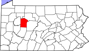
 Map of Jefferson County, Pennsylvania Highlighting Warsaw Township | |
 Map of Jefferson County, Pennsylvania | |
| Country | United States |
| State | Pennsylvania |
| County | Jefferson |
| Settled | 1800 |
| Incorporated | 1842 |
| Government | |
| • Type | Township of the Second Class, having a board of three supervisors |
| Area | |
| • Total | 51.50 sq mi (133.39 km2) |
| • Land | 51.28 sq mi (132.82 km2) |
| • Water | 0.22 sq mi (0.57 km2) |
| Population (2010) | |
| • Total | 1,424 |
| • Estimate (2018)[2] | 1,376 |
| • Density | 27.03/sq mi (10.43/km2) |
| Time zone | UTC-5 (Eastern (EST)) |
| • Summer (DST) | UTC-4 (EDT) |
| FIPS code | 42-065-81120 |
Geography
The township is in north-central Jefferson County, northeast of Brookville, the county seat, and west of Brockway. Unincorporated communities in the township include Warsaw, Hazen, Richardsville, Allens Mills, Egypt, and Reitz.
According to the United States Census Bureau, Warsaw township has a total area of 51.5 square miles (133.4 km2), of which 51.3 square miles (132.8 km2) are land and 0.2 square miles (0.6 km2), or 0.43%, are water.[3] North Fork Creek crosses the northern and western parts of the township, and Mill Creek forms the southeastern border. Both creeks are part of the Redbank Creek watershed, flowing west to the Allegheny River.
Demographics
| Historical population | |||
|---|---|---|---|
| Census | Pop. | %± | |
| 1850 | 870 | — | |
| 1860 | 933 | 7.2% | |
| 1870 | 1,122 | 20.3% | |
| 1880 | 1,414 | 26.0% | |
| 1890 | 1,567 | 10.8% | |
| 1900 | 1,563 | −0.3% | |
| 1910 | 1,256 | −19.6% | |
| 1920 | 1,082 | −13.9% | |
| 1930 | 919 | −15.1% | |
| 1940 | 992 | 7.9% | |
| 1950 | 911 | −8.2% | |
| 1960 | 976 | 7.1% | |
| 1970 | 1,004 | 2.9% | |
| 1980 | 1,169 | 16.4% | |
| 1990 | 1,213 | 3.8% | |
| 2000 | 1,346 | 11.0% | |
| 2010 | 1,424 | 5.8% | |
| Est. 2018 | 1,376 | [2] | −3.4% |
| U.S. Decennial Census[5] | |||
At the 2000 census there were 1,346 people in 517 households, including 396 families, in the township. The population density was 26.2 people per square mile (10.1/km²). There were 746 housing units at an average density of 14.5/sq mi (5.6/km²). The racial makeup of the township was 98.74% White, 0.67% Native American, 0.30% Asian, and 0.30% from two or more races. Hispanic or Latino of any race were 0.45%.[6]
There were 517 households, 31.5% had children under the age of 18 living with them, 67.3% were married couples living together, 6.8% had a female householder with no husband present, and 23.4% were non-families. 20.7% of households were made up of individuals, and 7.4% were one person aged 65 or older. The average household size was 2.60 and the average family size was 3.01.
The age distribution was 24.7% under the age of 18, 8.0% from 18 to 24, 27.9% from 25 to 44, 25.5% from 45 to 64, and 13.9% 65 or older. The median age was 39 years. For every 100 females, there were 105.2 males. For every 100 females age 18 and over, there were 103.4 males.
The median household income was $32,917 and the median family income was $39,438. Males had a median income of $26,927 versus $18,971 for females. The per capita income for the township was $14,487. About 8.5% of families and 9.4% of the population were below the poverty line, including 8.4% of those under age 18 and 11.1% of those age 65 or over.
References
- "2016 U.S. Gazetteer Files". United States Census Bureau. Retrieved Aug 14, 2017.
- Bureau, U. S. Census. "U.S. Census website". United States Census Bureau. US Census Bureau. Retrieved 30 November 2019.
- "Geographic Identifiers: 2010 Census Summary File 1 (G001): Warsaw township, Jefferson County, Pennsylvania". American Factfinder. U.S. Census Bureau. Archived from the original on February 13, 2020. Retrieved November 19, 2018.
- McKnight, William James (1917). Historical. J.H. Beers. p. 481.
- "Census of Population and Housing". Census.gov. Retrieved June 4, 2016.
- "U.S. Census website". United States Census Bureau. Retrieved 2008-01-31.
Municipalities and communities of Jefferson County, Pennsylvania, United States | ||
|---|---|---|
| Boroughs | | |
| Townships | ||
| CDP | ||
| Unincorporated communities |
| |
| Footnotes | ‡This populated place also has portions in an adjacent county or counties | |