Warrensburg, Illinois
Warrensburg is a village in Macon County, Illinois, United States whose population was 1,201 at the 2010 census, and 1,134 in 2018. It is included in the Decatur, Illinois Metropolitan Statistical Area. Warrensburg was established in 1841.
Warrensburg | |
|---|---|
Village | |
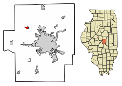 Location of Warrensburg in Macon County, Illinois. | |
.svg.png) Location of Illinois in the United States | |
| Coordinates: 39°55′52″N 89°3′41″W | |
| Country | United States |
| State | Illinois |
| County | Macon |
| Area | |
| • Total | 0.69 sq mi (1.79 km2) |
| • Land | 0.69 sq mi (1.79 km2) |
| • Water | 0.00 sq mi (0.00 km2) |
| Elevation | 700 ft (200 m) |
| Population (2010) | |
| • Total | 1,210 |
| • Estimate (2018)[2] | 1,134 |
| • Density | 1,671.99/sq mi (645.37/km2) |
| Time zone | UTC-6 (CST) |
| • Summer (DST) | UTC-5 (CDT) |
| ZIP Code(s) | 62573 |
| Area code(s) | 217 |
| FIPS code | 17-78916 |
| Wikimedia Commons | Warrensburg, Illinois |
| Website | warrensburgillinois |
Geography
Warrensburg is located at 39°55′52″N 89°3′41″W (39.931102, -89.061326).[3]
According to the 2010 census, Warrensburg has a total area of 0.69 square miles (1.79 km2), all land.[4]
Demographics
| Historical population | |||
|---|---|---|---|
| Census | Pop. | %± | |
| 1900 | 503 | — | |
| 1910 | 504 | 0.2% | |
| 1920 | 490 | −2.8% | |
| 1930 | 517 | 5.5% | |
| 1940 | 456 | −11.8% | |
| 1950 | 549 | 20.4% | |
| 1960 | 681 | 24.0% | |
| 1970 | 811 | 19.1% | |
| 1980 | 1,372 | 69.2% | |
| 1990 | 1,274 | −7.1% | |
| 2000 | 1,289 | 1.2% | |
| 2010 | 1,210 | −6.1% | |
| Est. 2018 | 1,134 | [2] | −6.3% |
| U.S. Decennial Census[5] | |||
As of the census[6] of 2000, there were 1,289 people, 500 households, and 364 families residing in the village. The population density was 1,900.6 people per square mile (731.9/km²). There were 527 housing units at an average density of 777.0 per square mile (299.2/km²). The racial makeup of the village was 97.67% White, 0.62% African American, 0.31% Native American, 0.23% Asian, 0.08% from other races, and 1.09% from two or more races. Hispanic or Latino of any race were 0.47% of the population.
There were 500 households out of which 35.8% had children under the age of 18 living with them, 58.6% were married couples living together, 10.2% had a female householder with no husband present, and 27.2% were non-families. 22.4% of all households were made up of individuals and 7.8% had someone living alone who was 65 years of age or older. The average household size was 2.56 and the average family size was 3.03.
In the village, the population was spread out with 27.0% under the age of 18, 8.2% from 18 to 24, 31.1% from 25 to 44, 25.0% from 45 to 64, and 8.7% who were 65 years of age or older. The median age was 35 years. For every 100 females, there were 95.0 males. For every 100 females age 18 and over, there were 97.3 males.
The median income for a household in the village was $45,708, and the median income for a family was $51,458. Males had a median income of $40,341 versus $22,688 for females. The per capita income for the village was $19,041. About 2.4% of families and 3.7% of the population were below the poverty line, including 3.5% of those under age 18 and 2.2% of those age 65 or over.
Notable people
- John L. Rotz, Hall of Fame jockey, winner of 1970 Belmont Stakes
- Margie Wright, softball coach and Hall of Famer
References
- "2016 U.S. Gazetteer Files". United States Census Bureau. Retrieved Jun 30, 2017.
- "Population and Housing Unit Estimates". Retrieved February 9, 2020.
- "US Gazetteer files: 2010, 2000, and 1990". United States Census Bureau. 2011-02-12. Retrieved 2011-04-23.
- "G001 - Geographic Identifiers - 2010 Census Summary File 1". United States Census Bureau. Archived from the original on 2020-02-13. Retrieved 2015-12-25.
- "Census of Population and Housing". Census.gov. Retrieved June 4, 2015.
- "U.S. Census website". United States Census Bureau. Retrieved 2008-01-31.
Municipalities and communities of Macon County, Illinois, United States | ||
|---|---|---|
| Cities | Map of Illinois highlighting Macon County | |
| Villages | ||
| Townships | ||
| CDP | ||
| Other unincorporated communities |
| |
| Ghost towns |
| |
| Authority control |
|
|---|