Ward No. 9, Kolkata Municipal Corporation
Ward No. 9, Kolkata Municipal Corporation is an administrative division of Kolkata Municipal Corporation in Borough No. 1, covering parts of Shobhabazar and Kumortuli neighbourhoods in North Kolkata, in the Indian state of West Bengal.
Ward No. 9 | |
|---|---|
Kolkata Municipal Corporation | |
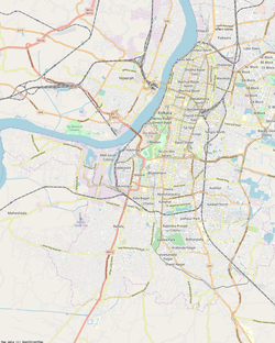 Ward No. 9 Location in Kolkata | |
| Coordinates: 22.595889°N 88.365306°E | |
| Country | |
| State | West Bengal |
| City | Kolkata |
| Neighbourhoods covered | Shobhabazar, Kumortuli |
| Parliamentary constituency | Kolkata Uttar |
| Assembly constituency | Shyampukur |
| Burough | 1 |
| Population (2011) | |
| • Total | 16,420 |
| Time zone | UTC+5:30 (IST) |
| PIN | 700 004 |
| Area code(s) | +91 33 |
 |
| Ward No. 9 in Kolkata |
History
Attempts were made to establish a municipal corporation at Kolkata from the middle of the 19th century. The electoral system was introduced for the first time in 1847, and 4 of the 7 board members were elected by the rate payers. In 1852 the board was replaced by a new one and in 1863 a new body was formed. As per old records, in 1872 there were 25 wards in Kolkata (spellings as in use at that time) – 1. Shyampukur, 2. Kumartuli, 3. Bartala, 4. Sukea Street, 5. Jorabagan, 6. Jorasanko, 7. Barabazar, 8. Kolutola, 9. Muchipara, 10. Boubazar, 11. Padmapukur, 12. Waterloo Street, 13. Fenwick Bazar, 14. Taltala, 15. Kalinga, 16. Park Street, 17. Victoria Terrace, 18. Hastings, 19. Entali, 20. Beniapukur, 21. Baliganj-Tollyganj, 22. Bhabanipur, 23. Alipur, 24.Ekbalpur and 25. Watganj. A new municipal corporation was created in 1876, wherein 48 commissioners were elected and 24 were appointed by the government. With the implementation of the Municipal Consolidation Act of 1888 the area under the jurisdiction of the municipal corporation was enlarged. Certain areas were already there but more parts of them were added (current spellings) - Entally, Manicktala, Beliaghata, Ultadanga, Chitpur, Cossipore, Beniapukur, Ballygunge, Watganj and Ekbalpur, and Garden Reach and Tollygunj. The Act of 1923 brought about important changes. It liberalised the constitution along democratic lines.[1][2]
The state government superseded the Corporation in 1948 and the Calcutta Municipal Act of 1951 came into force. Adult franchise was introduced in municipal elections in 1962. With the addition of certain areas in the southern parts of the city, the number of wards increased from 75 to 144.[3]
Geography
Ward No. 9 is bordered on the north by Kumartuli Street, Durga Charan Banerjee Street, Raja Nabakrishna Street and Shyambazar Street; on the east by Sobhabazr Street and Sri Aurobindo Sarani; on the south by Jyotindra Mohan Avenue, Rabindra Sarani and Gopeswar Paul Avenue; and on the west by the Hooghly River.[4][5]
The ward is served by Shaympukur police station of Kolkata Police.[6][7][8]
Amherst Street Women police station covers all police districts under the jurisdiction of the North and North Suburban division of Kolkata Police, i.e. Amherst Street, Jorabagan, Shyampukur, Cossipore, Chitpur, Sinthi, Burtolla and Tala.[6]
Demographics
As per 2011 Census of India Ward No. 9, Kolkata Municipal Corporation had a total population of 16,420, of which 8,573 (52%) were males and 7,847 (48%) were females. Population below 6 years was 1,033. The total number of literates in Ward No. 9 was 14,094 (91.60% of the population over 6 years).[9]
Kolkata is the second most literate district in West Bengal.[10] The literacy rate of Kolkata district has increased from 53.0% in 1951 to 86.3% in the 2011 census.[11]
See also – List of West Bengal districts ranked by literacy rate
| Literacy in KMC wards |
|---|
| North Kolkata |
| Ward No. 1 – 86.12% |
| Ward No. 2 – 94.24% |
| Ward No. 3 – 86.74% |
| Ward No. 4 – 89.27% |
| Ward No. 5 – 90.32% |
| Ward No. 6 – 81.12% |
| Ward No. 7 – 87.65% |
| Ward No. 8 – 93.57% |
| Ward No. 9 – 91.60% |
| Ward No. 10 – 92.38% |
| Ward No. 11 – 87.96% |
| Ward No. 12 – 84.95% |
| Ward No. 13 – 83.39% |
| Ward No. 14 – 87.87% |
| Ward No. 15 – 88.89% |
| Ward No. 16 – 88.62% |
| Ward No. 17 – 92.30% |
| Ward No. 18 – 78.72% |
| Ward No. 19 – 89.29% |
| Ward No. 20 – 85.93% |
| Ward No. 21 – 78.12% |
| Ward No. 22 – 85.07% |
| Ward No. 23 – 71.14% |
| Ward No. 24 – 73.16% |
| Ward No. 25 – 85.49% |
| Ward No. 26 – 82.34% |
| Ward No. 27 – 88.19% |
| Ward No. 28 – 79.39% |
| Ward No. 29 – 70.69% |
| Ward No. 30 – 88.71% |
| Ward No. 31 – 88.28% |
| Ward No. 32 – 75.73% |
| Ward No. 33 – 91.17% |
| Central Kolkata |
| Ward No. 34 – 92.79% |
| Ward No. 35 – 91.44% |
| Ward No. 36 – 66.34% |
| Ward No. 37 – 79.12% |
| Ward No. 38 – 85.77% |
| Ward No. 39 – 73.27% |
| Ward No. 40 – 88.14% |
| Ward No. 41 – 83.53% |
| Ward No. 42 – 75.02% |
| Ward No. 43 – 79.52% |
| Ward No. 44 – 79.09% |
| Ward No. 45 – 74.69% |
| Ward No. 46 – 85.38% |
| Ward No. 47 – 87.87% |
| Ward No. 48 – 82.04% |
| Ward No. 49 – 65.51% |
| Ward No. 50 – 88.70% |
| Ward No. 51 – 93.01% |
| Ward No. 52 – 86.18% |
| Ward No. 53 – 89.49% |
| Ward No. 54 – 82.10% |
| Ward No. 55 – 84.84% |
| Ward No. 56 – 85.53% |
| Ward No. 57 – 80.20% |
| Ward No. 58 – 74.35% |
| Ward No. 59 – 80.39% |
| Ward No. 60 – 44.16% |
| Ward No. 61 – 80.54% |
| Ward No. 62 – 86.04% |
| Ward No. 63 – 84.39% |
| Ward No. 64 – 85.21% |
| Ward No. 65 – 81.60% |
| South Kolkata |
| Ward No. 66 – 80.95% |
| Ward No. 67 – 89.52% |
| Ward No. 68 – 90.86% |
| Ward No. 69 – 86.07% |
| Ward No. 70 – 94.20% |
| Ward No. 71 – 92.01% |
| Ward No. 72 – 90.06% |
| Ward No. 73 – 89.28% |
| Ward No. 74 – 84.56% |
| Ward No. 75 – 80.27% |
| Ward No. 76 – 88.40% |
| Ward No. 77 – 83.84% |
| Ward No. 78 – 83.00% |
| Ward No. 79 – 81.96% |
| Ward No. 80 – 71.89% |
| Ward No. 81 – 85.14% |
| Ward No. 82 – 84.82% |
| Ward No. 83 – 85.63% |
| Ward No. 84 – 85.71% |
| Ward No. 85 – 88.19% |
| Ward No. 86 – 89.61% |
| Ward No. 87 – 90.26% |
| Ward No. 88 – 85.09% |
| Ward No. 89 – 92.40% |
| Ward No. 90 – 84.60% |
| Ward No. 91 – 90.57% |
| Ward No. 92 – 93.53% |
| Ward No. 93 – 91.30% |
| Ward No. 94 – 89.11% |
| Ward No. 95 – 95.61% |
| Ward No. 96 – 96.57% |
| Ward No. 97 – 94.60% |
| Ward No. 98 – 96.24% |
| Ward No. 99 – 95.79% |
| Ward No. 100 – 95.98% |
| Ward No. 101 – 95.36% |
| Ward No. 102 – 93.53% |
| Ward No. 103 – 94.77% |
| Ward No. 104 – 96.03% |
| Ward No. 105 – 93.86% |
| Ward No. 106 – 92.97% |
| Ward No. 107 – 90.06% |
| Ward No. 108 – 80.74% |
| Ward No. 109 – 85.49% |
| Ward No. 110 – 91.35% |
| Ward No. 111 – 93.36% |
| Ward No. 112 – 92.50% |
| Ward No. 113 – 92.18% |
| Ward No. 114 – 91.13% |
| Ward No. 115 – 95.53% |
| Ward No. 116 – 86.91% |
| Ward No. 117 – 86.53% |
| Ward No. 118 – 90.04% |
| Ward No. 119 – 94.04% |
| Ward No. 120 – 92.15% |
| Ward No. 121 – 91.86% |
| Ward No. 122 – 92.88% |
| Ward No. 123 – 93.42% |
| Ward No. 124 – 92.55% |
| Ward No. 125 – 92.50% |
| Ward No. 126 – 93.78% |
| Ward No. 127 – 91.82% |
| Ward No. 128 – 92.67% |
| Ward No. 129 – 92.56% |
| Ward No. 130 – 95.55% |
| Ward No. 131 – 93.48% |
| Ward No. 132 – 90.30% |
| Ward No. 133 – 83.48% |
| Ward No. 134 – 73.75% |
| Ward No. 135 – 75.75% |
| Ward No. 136 – 85.01% |
| Ward No. 137 – 79.16% |
| Ward No. 138 – 78.67% |
| Ward No. 139 – 77.56% |
| Ward No. 140 – 79.93% |
| Ward No. 141 – 75.15% |
| Note: The regional distribution is a broad one and there is some overlapping |
| Source: 2011 Census: Ward-Wise Primary Census Abstract Data |
Census data about mother tongue and religion is not available at the ward level. For district level information see Kolkata district.
According to the District Census Handbook Kolkata 2011, 141 wards of Kolkata Municipal Corporation formed Kolkata district. (3 wards were added later).[12]
Election highlights
The ward forms a city municipal corporation council electoral constituency and is a part of Shyampukur (Vidhan Sabha constituency).[13]
| Election Year | Constituency | Name of Councilor | Party | |
|---|---|---|---|---|
| 2005 | Ward No. 9 | Mahua Mallick | Communist Party of India (Marxist) | [14] |
| 2010 | Mitali Saha | All India Trinamool Congress | [15] | |
| 2015 | Mitali Saha | All India Trinamool Congress | [16] |
| Kolkata Municipal Corporation election 2015 summary | ||
|---|---|---|
| Party | Seats won | Seat change |
| All India Trinamool Congress | 123 (116+7) | |
| Left Front | 13 (15-2) | |
| Bharatiya Janata Party | 4 (5-1) | |
| Indian National Congress | 2 (5-3) | |
| Independents | 1 (3-2) | |
Source: DNA West Bengal Municipal Election Results, 28 April 2015
All India Trinamool Youth Congress President: Tapas Das (2015- Present)
All India Trinamool Youth Congress Secretary: Arpita Duttashaw (2019-Present)
External links
![]()
References
- Bagchi, Amiya Kumar, Wealth and Work in Calcutta, 1860-1921, in Calcutta, the Living City, Vol. I, edited by Sukanta Chaudhuri, p. 213-215, Oxford University Press, ISBN 978-0-19-563696-3.
- "A walk down memory lane". About Kolkata. KMC. Retrieved 16 February 2018.
- "Kolkata Municipal Corporation". Kolkata - a municipal history. KMC. Retrieved 16 February 2018.
- Kolkata: Detail Maps of 141 Wards with Street Directory. D.P.Publications & Sales Concern, 66 College Street, Kolkata-700073, 4th edition 2003.
- "Municipal Wards". Yellow Pages.com. Retrieved 23 March 2015.
- "Kolkata Police". North and North Suburban Division. KP. Retrieved 5 March 2018.
- Kolkata: Detail Maps of 141 Wards with Street Directory, Fourth Impression 2003, Map No. 6, D.P.publication and Sales Concern, 66 College Street, Kolkata - 700 073.
- "Table 3 District Wise List of Statutory Towns (Municipal Corporation, Municipality, Notified Area and Cantonment Board), Census Towns and Outgrowths, West Bengal, 2001". Census of India 2001. Census Commission of India. Archived from the original on 21 July 2011. Retrieved 12 February 2018.
- "2011 Census – Primary Census Abstract Data Tables". West Bengal – District-wise. Registrar General and Census Commissioner, India. Retrieved 4 April 2016.
- "District Census Handbook Kolkata, Census of India 2011, Series 20, Part XII B" (PDF). Page 25: District Highlights, 2011 Census. Directorate of Census Operations, West Bengal. Retrieved 15 February 2018.
- "District Census Handbook Kolkata, Census of India 2011, Series 20, Part XII A" (PDF). Pages 63-64: Literacy Rate. Directorate of Census Operations, West Bengal. Retrieved 15 February 2018.
- "District Census Handbook Kolkata, Census of India 2011, Series 20, Part XII A" (PDF). Map on third page plus demographic data about all the wards in the handbook. Directorate of Census Operations, West Bengal. Retrieved 15 February 2018.
- "Delimitation Commission Order No. 18 dated 15 February 2006" (PDF). West Bengal. Election Commission. Retrieved 8 April 2015.
- Search the web for COUNCILLORS OF KOLKATA MUNICITIPAL CORPORATION. In the search list click on this. On clicking one gets an option for "List of KMC Councillors" at the bottom of the page. Press <Open> to get to Adobe Acrobat file.
- "Kolkata Municipal Corporation General Election Results 2010". Government of West Bengal. Retrieved 23 March 2015.
- Prabahat Khabar, Hindi newspaper, print edition, 29 April 2015
| Wards |
|
|---|---|
| Related topics |
|
| See also |
|