Waikare
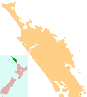
Waikare is a locality in Northland, New Zealand. The Waikare River flows from the Russell Forest past Waikare and into the Waikare Inlet, which leads into the Bay of Islands.[1][2]
Waikare | |
|---|---|
 Waikare | |
| Coordinates: 35°20′20″S 174°14′0″E | |
| Country | New Zealand |
| Region | Northland Region |
| District | Far North District |
The population is largely of the Te Kapotai hapū and Ngāti Pare iwi.[3]
The New Zealand Ministry for Culture and Heritage gives a translation of "rippling waters" for Waikare.[4]
Demographics
| Historical population | ||
|---|---|---|
| Year | Pop. | ±% p.a. |
| 2006 | 648 | — |
| 2013 | 660 | +0.26% |
| 2018 | 690 | +0.89% |
| Source: [5] | ||
The statistical area of Russell Forest-Rawhiti, which at 191 square kilometres is much larger than this locality, covers the area northeast to Cape Brett including some offshore islands, and west to Karetu. It had a population of 690 at the 2018 New Zealand census, an increase of 30 people (4.5%) since the 2013 census, and an increase of 42 people (6.5%) since the 2006 census. There were 255 households. There were 324 males and 363 females, giving a sex ratio of 0.89 males per female. Of the total population, 123 people (17.8%) were aged up to 15 years, 123 (17.8%) were 15 to 29, 288 (41.7%) were 30 to 64, and 153 (22.2%) were 65 or older. Figures may not add up to the total due to rounding.
Ethnicities were 47.0% European/Pākehā, 66.5% Māori, 5.7% Pacific peoples, 0.9% Asian, and 1.3% other ethnicities. People may identify with more than one ethnicity.
The percentage of people born overseas was 8.7, compared with 27.1% nationally.
Although some people objected to giving their religion, 40.4% had no religion, 33.9% were Christian, and 15.2% had other religions.
Of those at least 15 years old, 51 (9.0%) people had a bachelor or higher degree, and 135 (23.8%) people had no formal qualifications. The median income was $20,400. The employment status of those at least 15 was that 198 (34.9%) people were employed full-time, 108 (19.0%) were part-time, and 30 (5.3%) were unemployed.[5]
Marae
Waikare or Te Tūruki Marae and Te Huihuinga|Te Huihuinga or Te Aranga o te Pā meeting house is a meeting place for the Ngāpuhi hapū of Ngāti Pare and Te Kapotai.[6][7]
Education
Te Kura o Waikare, also called Waikare School, is a coeducational full primary (years 1-8) school with a roll of 81 students as of March 2020.[8][9] It is a Designated Special Character school with the Māori language as the principal language of instruction. The school replaced the previous Waikare School in 2004.[10]
Notes
- Peter Dowling (editor) (2004). Reed New Zealand Atlas. Reed Books. pp. map 5. ISBN 0-7900-0952-8.CS1 maint: extra text: authors list (link)
- Roger Smith, GeographX (2005). The Geographic Atlas of New Zealand. Robbie Burton. pp. map 21. ISBN 1-877333-20-4.
- "TE PŪRONGO AROTAKE mātauranga:TE KURA O WAIKARE". Education Review Office. June 2007.
- "1000 Māori place names". New Zealand Ministry for Culture and Heritage. 6 August 2019.
- "Statistical area 1 dataset for 2018 Census". Statistics New Zealand. March 2020. Russell Forest-Rawhiti (104400). 2018 Census place summary: Russell Forest-Rawhiti
- "Te Kāhui Māngai directory". tkm.govt.nz. Te Puni Kōkiri.
- "Māori Maps". maorimaps.com. Te Potiki National Trust.
- "New Zealand Schools Directory". New Zealand Ministry of Education. Retrieved 26 April 2020.
- Education Counts: Te Kura o Waikare
- "Mergers, Closures and New Schools, January 2004 - January 2005" (XLS). Education Counts.