Wagontire, Oregon
Wagontire is an unincorporated community in Harney County, Oregon, United States,[1] along U.S. Route 395.[2]
Wagontire, Oregon | |
|---|---|
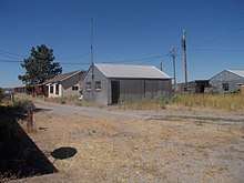
 The Wagontire Cafe | |
 Wagontire  Wagontire | |
| Coordinates: 43°14′59″N 119°52′33″W | |
| Country | United States |
| State | Oregon |
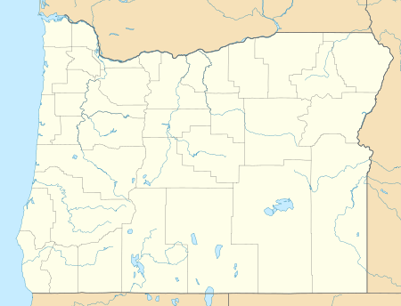
| County | Harney |
| Elevation | 4,737 ft (1,444 m) |
| Time zone | UTC-8 (PST) |
| • Summer (DST) | UTC-7 (PDT) |
| Area code(s) | 541 |
| Coordinates and elevation from United States Geological Survey[1] | |
The community was named after nearby Wagontire Mountain.[3] From 1986 to at least 1997, Wagontire was home to just two people: William and Olgie Warner.[4] The Warners' property included a gas station, cafe, motel, general store, and recreational vehicle (RV) park.[5] Also there was Wagontire Airport, across the road from the buildings.[5] Planes flying into the airport taxied across the highway, and filled up at the gas station.[4]
In summer 1999, the community was purchased by Ellie Downing of Burns, who moved there with her nephew, Jerry Gray.[6]
References
- "Wagontire". Geographic Names Information System. United States Geological Survey. November 28, 1980. Retrieved January 3, 2016.
- "United States Topographic Map". United States Geological Survey. Retrieved January 3, 2016 – via Acme Mapper.
- Moyer, Armond; Moyer, Winifred (1958). The origins of unusual place-names. Keystone Pub. Associates. p. 137.
- Monroe, Bill (December 14, 1997). "Under the Desert Sky: Solitude for Sale". The Oregonian. pp. A01.
- Weber, first (July 11, 1993). "Everyone Stops At Wagontire (Pop. 2)". The New York Times. Retrieved January 3, 2016.
- Frazier, Joseph B. (April 2, 2000). "Life takes on a slow pace in Wagontire". Albany Democrat-Herald. Retrieved July 16, 2017.
External links
- Historic images of Wagontire from Salem Public Library
Buildings in Wagontire
Municipalities and communities of Harney County, Oregon, United States | ||
|---|---|---|
| Cities | 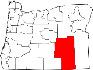 Harney County map | |
| CDP | ||
| Other unincorporated communities | ||
| Indian reservation | ||
| Ghost towns | ||
| Desert | ||
This article is issued from Wikipedia. The text is licensed under Creative Commons - Attribution - Sharealike. Additional terms may apply for the media files.