Volovets Pass
Volovets Pass (Ukrainian: Воловецький перевал,Hungarian: Kisszolyvai-hágó) is a mountain pass in the north-eastern Carpathian Mountains of Ukraine through the Vodorazdel'nyy backbone. Its crest is at 1,014 metres (3,327 ft) height. It is located on the border of Skole Raion of the Lviv Oblast and the Volovets Raion of the Zakarpattia Oblast, on the watershed of the rivers Opir and Viche.
| Volovets Pass | |
|---|---|
| Воловецький перевал | |
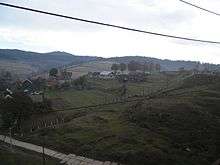
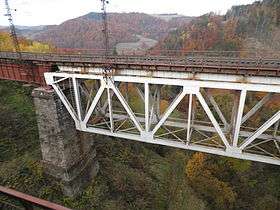 View of Volovets Pass . | |
| Elevation | 1,014 m (3,327 ft) |
| Traversed by | Rail in tunnel (and road) |
| Location | Ukraine, on the border of Skole Raion and Volovets Raion |
| Range | Carpathians |
| Coordinates | 48°45′29″N 23°18′53″E |
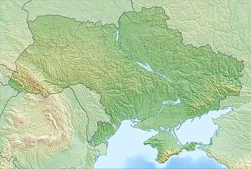 Location of Volovets Pass in Ukraine | |
The southern slope of the pass is steep, while the northern flank is declivous. It consists of sandstones and slates. Volovets Pass is only sparsely populated with meadows dominating the landscape. Below the mountain pass there is a system of railway tunnels connecting Mukachevo and Stryj.
Automobile traffic across the pass is impossible since the road is too difficult to traverse. The nearest settlements are Oporec and Skotarskoe.
See also
Further reading
- Географическая энциклопедия Украины, УСЭ, 1989—1993 гг. ( in Russian . Ukrainian Geografical Encyclopedia, the part of Ukrainian Soviet Encyclopedia, 1989–1993 years)
- Географічна енциклопедія України: в 3-х томах / Редколегія: О. М. Маринич (відпов. ред.) та ін. — К.: «Українська радянська енциклопедія» імені М. П. Бажана, 1989.(in Ukrainian. Geografical Encyclopedia, the part of Ukrainian Soviet Encyclopedia, 1989–1993 years)