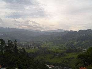
Villamaría, Caldas
Villamaría is a town and municipality in the Colombian Department of Caldas.
Villamaría, Caldas | |
|---|---|
Municipality and town | |
 | |
 Flag .svg.png) Seal | |
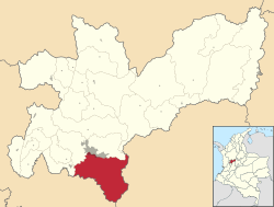 Location of the municipality and town of Villamaría, Caldas in the Caldas Department of Colombia. | |
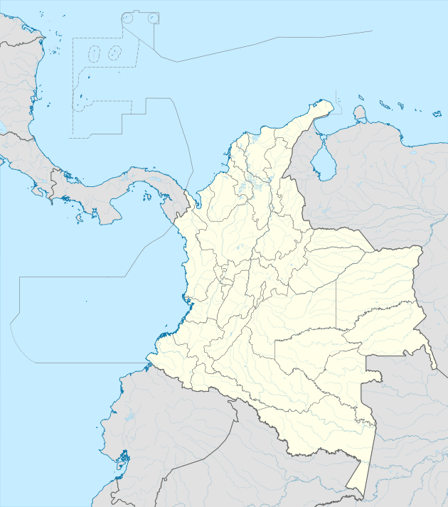 Villamaría, Caldas Location in Colombia | |
| Coordinates: 5°05′52″N 75°30′56″W | |
| Country | |
| Department | |
| Founded | October 19, 1852 |
| Government | |
| • Mayor | Juan Alejandro Holguin |
| Area | |
| • Municipality and town | 461 km2 (178 sq mi) |
| • Metro | 50,956 km2 (19,674 sq mi) |
| Elevation | 1,920 m (6,300 ft) |
| Population (2012) | |
| • Municipality and town | 43,085 |
| • Density | 93/km2 (240/sq mi) |
| Demonym(s) | Villamariano |
| Time zone | UTC-5 (Colombia Standard Time) |
| Area code(s) | 57 + 6 |
| Website | Official website (in Spanish) |
Climate
The city of Villamaría and the lower parts of the municipality have a subtropical highland climate (Cfb).
| Climate data for Villamaría | |||||||||||||
|---|---|---|---|---|---|---|---|---|---|---|---|---|---|
| Month | Jan | Feb | Mar | Apr | May | Jun | Jul | Aug | Sep | Oct | Nov | Dec | Year |
| Average high °C (°F) | 22.8 (73.0) |
22.8 (73.0) |
22.7 (72.9) |
22.0 (71.6) |
22.0 (71.6) |
21.8 (71.2) |
22.7 (72.9) |
22.5 (72.5) |
22.1 (71.8) |
21.3 (70.3) |
21.4 (70.5) |
22.0 (71.6) |
22.2 (71.9) |
| Daily mean °C (°F) | 17.7 (63.9) |
17.8 (64.0) |
18.1 (64.6) |
17.7 (63.9) |
17.9 (64.2) |
17.5 (63.5) |
17.8 (64.0) |
17.8 (64.0) |
17.4 (63.3) |
17.0 (62.6) |
17.0 (62.6) |
17.3 (63.1) |
17.6 (63.6) |
| Average low °C (°F) | 12.6 (54.7) |
12.9 (55.2) |
13.5 (56.3) |
13.4 (56.1) |
13.8 (56.8) |
13.3 (55.9) |
12.9 (55.2) |
13.1 (55.6) |
12.8 (55.0) |
12.8 (55.0) |
12.7 (54.9) |
12.7 (54.9) |
13.0 (55.5) |
| Average rainfall mm (inches) | 110.4 (4.35) |
116.5 (4.59) |
160.5 (6.32) |
213.9 (8.42) |
224.8 (8.85) |
154.1 (6.07) |
98.3 (3.87) |
95.5 (3.76) |
159.1 (6.26) |
249.8 (9.83) |
232.8 (9.17) |
138.5 (5.45) |
1,954.2 (76.94) |
| Average rainy days | 11 | 12 | 16 | 20 | 20 | 17 | 12 | 11 | 16 | 20 | 19 | 12 | 186 |
| Source 1: [1] | |||||||||||||
| Source 2: [2] | |||||||||||||
While the higher parts of the municipality have an alpine tundra climate (ET) and the highest parts has an ice cap climate (EF).
| Climate data for Las Brisas | |||||||||||||
|---|---|---|---|---|---|---|---|---|---|---|---|---|---|
| Month | Jan | Feb | Mar | Apr | May | Jun | Jul | Aug | Sep | Oct | Nov | Dec | Year |
| Average high °C (°F) | 8.6 (47.5) |
8.5 (47.3) |
8.7 (47.7) |
8.5 (47.3) |
8.5 (47.3) |
8.7 (47.7) |
8.6 (47.5) |
8.6 (47.5) |
8.3 (46.9) |
7.7 (45.9) |
8.0 (46.4) |
8.4 (47.1) |
8.4 (47.2) |
| Daily mean °C (°F) | 4.4 (39.9) |
4.6 (40.3) |
4.8 (40.6) |
5.0 (41.0) |
5.1 (41.2) |
4.9 (40.8) |
4.5 (40.1) |
4.5 (40.1) |
4.4 (39.9) |
4.4 (39.9) |
4.4 (39.9) |
4.5 (40.1) |
4.6 (40.3) |
| Average low °C (°F) | 0.8 (33.4) |
1.0 (33.8) |
1.2 (34.2) |
1.8 (35.2) |
1.9 (35.4) |
1.5 (34.7) |
0.9 (33.6) |
0.9 (33.6) |
1.0 (33.8) |
1.3 (34.3) |
1.5 (34.7) |
1.0 (33.8) |
1.2 (34.2) |
| Average rainfall mm (inches) | 85.7 (3.37) |
83.3 (3.28) |
116.7 (4.59) |
178.0 (7.01) |
189.3 (7.45) |
112.3 (4.42) |
70.7 (2.78) |
73.2 (2.88) |
114.7 (4.52) |
192.2 (7.57) |
145.7 (5.74) |
86.7 (3.41) |
1,448.5 (57.02) |
| Average rainy days | 14 | 16 | 20 | 23 | 23 | 21 | 18 | 18 | 19 | 25 | 23 | 18 | 238 |
| Average relative humidity (%) | 89 | 92 | 92 | 94 | 93 | 92 | 91 | 91 | 92 | 93 | 92 | 90 | 92 |
| Mean monthly sunshine hours | 96.1 | 84.7 | 71.3 | 45.0 | 52.7 | 72.0 | 102.3 | 99.2 | 63.0 | 43.4 | 63.0 | 83.7 | 876.4 |
| Mean daily sunshine hours | 3.1 | 3.0 | 2.3 | 1.5 | 1.7 | 2.4 | 3.3 | 3.2 | 2.1 | 1.4 | 2.1 | 2.7 | 2.4 |
| Source: [1] | |||||||||||||
References
Capital: Manizales | |||||||||||||
| Districts and municipalities |
| ||||||||||||
This article is issued from Wikipedia. The text is licensed under Creative Commons - Attribution - Sharealike. Additional terms may apply for the media files.