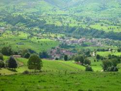
Villacarriedo
Villacarriedo is a municipality in the Spanish "comunidad autónoma" of Cantabria.
Villacarriedo | |
|---|---|
 | |
.svg.png) Coat of arms | |
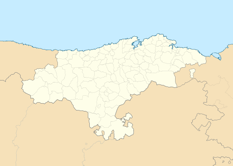 Villacarriedo Location in Spain 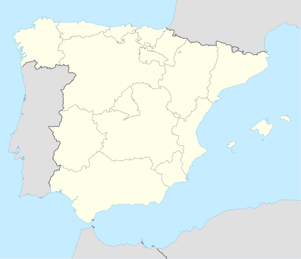 Villacarriedo Villacarriedo (Spain) | |
| Coordinates: 43°13′46″N 3°48′33″W | |
| Country | |
| Autonomous community | Cantabria |
| Province | Cantabria |
| Seat | Villacarriedo |
| Government | |
| • Alcalde | Ángel Sainz Ruiz (PRC) |
| Area | |
| • Total | 50.74 km2 (19.59 sq mi) |
| Elevation | 211 m (692 ft) |
| Population (2018)[1] | |
| • Total | 1,604 |
| • Density | 32/km2 (82/sq mi) |
| Time zone | UTC+1 (CET) |
| • Summer (DST) | UTC+2 (CEST) |
| Postal code | 39640 |
| Website | Ayunt. de Villacarriedo |
Sub-districts and demography
In 2009 the municipality contained 1,765 registered inhabitants divided between the various villages and hamlets as follows:
- Abionzo (174 people)
- Aloños (159 people)
- Bárcena de Carriedo (185 people)
- Pedroso (71 people)
- Santibáñez (254 people)
- Soto (29 people)
- Tezanos (385 people)
- Villacarriedo (capital) (508 people)
Location
Villacarriedo, the administrative centre and the most populous village in the municipality, is positioned 211 meters above sea level and 36 km (22 miles) to the south of Santander, the Cantabrian capital.
Economy
36.9% of the working population are recorded as working in the primary (agricultural) sector. 15.1% work in construction and 10.8% in industry while a further 37.2% work in the tertiary (service) sector.
- Municipal Register of Spain 2018. National Statistics Institute.
This article is issued from Wikipedia. The text is licensed under Creative Commons - Attribution - Sharealike. Additional terms may apply for the media files.