Vila Franca de Xira
Vila Franca de Xira (Portuguese pronunciation: [ˈvilɐ ˈfɾɐ̃kɐ ðɨ ˈʃiɾɐ] (![]()
Vila Franca de Xira | |
|---|---|
_(cropped).jpg) .jpg) .jpg) .jpg) .JPG) .jpg) | |
 Flag  Coat of arms | |
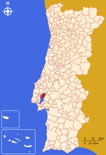 | |
| Coordinates: 38°57′N 8°59′W | |
| Country | |
| Region | Lisboa |
| Metropolitan area | Lisbon |
| District | Lisbon |
| Parishes | 6 |
| Government | |
| • President | Alberto Mesquita (PS) |
| Area | |
| • Total | 318.19 km2 (122.85 sq mi) |
| Population (2011) | |
| • Total | 136,886 |
| • Density | 430/km2 (1,100/sq mi) |
| Time zone | UTC±00:00 (WET) |
| • Summer (DST) | UTC+01:00 (WEST) |
| Local holiday | Ascension Day date varies |
| Website | www |
The town is mostly famous for its bull-running festivals in July and October. Bulls are raised in the salty marshlands of the Ribatejo, which is also a notable breeding ground for the magnificent Lusitano horse, esteemed for its quick reflexes and maneuverability. A number of brightly coloured Portuguese bullfighting costumes are on display in the ethnographic museum in the town's bullring, the Praça de Toiros (or Touros) Palha Blanco. Nearby, the town's Misericórdia church features striking 18th-century azulejos (glazed tiles). The town also has a Museum of Neo-Realism.[3]
Three km south of Vila Franca de Xira lies the Lezíria Grande Equestrian Centre, where visitors can watch stylish displays of the impressive Lusitano horses. The centre also stages typical bullfighting spectacles in its outdoor bullring. Visitors can ride Lusitano horses and take dressage lessons at the Quinta de São Sebastião, a sprawling estate at Arruda dos Vinhos, 11 km west of Vila Franca de Xira.
The municipality contains several forts built during the Peninsular War and forming part of the Lines of Torres Vedras. These include the Fort of Subserra on the first line of defence and the Forts of Serra da Aguieira and the Fort of Casa on the second line. Another place of interest, on the left bank, is the Hermitage of Nossa Senhora de Alcamé, which was built so that farmers on the Tagus floodplain would both have somewhere to pray and also somewhere of safety during floods. An annual pilgrimage is held to the hermitage with participants going by boat from the town of Vila Franca de Xira on the right bank.
The current Mayor is Alberto Mesquita,[4] elected in 2013 as a member of the Socialist Party.[5]
Demographics
| Vila Franca de Xira Municipality (1801–2011) | ||||||||
|---|---|---|---|---|---|---|---|---|
| 1801 | 1849 | 1900 | 1930 | 1960 | 1981 | 1991 | 2001 | 2011 |
| 3 839 | 5 202 | 15 766 | 24 053 | 40 594 | 88 193 | 103 571 | 122 908 | 136 886 |

Parishes
Administratively, the municipality is divided into 6 civil parishes (freguesias):[6]
References
- Instituto Nacional de Estatística
- "Áreas das freguesias, concelhos, distritos e país". Archived from the original on 5 November 2018. Retrieved 5 November 2018.
- Museu do Neo-Realismo Archived 2 April 2015 at the Wayback Machine
- "Autoridades continuam no terreno a tentar descobrir foco da infeção de 'legionella'" (in Portuguese). Diário de Notícias. Archived from the original on 9 November 2014. Retrieved 12 November 2014.
- O Mirante (local weekly paper)
- Diário da República. "Law nr. 11-A/2013, page 552 131" (PDF) (in Portuguese). Retrieved 4 August 2014.