Veauville-lès-Baons
Veauville-lès-Baons is a former commune in the Seine-Maritime department in the Normandy region in northern France. On 1 January 2019, it was merged into the new commune Les Hauts-de-Caux.[2]
Veauville-lès-Baons | |
|---|---|
Part of Les Hauts-de-Caux | |
Location of Veauville-lès-Baons 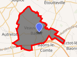
| |
 Veauville-lès-Baons  Veauville-lès-Baons | |
| Coordinates: 49°39′14″N 0°46′03″E | |
| Country | France |
| Region | Normandy |
| Department | Seine-Maritime |
| Arrondissement | Rouen |
| Canton | Yvetot |
| Commune | Les Hauts-de-Caux |
| Area 1 | 7.96 km2 (3.07 sq mi) |
| Population (2017-01-01)[1] | 717 |
| • Density | 90/km2 (230/sq mi) |
| Time zone | UTC+01:00 (CET) |
| • Summer (DST) | UTC+02:00 (CEST) |
| Postal code | 76190 |
| Elevation | 118–152 m (387–499 ft) (avg. 145 m or 476 ft) |
| 1 French Land Register data, which excludes lakes, ponds, glaciers > 1 km2 (0.386 sq mi or 247 acres) and river estuaries. | |
Geography
A farming village situated in the Pays de Caux, some 24 miles (39 km) northwest of Rouen at the junction of the C5 with the D37 road. The A29 autoroute passes through the commune's borders.
Population
| Year | 1962 | 1968 | 1975 | 1982 | 1990 | 1999 | 2006 |
|---|---|---|---|---|---|---|---|
| Population | 301 | 327 | 528 | 672 | 725 | 717 | 671 |
| From the year 1962 on: No double counting—residents of multiple communes (e.g. students and military personnel) are counted only once. | |||||||
Places of interest
- The church of St. Austreberthe, dating from the sixteenth century.
- The chapel of St. Gilles, dating from the fifteenth century.
- A sixteenth-century stone cross at the crossroads.
- A 30-foot high granite cross, erected in 1874.
References
- "Populations légales 2017". INSEE. Retrieved 6 January 2020.
- Arrêté préfectoral 19 December 2018 (in French)
External links
| Wikimedia Commons has media related to Veauville-lès-Baons. |
- Veauville-lès-Baons on the Quid website (in French)
This article is issued from Wikipedia. The text is licensed under Creative Commons - Attribution - Sharealike. Additional terms may apply for the media files.