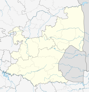
Vandyksdrif
Vandyksdrif is a small village and railway siding in Nkangala District Municipality in the Mpumalanga province of South Africa. It is situated next to the R544 road between Witbank and Bethal and is surrounded by coal mines.[2]
Vandyksdrif | |
|---|---|
 Vandyksdrif  Vandyksdrif | |
| Coordinates: 26.0998°S 29.3237°E | |
| Country | South Africa |
| Province | Mpumalanga |
| District | Nkangala |
| Municipality | Emalahleni |
| Area | |
| • Total | 19.89 km2 (7.68 sq mi) |
| Population (2011)[1] | |
| • Total | 741 |
| • Density | 37/km2 (96/sq mi) |
| Racial makeup (2011) | |
| • Black African | 99.3% |
| • Indian/Asian | 0.7% |
| First languages (2011) | |
| • Southern Sotho | 27.1% |
| • Xhosa | 25.1% |
| • Zulu | 17.5% |
| • Northern Sotho | 9.3% |
| • Other | 30.7% |
| Time zone | UTC+2 (SAST) |
| Postal code (street) | 2230 |
| Area code | 017 |
References
- "Sub Place Vandyksdrif". Census 2011.
- "Vandyksdrift (mine(s))". za.geoview.info. Retrieved 2016-03-18.
This article is issued from Wikipedia. The text is licensed under Creative Commons - Attribution - Sharealike. Additional terms may apply for the media files.
.svg.png)