Van Buren Township, Grant County, Indiana
Van Buren Township is one of thirteen townships in Grant County, Indiana, United States. As of the 2010 census, its population was 1,934 and it contained 838 housing units.[1]
Van Buren Township | |
|---|---|
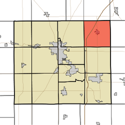 Location of Van Buren Township in Grant County | |
| Coordinates: 40°36′31″N 85°30′17″W | |
| Country | United States |
| State | Indiana |
| County | Grant |
| Government | |
| • Type | Indiana township |
| Area | |
| • Total | 35.51 sq mi (92.0 km2) |
| • Land | 35.48 sq mi (91.9 km2) |
| • Water | 0.03 sq mi (0.08 km2) 0.08% |
| Elevation | 843 ft (257 m) |
| Population (2010) | |
| • Total | 1,934 |
| • Density | 54.5/sq mi (21.0/km2) |
| GNIS feature ID | 0453946 |
Geography
According to the 2010 census, the township has a total area of 35.51 square miles (92.0 km2), of which 35.48 square miles (91.9 km2) (or 99.92%) is land and 0.03 square miles (0.078 km2) (or 0.08%) is water.[1] The streams of Brushy Run, Little Black Creek and Roods Run run through this township.
Cities and towns
Unincorporated towns
- Doyle Ferguson
- Farrville
(This list is based on USGS data and may include former settlements.)
Adjacent townships
- Jefferson Township, Huntington County (north)
- Salamonie Township, Huntington County (northeast)
- Jackson Township, Wells County (east)
- Washington Township, Blackford County (southeast)
- Monroe Township (south)
- Center Township (southwest)
- Washington Township (west)
- Wayne Township, Huntington County (northwest)
Cemeteries
The township contains six cemeteries: Cory, Doyle, Farrville, Landess, Lee and Masonic.
Education
Van Buren Township residents may obtain a free library card from the Van Buren Public Library in Van Buren.[2]
References
- "Population, Housing Units, Area, and Density: 2010 - County -- County Subdivision and Place -- 2010 Census Summary File 1". United States Census. Archived from the original on 2020-02-12. Retrieved 2013-05-10.
- "Sign Up for a Library Card". Van Buren Public Library. Retrieved 7 March 2018.
External links
Municipalities and communities of Grant County, Indiana, United States | ||
|---|---|---|
| Cities | Map of Indiana highlighting Grant County | |
| Towns | ||
| Townships | ||
| CDPs | ||
| Unincorporated communities | ||
| Footnotes | ‡This populated place also has portions in an adjacent county or counties | |
This article is issued from Wikipedia. The text is licensed under Creative Commons - Attribution - Sharealike. Additional terms may apply for the media files.