Urandangi
Urandangi is an outback town in the locality of Piturie in the Shire of Boulia, Queensland, Australia.[1]
| Urandangi Queensland | |
|---|---|
 Urandangi Hotel in 2004 | |
 Urandangi | |
| Coordinates | 21°36′30″S 138°18′51″E |
| Established | 1885 |
| Postcode(s) | 4824 |
| Location | |
| LGA(s) | Shire of Boulia |
| State electorate(s) | Gregory |
| Federal Division(s) | Kennedy |
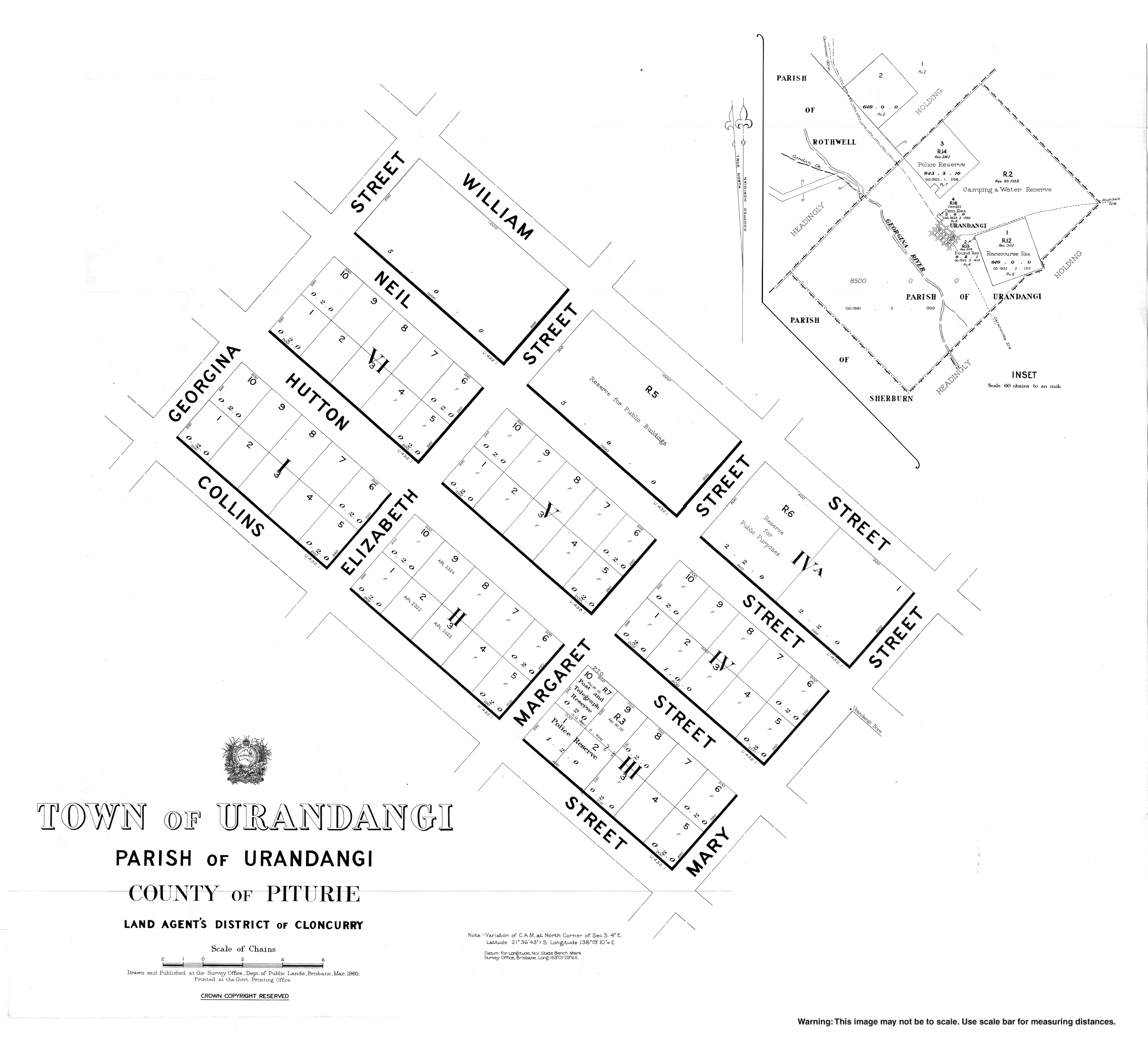
Geography
The town is located on the banks of the Georgina River in Central West Queensland, 2,007 kilometres (1,247 mi) north west of the state capital, Brisbane and 187 kilometres (116 mi) south west of the regional centre of Mount Isa.
Urandangi is in the Channel Country. All watercourses in this area are part of the Lake Eyre drainage basin,[2] and most will dry up before their water reaches Lake Eyre.[3]
The predominant land use is grazing on native vegetation.[2]
The Marmanya Aboriginal community is located in Urandangi.[4]
History
Waluwarra (also known as Warluwarra, Walugara, and Walukara) is an Australian Aboriginal language of Western Queensland. Its traditional language region is the local government area of Shire of Boulia, including Walgra Station and Wolga, from Roxborough Downs north to Carandotta Station and Urandangi on the Georgina River, on Moonah Creek to Rochedale, south-east of Pituri Creek.[5]
An unnamed township was established 2 August 1883. On 12 December 1884, it was officially named Urandangi. The name is believed to be derived Aboriginal words, uranda-ngie, meaning much gidyea.[1]
The township was a centre for travellers and drovers where a stock route crossed the Georgina River. By 1920 Urandangi had a pub, two stores, post office, police station and a dance hall.[6]
Facilities
Today, Urandangi's only major facility is the Urandangi Hotel or the "Dangi Pub".[7]
Education
Urandangi State School opened on 11 April 1994.[8] The school caters for students from Prep -Year 7. It is a very small school, with only 8 students enrolled in 2015.[9]
There are no secondary schools in Urandangi.[2] The nearest secondary school is in Mount Isa but too far for a daily commute.[2] The Spinifex State College in Mount Isa offers boarding facilities.[10] Other boarding schools or distance education would be options.
References
- "Urandangi - town (entry 35864)". Queensland Place Names. Queensland Government. Retrieved 9 April 2017.
- "Queensland Globe". State of Queensland. Retrieved 15 August 2019.
- FitzSimons, Trish (2010). "Channel Country". Queensland Historical Atlas. University of Queensland. Archived from the original on 15 August 2019. Retrieved 15 August 2019.
- Anderson, John (17 May 2010). "The voice not heard". Townsville Bulletin. Retrieved 6 November 2010.
-

- "Queensland's Outback: Urandangi". Queensland Holidays. Tourism Queensland. Retrieved 6 November 2010.
- Anderson, John (4 May 2010). "Urandangi gateway to anywhere". Townsville Bulletin. Retrieved 6 November 2010.
- "Opening and closing dates of Queensland Schools". Queensland Government. Retrieved 18 April 2019.
- "Urandangi State School Annual Report 2015". Education Queensland. 30 June 2016. Retrieved 30 January 2017.
- "Residential Campus" (PDF). Spinifex State College. 2015. Archived (PDF) from the original on 15 August 2019. Retrieved 15 August 2019.