Uncertain, Texas
Uncertain is a city in Harrison County, Texas, in the United States. According to the 2010 census, the city population was 94,[3] down from 150 at the 2000 census. In 2018, it had an estimated population of 59.[4]
Uncertain, Texas | |
|---|---|
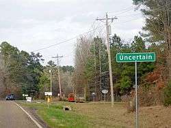 City marker of Uncertain | |
 Uncertain  Uncertain | |
| Coordinates: 32°42′36″N 94°7′19″W | |
| Country | United States |
| State | Texas |
| County | Harrison |
| Area | |
| • Total | 0.5 sq mi (1.3 km2) |
| • Land | 0.5 sq mi (1.3 km2) |
| • Water | 0.0 sq mi (0.0 km2) |
| Elevation | 180 ft (55 m) |
| Population (2010) | |
| • Total | 94 |
| • Density | 184/sq mi (71.0/km2) |
| Time zone | UTC-6 (Central (CST)) |
| • Summer (DST) | UTC-5 (CDT) |
| ZIP code | 75661 |
| Area code(s) | 903 |
| FIPS code | 48-74240[1] |
| GNIS feature ID | 1349024[2] |
| Website | www |
History
The city of Uncertain was incorporated in 1961 as a Type B general law city, with a mayor and five aldermen on an at-large basis.[5]
Uncertain is located on the west shore of Caddo Lake and derives its name from the original application for township where the name for it had not been decided. Therefore when the original residents filled out the application they put "Uncertain" in the blank for the name. When the township was given, it then became "Uncertain".
Geography
Uncertain is in the northeast corner of Harrison County, at the west end of Caddo Lake, a water body on Big Cypress Bayou that extends east into Louisiana. The city is at the east end of Farm Road 2198, which leads southwest 5 miles (8 km) to Texas State Highway 43 near Karnack. Uncertain is 21 miles (34 km) northeast of Marshall, the Harrison county seat.
According to the United States Census Bureau, the city has a total area of 0.50 square miles (1.3 km2), of which 0.2 acres (996 m2), or 0.08%, are water.[3]
Demographics
| Historical population | |||
|---|---|---|---|
| Census | Pop. | %± | |
| 1970 | 202 | — | |
| 1980 | 176 | −12.9% | |
| 1990 | 194 | 10.2% | |
| 2000 | 150 | −22.7% | |
| 2010 | 94 | −37.3% | |
| Est. 2016 | 94 | [6] | 0.0% |
| U.S. Decennial Census[7] | |||
As of the census[1] of 2000, there were 150 people, 77 households, and 49 families residing in the city. The population density was 294.1 people per square mile (113.6/km²). There were 137 housing units at an average density of 268.7 per square mile (103.7/km²). The racial makeup of the city was 72.67% White, 26.67% African American and 0.67% (i.e. 1 person) Native American.
There were 77 households out of which 14.3% had children under the age of 18 living with them, 49.4% were married couples living together, 11.7% had a female householder with no husband present, and 35.1% were non-families. 31.2% of all households were made up of individuals and 15.6% had someone living alone who was 65 years of age or older. The average household size was 1.95 and the average family size was 2.32.
In the city, the population was spread out with 10.0% under the age of 18, 5.3% from 18 to 24, 19.3% from 25 to 44, 35.3% from 45 to 64, and 30.0% who were 65 years of age or older. The median age was 56 years. For every 100 woman, there were 105.5 men. For every 100 woman age 18 and over, there were 104.5 men.
The median income for a household in the city was $27,000, and the median income for a family was $43,438. Men had a median income of $36,250 versus $38,333 for women. The per capita income for the city was $18,352. There were 5.7% of families and 12.6% of the population living below the poverty line, including no under eighteens and 10.0% of those over 64.
In 2018, there were an estimated 59 people residing within Uncertain. 67.8% of the population were non-Hispanic white and 32.2% Black or African American.[4]
Education
The city of Uncertain is served by the Karnack Independent School District.
In film
- A 2017 documentary film Uncertain is about the city, several of its residents, and its lake with its extreme weed growth problem.
- In 2010, several scenes from the film Shark Night 3D were filmed at Caddo Lake.
- In 1966, several scenes from the film Curse of the Swamp Creature were filmed around the local Fly-N-Fish Lodge Airport.
References
- "U.S. Census website". United States Census Bureau. Retrieved 2008-01-31.
- "US Board on Geographic Names". United States Geological Survey. 2007-10-25. Retrieved 2008-01-31.
- "Geographic Identifiers: 2010 Census Summary File 1 (G001): Uncertain city, Texas". American Factfinder. U.S. Census Bureau. Archived from the original on February 13, 2020. Retrieved February 7, 2018.
- "2018 ACS Demographic and Housing Estimates". data.census.gov. Retrieved 2020-01-25.
- "City of Uncertain Texas". City of Uncertain Texas. Archived from the original on June 14, 2012. Retrieved July 27, 2012.
- "Population and Housing Unit Estimates". Retrieved June 9, 2017.
- "Census of Population and Housing". Census.gov. Retrieved June 4, 2015.
External links
| Wikimedia Commons has media related to Uncertain, Texas. |
Municipalities and communities of Harrison County, Texas, United States | ||
|---|---|---|
| Cities |  Harrison County map | |
| Unincorporated communities | ||
| Footnotes | ‡This populated place also has portions in an adjacent county or counties | |