U.S. Route 166
U.S. Route 166 (US 166) is a 164-mile (264 km) west–east United States highway. This route and US-266 are the only two remaining spurs of historic U.S. Route 66 (which was decommissioned in 1985), since US-666 was renumbered to US-491 in 2003.
| |||||||
|---|---|---|---|---|---|---|---|

US 166 highlighted in red | |||||||
| Route information | |||||||
| Auxiliary route of US 66 | |||||||
| Maintained by KDOT and MoDOT | |||||||
| Length | 164.159 mi (264.188 km) | ||||||
| Existed | 1926–present | ||||||
| Major junctions | |||||||
| West end | |||||||
| |||||||
| East end | |||||||
| Location | |||||||
| States | Kansas, Missouri | ||||||
| Counties | KS: Sumner, Cowley, Chautauqua, Montgomery, Labette, Cherokee MO: Newton | ||||||
| Highway system | |||||||
| |||||||

US-166 meets the old route of US-66, now designated US-69 Alternate, in Baxter Springs in the southeast corner of Kansas.
Route description
| mi | km | |
|---|---|---|
| KS | 163.223 | 262.682 |
| MO | 0.936 | 1.506 |
| Total | 164.159 | 264.188 |
Kansas
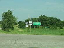

US 166 is an east–west highway that meanders about 164 miles (264 km) along the Kansas–Oklahoma state line. The highway's western terminus is in South Haven, Kansas at an intersection with US-81, approximately 1-mile (1.6 km) north of the northern terminus of US-177. US 166's eastern terminus, which is also shared by US-400, is an intersection with I-44 just inside the Missouri state line, near the point where Kansas, Oklahoma, and Missouri meet, southwest of Joplin, Missouri near Loma Linda, MO.
About 4 miles (6.4 km) east from its intersection with US-81, the highway intersects with the Kansas Turnpike (I-35) at exit 4. Continuing east about 60 miles (97 km), US-166 crosses the Arkansas River into Arkansas City, where it runs concurrently with US-77 for approximately 2 miles (3.2 km), splitting off near Parkerfield.
Traveling 50 miles (80 km) east of Arkansas City, US-166 turns northeast, arcing above Cowley County Lake Dam and Cedar Vale. US. 166 crosses the Caney River approximately 0.5 miles (0.80 km) east of Chautauqua County Road 2. It turns south of Sedan approximately 0.6 miles (0.97 km) east of Chautauqua County Road 14. A business loop connects the main US-166 route with Sedan.
Continuing east from Sedan, about 34 miles (55 km) to Coffeyville, US-166 skims through Peru and Niotaze, US 166 crosses the Little Caney River 1.1 miles (1.77 km) to the east of Niotaze and proceeds east to the junction of US-75 near Havana. The two routes turn south for a 3-mile (4.8 km) concurrency. US-166 splits off just north of Caney turning east again through Tyro to Coffeyville. US-166 has a brief concurrency with US-169 beginning at the intersection of Walnut/Paterson Streets and Eleventh Street on the south side of downtown Coffeyville. The highway proceeds east on Eleventh Street, curves to the northeast and becomes Northeast Street. It then proceeds northeasterly past Walter Johnson Park and the Montgomery County Fairgrounds before it crosses the Verdigris River. US-166 will exit from US-169 0.4 miles (0.64 km) east of the Verdigris River and proceeds east toward the town of Chetopa
US-166 runs eastward about 50 miles (80 km) from Coffeyville bypassing Edna and Bartlett. US-166 passes through Chetopa, where US-166 and US-59 travel concurrently from 0.2 miles (0.32 km) east of the BNSF Railroad overpass, and proceeds south on Eleventh Street, then turns to the east near the Chetopa ball field. US-166/US-59 will run concurrently along Maple Street into downtown Chetopa. US-59 will then break off on Third Street and proceeds south towards the Kansas-Oklahoma state linesouth of the intersection. Leaving Chetopa, US-166 crosses over the Neosho River and crosses US-69 Alternate, 6 miles (9.7 km) before Baxter Springs.

Heading east from Baxter Springs, US-166 crosses the Spring River. Approximately 2 miles (3.2 km) later, US-166 intersects with US-400. US-166/US-400 then turn sharply southeast for 6 miles (9.7 km) to cross the Missouri state line approximately 1⁄2 mile (0.80 km) from the I-44 interchange.
History
US 166 is an original 1926 route and originally ran from South Haven to Baxter Springs, Kansas. In 1945, it was extended east through Joplin, Missouri, where it paralleled US 66 to Springfield. This extension absorbed Route 38, which had been formed in 1922 from Carthage to west of Springfield and realigned to Joplin in about 1930, with the former route becoming Route 38N and soon US 71 Alternate. In 1966, following the completion of the last section of I-44 in Missouri, the east end of US 166 was truncated back from Springfield to its current terminus. Most sections of US 166 between Joplin and Springfield were not upgraded to Interstate Highway standards and were renumbered as I-44 Business Loops, state highways (such as Route 174) or turned over to local or county jurisdiction.
Major intersections
| State | County | Location | mi[2][1] | km | Destinations | Notes |
|---|---|---|---|---|---|---|
| Kansas | Sumner | | 0.000 | 0.000 | Western terminus; road continues as 160th Street South | |
| | 3.481 | 5.602 | Parclo interchange; I-35/Kansas Tpke. exit 4 | |||
| Cowley | Arkansas City | 20.540 | 33.056 | West end of US-77 concurrency | ||
| 22.993 | 37.004 | Roundabout; east end of US-77 concurrency; US-77 north serves South Central Kansas Medical Center | ||||
| | 40.883 | 65.795 | West end of K-15 concurrency | |||
| | 44.833 | 72.152 | East end of K-15 concurrency | |||
| Chautauqua | | 66.984 | 107.800 | Western terminus of US-166 Bus. | ||
| | 71.325 | 114.786 | Eastern terminus of US-166 Bus. | |||
| Montgomery | | 85.579 | 137.726 | Trumpet interchange; west end of US-75 concurrency | ||
| | 88.577 | 142.551 | East end of US-75 concurrency | |||
| Coffeyville | 106.083 | 170.724 | West end of US-169 concurrency | |||
| | 108.104 | 173.977 | Interchange; east end of US-169 concurrency | |||
| Labette | Edna | 120.743 | 194.317 | Southern terminus of K-101 | ||
| Chetopa | 135.054 | 217.348 | West end of US-59 concurrency | |||
| 136.548 | 219.753 | East end of US-59 concurrency | ||||
| Cherokee | | 150.694 | 242.518 | |||
| Baxter Springs | 156.181 | 251.349 | Former US-66 | |||
| | 158.017 | 254.304 | West end of US-400 concurrency | |||
| | 161.322 | 259.623 | Southern terminus of K-26 | |||
| 163.223 0.000 | 262.682 0.000 | Kansas–Missouri state line | ||||
| Missouri | Newton | | 0.406– 0.936 | 0.653– 1.506 | East end of US 400 concurrency; I-44 exit 1; eastern termini of US 166 and US 400 | |
1.000 mi = 1.609 km; 1.000 km = 0.621 mi
| ||||||
Special routes
- U.S. Route 166 Business – Sedan, Kansas
- U.S. Route 166 Business – Joplin, Missouri (decommissioned)
- U.S. Route 166 Business – Springfield, Missouri (decommissioned)
- U.S. Route 166 City - Springfield, Missouri (decommissioned)
- U.S. Route 166 Truck - Springfield, Missouri (decommissioned)
See also

References
- Missouri Department of Transportation (January 11, 2018). MoDOT HPMAPS (Map). Missouri Department of Transportation. Retrieved January 11, 2018.
- Kansas Department of Transportation. "Pavement Management Information System". Archived from the original on April 30, 2009. Retrieved September 26, 2008.