Two Hummock Island
Two Hummock Island is an ice-covered island, 9.4 kilometres (6 mi) long in a north-south direction, conspicuous for its two rocky summits Buache Peak and Modev Peak 670 metres (2,198 feet) high, lying 9.6 kilometres (6.0 miles) southeast of Liège Island and 11.5 kilometres (7.1 miles) east of Brabant Island in the Palmer Archipelago.[1] This name has appeared on maps for over 100 years and its usage has become established internationally.
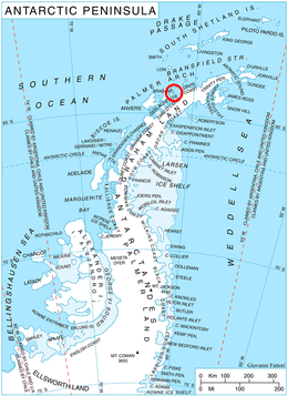 Location of Two Hummock Island, Antarctica. | |
 Two Hummock Island Location in Antarctica | |
| Geography | |
|---|---|
| Location | Antarctica |
| Coordinates | 64°8′S 61°42′W |
| Archipelago | Palmer Archipelago |
| Length | 9.4 km (5.84 mi) |
| Width | 5 km (3.1 mi) |
| Highest elevation | 670 m (2,200 ft) |
| Administration | |
| Administered under the Antarctic Treaty System | |
| Demographics | |
| Population | Uninhabited |
See also
- Composite Antarctic Gazetteer
- List of Antarctic and sub-Antarctic islands
- List of Antarctic islands south of 60° S
- SCAR
- Territorial claims in Antarctica
Maps
- British Antarctic Territory. Scale 1:200000 topographic map. DOS 610 Series, Sheet W 64 60. Directorate of Overseas Surveys, UK, 1978.
- Antarctic Digital Database (ADD). Scale 1:250000 topographic map of Antarctica. Scientific Committee on Antarctic Research (SCAR). Since 1993, regularly upgraded and updated.
References
- Two Hummock Island. SCAR Composite Antarctic Gazetteer.
External links
![]()
This article is issued from Wikipedia. The text is licensed under Creative Commons - Attribution - Sharealike. Additional terms may apply for the media files.