Turkul
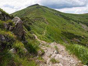
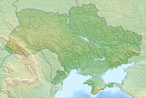
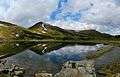
Turkul (Ukrainian: Туркул) is a 1,933-metre (6,342 ft) [1] peak located in the Chornohora (Чорногора) mountain range of Carpathian Mountains in west Ukraine. It is situated between the Dancer (1850 m) in the north and Rebra (2001 m) in the south-east. The western slopes fall into the valley of the Ozirny Stream, south to the valley of the Butynyc stream, and to the northeastern to the glacier basin where the Lake Nesamovyte lie. The back ridge from the summit in the south-west direction occupies Turkulska alpine meadow.
| Turkul | |
|---|---|
 Turkul | |
| Highest point | |
| Elevation | 1,933 m (6,342 ft) |
| Coordinates | 48°07′26″N 24°31′52″E |
| Geography | |
 Turkul Ukraine | |
| Location | Ukraine |
| Country | |
| Parent range | Chornohora |
Trenches from the First World War have survived. In the inter-war period, the border between Poland and Czechoslovakia was crossed by the peak (border post No. 33). Turkuł is a good viewpoint for the nearby summits of Chornohora and for further mountain ranges.
Gallery
References
| Wikimedia Commons has media related to Turkul Mountain. |
- "Top- 10 highest mountains in Carpathians - Touch Ukraine". Touch Ukraine. 2017-04-03. Retrieved 2017-09-23.