Tununak, Alaska
Tununak (Tuen-unak) (Central Yupik: Tununeq) is a census-designated place (CDP) in Bethel Census Area, Alaska, United States. At the 2010 census the population was 327.
Tununak Tununeq | |
|---|---|
.jpg) Aerial view of Tununak | |
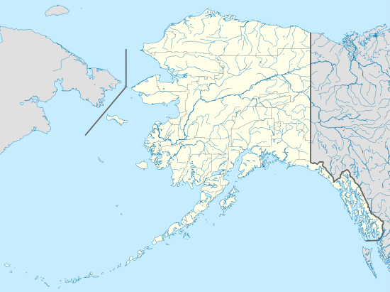 Tununak Location within the state of Alaska | |
| Coordinates: 60°34′50″N 165°15′34″W | |
| Country | United States |
| State | Alaska |
| Census Area | Bethel |
| Government | |
| • State senator | Lyman Hoffman (D) |
| • State rep. | Tiffany Zulkosky (R) |
| Area | |
| • Total | 60.7 sq mi (157.2 km2) |
| • Land | 60.5 sq mi (156.7 km2) |
| • Water | 0.2 sq mi (0.5 km2) |
| Population (2010) | |
| • Total | 327 |
| • Density | 5.4/sq mi (2.1/km2) |
| Time zone | UTC-9 (Alaska (AKST)) |
| • Summer (DST) | UTC-8 (AKDT) |
| ZIP code | 99681 |
| Area code(s) | 907 |
Geography
Tununak is located at 60°34′50″N 165°15′34″W (60.580477, -165.259486).[1]
It is located on the northwest side of Nelson Island in the Bering Sea. It is approximately 5 miles (8.0 km) from the closest village Toksook Bay and a year-round trail exists between the two villages.
According to the United States Census Bureau, the CDP has a total area of 60.7 square miles (157 km2), of which, 60.5 square miles (157 km2) of it is land and 0.2 square miles (0.52 km2) of it (0.33%) is water.
Demographics
| Historical population | |||
|---|---|---|---|
| Census | Pop. | %± | |
| 1880 | 8 | — | |
| 1890 | 48 | 500.0% | |
| 1940 | 65 | — | |
| 1950 | 112 | 72.3% | |
| 1960 | 183 | 63.4% | |
| 1970 | 274 | 49.7% | |
| 1980 | 298 | 8.8% | |
| 1990 | 316 | 6.0% | |
| 2000 | 325 | 2.8% | |
| 2010 | 327 | 0.6% | |
| U.S. Decennial Census[2] | |||
Tununak first appeared on the 1880 U.S. Census as "Tanunak", an unincorporated village of 8 residents, all Inuit. It appeared on the 1890 census as the village of "Dununuk." In 1940, it appeared again as "Tanunak" until it was incorporated as Tununak in 1975. It was disincorporated in 1997 and made a census-designated place (CDP) effective with the 2000 census.
As of the census[3] of 2000, there were 325 people, 82 households, and 59 families residing in the CDP. The population density was 5.4 people per square mile (2.1/km²). There were 93 housing units at an average density of 1.5/sq mi (0.6/km²). The racial makeup of the CDP was 94.77% Native American, 3.08% White, and 2.15% from two or more races.
There were 82 households out of which 47.6% had children under the age of 18 living with them, 50.0% were married couples living together, 7.3% had a female householder with no husband present, and 28.0% were non-families. 23.2% of all households were made up of individuals and 1.2% had someone living alone who was 65 years of age or older. The average household size was 3.96 and the average family size was 5.00.
In the CDP, the population was spread out with 42.5% under the age of 18, 10.8% from 18 to 24, 26.8% from 25 to 44, 12.9% from 45 to 64, and 7.1% who were 65 years of age or older. The median age was 23 years. For every 100 females, there were 139.0 males. For every 100 females age 18 and over, there were 159.7 males.
The median income for a household in the CDP was $25,000, and the median income for a family was $26,500. Males had a median income of $18,125 versus $0 for females. The per capita income for the CDP was $7,653. About 29.6% of families and 30.8% of the population were below the poverty line, including 37.9% of those under age 18 and 50.0% of those age 65 or over.
The naturalist Edward Nelson, who visited the island in 1878, noted 6 people living on Nelson Island: 5 Yupik and one non-Yupik trader.
Education
Lower Kuskokwim School District operates Paul T. Albert Memorial School, K-12. It is a bilingual English-Yugtun school. As of 2018 there are about 108 students at the school, all Alaska Natives.[4]
Transportation
.jpg) Tununak
Tununak.jpg) Tununak in the winter
Tununak in the winter.jpg) View towards Tununak from the north
View towards Tununak from the north.jpg) Houses in Tununak
Houses in Tununak
References
- "US Gazetteer files: 2010, 2000, and 1990". United States Census Bureau. 2011-02-12. Retrieved 2011-04-23.
- "U.S. Decennial Census". Census.gov. Retrieved June 6, 2013.
- "U.S. Census website". United States Census Bureau. Retrieved 2008-01-31.
- "Paul T. Albert Memorial School." Paul T. Albert Memorial School. Retrieved on July 13, 2018.
Municipalities and communities of Bethel Census Area, Alaska, United States | ||
|---|---|---|
| Cities | 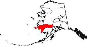 Bethel Census Area map | |
| CDPs | ||
| Unincorporated communities | ||
| Ghost towns | ||