Tsilhqot'in
The Tsilhqot'in ("People of the river", /tʃɪlˈkoʊtɪn/ chil-KOH-tin;[2] also spelled Chilcotin, Tsilhqut'in, Tŝinlhqot’in, Chilkhodin, Tsilkótin, Tsilkotin) are a North American Tribal government of the Athabaskan-speaking ethnolinguistic group that live in British Columbia, Canada. They are the most southern of the Athabaskan-speaking aboriginal peoples in British Columbia.
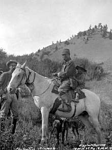 Tsilhqot'in man on horse (1901) | |
| Total population | |
|---|---|
| 4,100 (2008)[1] | |
| Regions with significant populations | |
| Canada (British Columbia) | |
| Languages | |
| English, Tsilhqot’in | |
| Religion | |
| Christianity, Animism | |
| Related ethnic groups | |
| Dakelh, Navajo |
History
Pre-contact
The Tŝilhqot'in Nation before contact with Europeans was a strong warrior nation with political influence from the Similkameen region in the south (of British Columbia), the Pacific coast in the west, and the Rocky Mountains in the east. They were part of an extensive trade network centred around control and distribution of obsidian, the material of choice for arrowheads and other stone tools.
.jpg)
European trade
The Tsilhqot’in first encountered European trading goods in the 1780s and 1790s when British and American ships arrived along the northwest coast seeking sea otter pelts. By 1808, a fur-trading company out of Montreal called the North West Company had established posts in the Carrier (Dene) territory just north of the Tsilhqot’in. They began trading directly and through Carrier intermediaries.
In 1821, what was then the Hudson’s Bay Company established a fur trade post at Fort Alexandria on the Fraser River, at the eastern limit of Tsilhqot’in territory. This became the tribal people's major source for European goods.
Disease
Contact with Europeans and First Nations intermediaries led to the introduction of Eurasian diseases, which were endemic among the Europeans. As they had long been exposed, some had developed acquired immunity, but the First Nations peoples were devastated by epidemics of these new diseases.
Infectious diseases with high fatalities for Tsilhqot'in populations:
- Whooping cough ,1845
- Measles, 1850.
- Smallpox, 1855 (from infected blankets from the Thompson River area).
- Smallpox, 1862–1863 (reduced BC aboriginal population by 62% – completely destroyed six Secwepemc bands, a total of 850 people; 2/3 of the Secwepemc population died; half of the 14 Fraser River Bands became extinct).
- Spanish flu, 1919 – this epidemic affected European Canadians as well as First Nations, and millions of people died internationally.
The isolated position of the Tsilhqot’in may have protected them from the first of the smallpox epidemics, which spread up from Mexico in the 1770s. They may have been spared the smallpox epidemic of 1800 and the measles of the 1840s. Furniss in The Burden of History states that "there is no direct evidence that these smallpox epidemics reached the central interior of British Columbia or the Secwepemc, Carrier, or Tsilhqot'in". However, in the epidemic of 1836–38, the disease spread to Ootsa Lake and killed an entire Carrier band. Oral history of the bands has continued to recount the effects of the many deaths in these epidemics.
Gold rush and European settlement
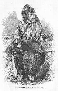
By the 1860s, miners panned along the Fraser, Quesnel, and Horsefly rivers and their tributaries. Various business operators and merchants followed the miners and business was booming. Farmers and ranchers developed land to provision the mining towns that developed around the merchants. This led to competition for resources between the Chilcotin and Europeans, leading to a stream of events known as the Chilcotin War.
The reserves
Governor James Douglas supported a system of reserves and indoctrination to "civilized" practices such as subsistence agriculture up until his retirement in 1864. Joseph Trutch, the chief commissioner of lands and works, abandoned the reserve policy, and set Indian policy as their having no rights to the land. By 1866, BC colonial rule required natives to request permission from the Governor to use lands. Newspapers supported the preempting of native lands, seeing settlers ploughing native burial grounds. Natives who requested redress from a Justice of the Peace were refused leave.
Environmental problems
In the 1870s, the loss of hunting territories, and crashes of the Salmon runs placed more dependence on agricultural produce such as grains, hay, and vegetables. Activities migrated to cutting hay, constructing irrigation ditches, and practicing animal husbandry. Settlers however assumed water rights, making agriculture ever more fragile. Natives were huddled in on small acreages, such as with Canoe Creek, 20 acres for 150 natives. Starvation became a threat.
Canadian government set to reallocate land back to natives
In contrast to the 160 to 640 acres per family set aside in other treaties at the time in the Prairies, the Federal Government opted for 80 acres per native family to be set aside in reserve, while the provincial government was keen on 10 acres per family.
Catholic missionaries and the residential schools
Catholic Missionaries were sent to convert First Nations children to Christianity. By 1891, the first group of students were sent to receive a so-called "formal" education. The program continued for the next six decades until a point when Native children were allowed into the public school system. Ninety years after the start of the Residential School program, the mission school closed circa 1981. Throughout that period, Indian agents were empowered to remove children from homes to attend St. Joseph's Mission school in 150 Mile House. This led some to attempt to hide their children by sneaking out to hunting grounds or fields. Children fled the schools, and within the first 30 years, three investigations on the physical abuse and malnutrition were conducted; however, the Natives were said to be "wild", deserving the treatment.
Disenfranchisement
Voting rights in Canadian Federal Elections were denied until 1960, and in Provincial Elections until 1949.
First Nations and Communities
Today, some 5,000 Tsilhqot’in people live in Alexandria, north of Williams Lake, British Columbia, and in a string of five communities accessible from Williams Lake on Highway 20 (from east to west), and south from Highway 20 is the Nemiah Valley the Xeni-Gwet’in[3].
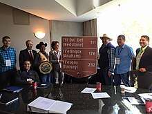
- Toosey First Nation (Tl’esqox of the Tsilhqot’in) (offices are located at Riske Creek; Tsilhqot’in community: Tl'esqox (Toosey); Tsilhqot’in band name: Tl’esqoxt’in (Tl'esqox Gwet'in) = "People at/on Tl'esqox"; Registered Population April, 2020: 377)
- Yunesit'in First Nation (Stone First Nation) (offices at the town of Hanceville, B.C.; Tsilhqot’in community: Yunesit’in - "Stone/Stoney", original place-name: Gex Nats’inilht’ih; Tsilhqot’in band name: Yunesit'in (Yuneŝit'in Gwet'in); Registered Population April, 2020: 491)
- Tl'etinqox-t'in Government Office (Anaham Reserve First Nations) (offices east of the town of Alexis Creek; Tsilhqot’in community: Tl'etinqox - "the river flats"; Tsilhqot’in band name: Tl'etinqox-t'in (Tl'etinqox Gwet'in) - "People of Tl'etinqox"; Registered Population April, 2020: 1,631)
- Tŝideldel First Nation (Alexis Creek First Nation) (offices are at Redstone on the main Redstone Reserve; Tsilhqot’in community: Tsi Del Del] - "Red Stone"; Tsilhqot’in band name: Tŝideldel (Tŝi Deldel Gwet'in); Registered Population April, 2020: 703)
- Ulkatcho First Nation (offices at Anahim Lake; mixed Dakelh-Tŝilhqot’in community, mostly of the Ulkatchot’en Dakelh-subgroup with intermarried Nagwentl’un-Tsilhqot’in-subgroup and some Nuxalkmc; Registered Population April, 2020: 1,065)
- ʔEsdilagh First Nation (Alexandria First Nation) (historic Tsilhqot’in band name: ʔElhdaqox-t'in - "People of the Sturgeon River; i.e. Fraser River"; Tsilhqot’in community: ʔEsdilagh - "where the land meets the water." or "Peninsula"; Tsilhqot’in band name: ʔEsdilagh-t'in (ʔEsdinlagh Gwet'in) - "People of the Peninsula"; Registered Population April, 2020: 256)
- Xeni Gwet'in First Nation (offices at the wilderness community and reserve Nemaia Valley; Tsilhqot’in community: Xeni Gwet; Tsilhqot’in band name: Xeni Gwet'in - "People of Xeni Village"; Registered Population April, 2020: 454)
Aside from the aboriginal communities, there are only two small unincorporated towns in the whole region: Alexis Creek and Anahim Lake, the largest, with 522 people. Numerically, at least, the Tsilhqot’in still dominate the Chilcotin plateau.
Tsilhqot’in First Nations belong to two tribal councils:
Carrier-Chilcotin Tribal Council (two Carrier/Dakelh bands, one Tsilhqot'in band, and one mixed Carrier/Dakelh-Tsilhqot'in band)
- Kluskus First Nation
- Red Bluff First Nation
- Toosey First Nation (Tl’esqox of the Tsilhqot’in)
- Ulkatcho First Nation
Tsilhqot'in National Government (all Tsilhqot'in bands without the mixed Carrier/Dakelh-Tsilhqot'in band)
- ʔEsdilagh First Nation (Alexandria First Nation)
- Tŝideldel First Nation (Alexis Creek First Nation)
- Yunesit'in First Nation (Stone First Nation)
- Tl'etinqox-t'in Government Office (Anaham Reserve First Nations)
- Xeni Gwet'in First Nation
- Toosey First Nation (Tl’esqox of the Tsilhqot’in)
Despite its small population and isolation, the region has produced an impressive collection of literature mixing naturalism with native and settler cultures. The area is accessed by Highway 20, which runs from the City of Williams Lake to the port town of Bella Coola. Highway 20 westbound from Williams Lake crosses the Fraser River at Sheep Creek - thereby entering Tsilhqot'in Traditional Territory. The Highway passes over the Chilcotin Plateau, characterized by undulating grasslands, expansive Lodgepole Pine & Douglas Fir forests, a scattering of lakes, rivers, creeks & ponds, volcanic & glaciated landforms, and a magnificent backdrop of snow-covered peaks.
See also
- Chilcotin language
- Chilcotin War
- Carrier Chilcotin Tribal Council
- Tsilhqot'in Tribal Council
- Tsilhqot'in Nation v. British Columbia
References
- Linda Ruth Smith (2008), Súwh-tŝ’éghèdúdính: the Tsìnlhqút’ín Nímính Spiritual Path. A Thesis Submitted in Partial Fulfillment of the Requirements for the Degree of Master of Arts, In the Department of Linguistics, University of Victoria
- "First Nations Peoples of British Columbia". Government of British Columbia – Ministry of Education. Retrieved 2013-05-14.
- Indigenous and Northern Affairs Canada - Indigenous peoples and communities - First Nation Profiles - Council Detail
External links
- Tŝilhqot'in National Government
- Tsilhqot'in Nation
- Unjust Trial and Hanging of the Tsilhqot'in Warriors
- Tsilhqot’in Culture
- Tsilhqot’in Homeland by James Teit, 1909
- The Tsilhqot'in and Their Neighbours According to James Teit, 1909
- Tsîlhqot’in Food Supply According to James Teit, 1909
- Tsîlhqot’in Travel and Trade by James Teit, 1909
- Tsîlhqot’in Warfare by James Teit, 1909
- Tsilhqot'in National Government
- Tsilkotin Indian Tribe History
- Makuk: A New History of Aboriginal-White Relations, John Sutton Lutz, UBC Press, 2009, Chapter The Tshilqot'in, ISBN 978-0-7748-1140-8, pp. 119–162
Bibliography
- Nemiah: The Unconquered Country by Terry Glavin
- Chilcotin Cowboy by Paul St. Pierre
- Smith and Other Events by Paul St. Pierre
- Caruso of Lonesome Lake by Ralph Edwards
- Chiwid by Sage Birchwater
- The Chilcotin War by Mel Rothenburger
- High Slack: Waddington's Gold Road and the Bute Inlet Massacre of 1864 by Judith Williams