Tragano
Tragano (Greek, Modern: Τραγανό, Ancient/Katharevousa: -on) is a town and a former municipality in Elis, West Greece, Greece. Since the 2011 local government reform it is part of the municipality Pineios, of which it is a municipal unit.[2] The municipal unit has an area of 41.475 km2.[3] Tragano is situated in a flat, rural area, north of the river Pineios. It is 2 km east of Stafidokampos, 4 km east of Andravida, 3 km north of Agia Mavra, 5 km northwest of Avgeio and 8 km northeast of Gastouni. It is 2 km southeast of the Andravida Air Base.
Tragano Τραγανό | |
|---|---|
 Tragano Location within the regional unit 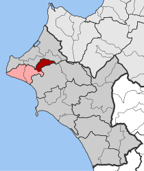 | |
| Coordinates: 37°54′N 21°19′E | |
| Country | Greece |
| Administrative region | West Greece |
| Regional unit | Elis |
| Municipality | Pineios |
| • Municipal unit | 41.475 km2 (16.014 sq mi) |
| Elevation | 5 m (16 ft) |
| Population (2011)[1] | |
| • Municipal unit | 3,881 |
| • Municipal unit density | 94/km2 (240/sq mi) |
| Time zone | UTC+2 (EET) |
| • Summer (DST) | UTC+3 (EEST) |
| Postal code | 270 57 |
| Area code(s) | 26230 |
| Vehicle registration | ΗΑ |
Subdivisions
The municipal unit Tragano is subdivided into the following communities:
- Tragano
- Agia Mavra
- Simiza
The community Tragano consists of the town Tragano (population 2,509 in 2011) and the small villages Markopoulo, Olga and Pigadi. Markopoulo is 1 km east of Tragano town centre. Its population was 125 in 2011. Olga is 3 km east of Tragano, and its population was 672 in 2011. Pigadi is 7 km east of Tragano, population 41 in 2011.
Historical population
| Year | Community | Municipal unit |
|---|---|---|
| 1981 | - | 2,502 |
| 1991 | 1,980 | 2,774 |
| 2001 | 2,688 | 3,361 |
| 2011 | 3,347 | 3,881 |
See also
References
- "Απογραφή Πληθυσμού - Κατοικιών 2011. ΜΟΝΙΜΟΣ Πληθυσμός" (in Greek). Hellenic Statistical Authority.
- Kallikratis law Greece Ministry of Interior (in Greek)
- "Population & housing census 2001 (incl. area and average elevation)" (PDF) (in Greek). National Statistical Service of Greece.