Toro Canyon, California
Toro Canyon is a census-designated place (CDP) in Santa Barbara County, California, United States. The population was 1,508 at the 2010 census, down from 1,697 at the 2000 census.
Toro Canyon | |
|---|---|
 Location in Santa Barbara County and the state of California | |
| Coordinates: 34°25′6″N 119°33′47″W | |
| Country | |
| State | |
| County | Santa Barbara |
| Government | |
| • State Senator | Hannah-Beth Jackson (D)[1] |
| • CA Assembly | Monique Limón (D)[1] |
| • U. S. Congress | Salud Carbajal (D)[2] |
| Area | |
| • Total | 3.573 sq mi (9.255 km2) |
| • Land | 3.570 sq mi (9.246 km2) |
| • Water | 0.003 sq mi (0.009 km2) 0.10% |
| Elevation | 49 ft (15 m) |
| Population (2010) | |
| • Total | 1,508 |
| • Density | 420/sq mi (160/km2) |
| Time zone | UTC-8 (PST) |
| • Summer (DST) | UTC-7 (PDT) |
| ZIP code | 93013 |
| Area code(s) | 805 |
| FIPS code | 06-79529 |
| GNIS feature ID | 1853418 |
Geography
Toro Canyon is bounded on the west by Montecito and Summerland, on the east and southeast by Carpinteria, on the north by Los Padres National Forest, and on the south by the Pacific Ocean.
According to the United States Census Bureau, the CDP has a total area of 3.6 square miles (9.3 km2), 99.90% of it land and 0.10% of it water.
Demographics
2010
At the 2010 census Toro Canyon had a population of 1,508. The population density was 422.0 people per square mile (162.9/km²). The racial makeup of Toro Canyon was 1,388 (92.0%) White, 7 (0.5%) African American, 7 (0.5%) Native American, 14 (0.9%) Asian, 1 (0.1%) Pacific Islander, 73 (4.8%) from other races, and 18 (1.2%) from two or more races. Hispanic or Latino of any race were 293 people (19.4%).[4]
The whole population lived in households, no one lived in non-institutionalized group quarters and no one was institutionalized.
There were 620 households, 138 (22.3%) had children under the age of 18 living in them, 352 (56.8%) were opposite-sex married couples living together, 49 (7.9%) had a female householder with no husband present, 15 (2.4%) had a male householder with no wife present. There were 32 (5.2%) unmarried opposite-sex partnerships, and 8 (1.3%) same-sex married couples or partnerships. 153 households (24.7%) were one person and 71 (11.5%) had someone living alone who was 65 or older. The average household size was 2.43. There were 416 families (67.1% of households); the average family size was 2.87.
The age distribution was 253 people (16.8%) under the age of 18, 107 people (7.1%) aged 18 to 24, 290 people (19.2%) aged 25 to 44, 525 people (34.8%) aged 45 to 64, and 333 people (22.1%) who were 65 or older. The median age was 50.2 years. For every 100 females, there were 91.1 males. For every 100 females age 18 and over, there were 93.1 males.
There were 804 housing units at an average density of 225.0 per square mile, of the occupied units 440 (71.0%) were owner-occupied and 180 (29.0%) were rented.The homeowner vacancy rate was 1.6%; the rental vacancy rate was 6.6%. 1,088 people (72.1% of the population) lived in owner-occupied housing units and 420 people (27.9%) lived in rental housing units.
2000
At the 2000 census there were 1,697 people, 698 households, and 450 families in the CDP. The population density was 468.1 people per square mile (180.5/km²). There were 814 housing units at an average density of 224.5 per square mile (86.6/km²). The racial makeup of the CDP was 87.98% White, 0.35% African American, 0.35% Native American, 1.36% Asian, 0.18% Pacific Islander, 8.01% from other races, and 1.77% from two or more races. Hispanic or Latino of any race were 16.26%.[5]
Of the 698 households 22.8% had children under the age of 18 living with them, 54.2% were married couples living together, 7.3% had a female householder with no husband present, and 35.4% were non-families. 27.9% of households were one person and 9.5% were one person aged 65 or older. The average household size was 2.43 and the average family size was 2.91.
The age distribution was 20.2% under the age of 18, 5.7% from 18 to 24, 25.0% from 25 to 44, 31.8% from 45 to 64, and 17.4% 65 or older. The median age was 44 years. For every 100 females, there were 98.5 males. For every 100 females age 18 and over, there were 95.5 males.
The median household income was $68,789 and the median family income was $79,732. Males had a median income of $58,207 versus $32,969 for females. The per capita income for the CDP was $45,967. About 4.6% of families and 7.4% of the population were below the poverty line, including 1.5% of those under age 18 and 3.3% of those age 65 or over.
References
- "Statewide Database". UC Regents. Retrieved December 8, 2014.
- "California's 24th Congressional District - Representatives & District Map". Civic Impulse, LLC. Retrieved September 29, 2014.
- "2010 Census U.S. Gazetteer Files – Places – California". United States Census Bureau.
- "2010 Census Interactive Population Search: CA - Toro Canyon CDP". U.S. Census Bureau. Archived from the original on July 15, 2014. Retrieved July 12, 2014.
- "U.S. Census website". United States Census Bureau. Retrieved 2008-01-31.
Municipalities and communities of Santa Barbara County, California, United States | ||
|---|---|---|
| Cities | 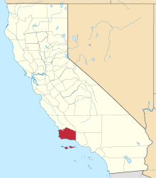 Santa Barbara County map | |
| CDPs | ||
| Unincorporated communities | ||
| Indian reservation | ||
| Ghost towns | ||