Toconao
Toconao is a village 38 km (24 mi) south of San Pedro de Atacama in the San Pedro de Atacama province of Chile's northern Antofagasta Region. It lies at an elevation of 2,485 m (8,153 ft) above sea level, close to the northeast margin of the Salar de Atacama.
Toconao | |
|---|---|
Village | |
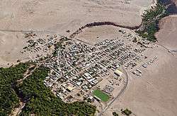 Toconao seen from above | |
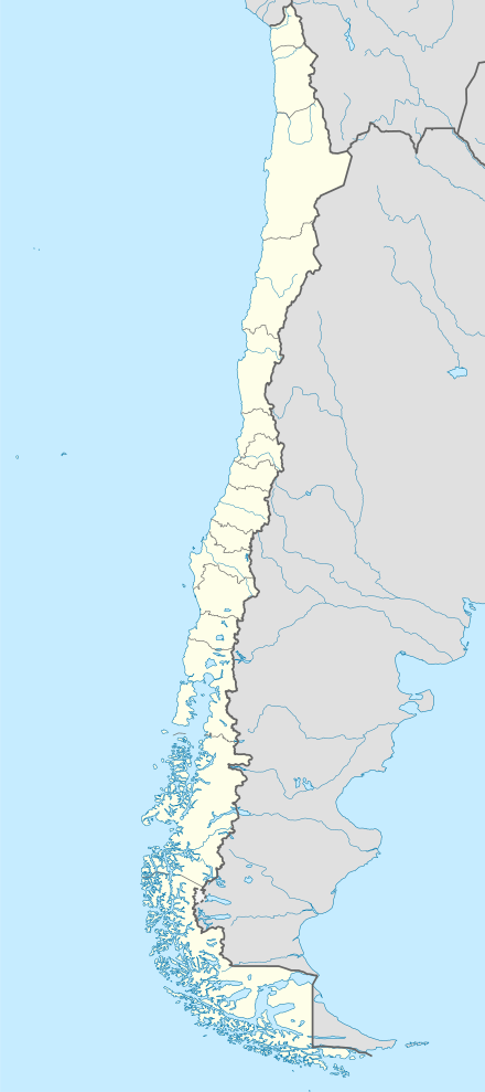 Toconao Location of Toconao in Chile. | |
| Coordinates: 23°11′25″S 68°00′18″W | |
| Country | |
| Region | Antofagasta Region |
| Province | El Loa Province |
| Elevation | 2,485 m (8,153 ft) |
The most notable building in Toconao is its church. The bell tower is separated from the main church structure and dates from 1750.
Climate
| Climate data for Toconao | |||||||||||||
|---|---|---|---|---|---|---|---|---|---|---|---|---|---|
| Month | Jan | Feb | Mar | Apr | May | Jun | Jul | Aug | Sep | Oct | Nov | Dec | Year |
| Average high °C (°F) | 27.5 (81.5) |
27.3 (81.1) |
26.4 (79.5) |
24.8 (76.6) |
21.7 (71.1) |
19.0 (66.2) |
18.7 (65.7) |
21.0 (69.8) |
22.6 (72.7) |
24.9 (76.8) |
26.1 (79.0) |
27.6 (81.7) |
24.0 (75.2) |
| Average low °C (°F) | 11.0 (51.8) |
11.2 (52.2) |
10.2 (50.4) |
8.6 (47.5) |
6.1 (43.0) |
3.8 (38.8) |
3.3 (37.9) |
5.3 (41.5) |
6.5 (43.7) |
8.3 (46.9) |
9.0 (48.2) |
11.2 (52.2) |
7.9 (46.2) |
| Average precipitation mm (inches) | 7 (0.3) |
11 (0.4) |
8 (0.3) |
0 (0) |
1 (0.0) |
2 (0.1) |
0 (0) |
0 (0) |
1 (0.0) |
0 (0) |
0 (0) |
1 (0.0) |
31 (1.2) |
| Average relative humidity (%) | 31 | 38 | 33 | 26 | 23 | 24 | 23 | 20 | 16 | 16 | 19 | 24 | 24 |
| Source: Atlas Agroclimatico de Chile (temperatures 1988–2007, precipitation 1975–2009, humidity 1988–2015)[1] | |||||||||||||
References
- "Atlas Agroclimático de Chile–Estado Actual y Tendencias del Clima (Tomo I: Regiones de Arica Y Parinacota, Tarapacá y Antofagasta" (in Spanish). Universidad de Chile. 2017. pp. 136–146. Retrieved 9 December 2018.
- (in Spanish) Sernatur - Toconao
| Wikimedia Commons has media related to Toconao. |
This article is issued from Wikipedia. The text is licensed under Creative Commons - Attribution - Sharealike. Additional terms may apply for the media files.