Tilden, Nebraska
Tilden is a city in Antelope and Madison counties in the U.S. state of Nebraska. The population was 953 at the 2010 census. The Madison County portion of Tilden is part of the Norfolk, Nebraska Micropolitan Statistical Area.
Tilden, Nebraska | |
|---|---|
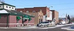 North side of 2nd Street in Tilden | |
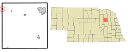 Location of Tilden, Nebraska | |
| Coordinates: 42°2′43″N 97°50′1″W | |
| Country | United States |
| State | Nebraska |
| Counties | Madison, Antelope |
| Area | |
| • Total | 0.74 sq mi (1.91 km2) |
| • Land | 0.74 sq mi (1.91 km2) |
| • Water | 0.00 sq mi (0.00 km2) |
| Elevation | 1,683 ft (513 m) |
| Population | |
| • Total | 953 |
| • Estimate (2018)[3] | 936 |
| • Density | 1,262.87/sq mi (487.61/km2) |
| Time zone | UTC-6 (Central (CST)) |
| • Summer (DST) | UTC-5 (CDT) |
| ZIP code | 68781 |
| Area code(s) | 402 |
| FIPS code | 31-48935[4] |
| GNIS feature ID | 0834109[5] |
History
Tilden was originally called Burnett, and under the latter name was laid out by the railroad in 1880.[6] It was then incorporated as Burnett in 1885, but the U.S. Post Office officially changed the name of the village in 1887, after presidential candidate Samuel J. Tilden, due to confusion with Bennet, Nebraska.[7] Tilden was incorporated as a city in 1919.[8]
Geography
Tilden is located at 42°2′43″N 97°50′1″W (42.045297, -97.833599).[9] The city is located mostly within Madison County, with a portion of the city in Antelope County.
According to the United States Census Bureau, the city has a total area of 0.74 square miles (1.92 km2), all land.[10]
Tilden was located on the Cowboy Line of the Chicago and Northwestern Railroad. The line was abandoned in 1992, and with it the antique wigwag signal that protected the main crossing in town. The abandoned line has been converted to the Cowboy Trail, running 321 miles from Norfolk to Chadron; when complete, it will be the longest rails-to-trails line in the United States.[11]
Demographics
| Historical population | |||
|---|---|---|---|
| Census | Pop. | %± | |
| 1900 | 533 | — | |
| 1910 | 901 | 69.0% | |
| 1920 | 1,101 | 22.2% | |
| 1930 | 1,106 | 0.5% | |
| 1940 | 984 | −11.0% | |
| 1950 | 1,033 | 5.0% | |
| 1960 | 917 | −11.2% | |
| 1970 | 947 | 3.3% | |
| 1980 | 1,012 | 6.9% | |
| 1990 | 895 | −11.6% | |
| 2000 | 1,078 | 20.4% | |
| 2010 | 953 | −11.6% | |
| Est. 2018 | 936 | [3] | −1.8% |
| U.S. Decennial Census[12] | |||
2010 census
At the 2010 census there were 953 people in 403 households, including 262 families, in the city. The population density was 1,287.8 inhabitants per square mile (497.2/km2). There were 453 housing units at an average density of 612.2 per square mile (236.4/km2). The racial makeup of the city was 96.2% White, 0.4% African American, 0.2% Native American, 0.6% Asian, 1.4% from other races, and 1.2% from two or more races. Hispanic or Latino of any race were 2.2%.[2]
Of the 403 households 30.3% had children under the age of 18 living with them, 56.1% were married couples living together, 5.7% had a female householder with no husband present, 3.2% had a male householder with no wife present, and 35.0% were non-families. 32.5% of households were one person and 18.1% were one person aged 65 or older. The average household size was 2.35 and the average family size was 2.98.
The median age was 38.3 years. 25.3% of residents were under the age of 18; 5.4% were between the ages of 18 and 24; 23.6% were from 25 to 44; 24.2% were from 45 to 64; and 21.3% were 65 or older. The gender makeup of the city was 49.5% male and 50.5% female.
2000 census
At the 2000 census there were 1,078 people in 418 households, including 270 families, in the city. The population density was 1,475.5 people per square mile (570.2/km²). There were 470 housing units at an average density of 643.3 per square mile (248.6/km²). The racial makeup of the city was 95.55% White, 0.09% African American, 0.93% Native American, 0.09% Asian, 2.13% from other races, and 1.21% from two or more races. Hispanic or Latino of any race were 6.77%.[4]
Of the 418 households 28.7% had children under the age of 18 living with them, 54.8% were married couples living together, 6.9% had a female householder with no husband present, and 35.2% were non-families. 31.3% of households were one person and 20.6% were one person aged 65 or older. The average household size was 2.45 and the average family size was 3.11.
In the city, the population was spread with 25.6% under the age of 18, 8.9% from 18 to 24, 22.4% from 25 to 44, 18.6% from 45 to 64, and 24.6% 65 or older. The median age was 40 years. For every 100 females, there were 91.8 males. For every 100 females age 18 and over there were 92.3 males.
As of 2000 the median income for a household in the city was $31,875, and the median family income was $42,188. Males had a median income of $29,750 versus $19,844 for females. The per capita income for the city was $14,663. About 7.0% of families and 11.1% of the population were below the poverty line, including 17.6% of those under age 18 and 8.456% of those age 65 or over.
Notable people
L. Ron Hubbard, science-fiction author and founder of Scientology, was born in Tilden in 1911.[13] Professional baseball player Richie Ashburn was born in Tilden in 1927.[14] Theologian and author Walter Brueggemann was born in Tilden in 1933.[15]
References
- "2017 U.S. Gazetteer Files". United States Census Bureau. Retrieved Jan 12, 2019.
- "U.S. Census website". United States Census Bureau. Retrieved 2012-06-24.
- "Population and Housing Unit Estimates". Retrieved February 22, 2020.
- "U.S. Census website". United States Census Bureau. Retrieved 2008-01-31.
- "US Board on Geographic Names". United States Geological Survey. 2007-10-25. Retrieved 2008-01-31.
- Leach, A.J. (1909). A history of Antelope County, Nebraskafrom its first settlement in 1868 to the close of the year 1883. R.R. Donnelley & Sons Company. p. 156.
- Welcome to Tilden, Nebraska
- "Tilden, Antelope County". Center for Advanced Land Management Information Technologies. University of Nebraska. Retrieved 2014-07-29.
- "US Gazetteer files: 2010, 2000, and 1990". United States Census Bureau. 2011-02-12. Retrieved 2011-04-23.
- "US Gazetteer files 2010". United States Census Bureau. Archived from the original on 2012-07-02. Retrieved 2012-06-24.
- "The Cowboy Trail". Archived 2010-01-06 at the Wayback Machine Nebraska Game and Parks Commission. Archived 2009-03-17 at the Wayback Machine Retrieved 2010-02-15.
- "Census of Population and Housing". Census.gov. Retrieved June 4, 2015.
- "Who Was L. Ron Hubbard?" Church of Scientology. Retrieved 2016-03-10.
- "Richie Ashburn". National Baseball Hall of Fame and Museum. Retrieved 2016-03-10.
- "About Walter Brueggemann". WalterBrueggemann.com. Retrieved 2016-03-10.
External links
- Tilden Woman's Club project of local historical remembrance - Nebraska Memories
Municipalities and communities of Antelope County, Nebraska, United States | ||
|---|---|---|
| Cities | Map of Nebraska highlighting Antelope County | |
| Villages | ||
| Townships | ||
| Footnotes | ‡This populated place also has portions in an adjacent county or counties | |
Municipalities and communities of Madison County, Nebraska, United States | ||
|---|---|---|
| Cities | Map of Nebraska highlighting Madison County | |
| Village | ||
| Unincorporated communities | ||
| Footnotes | ‡This populated place also has portions in an adjacent county or counties | |
| Authority control |
|
|---|