Tibet, Georgia
Tibet is an unincorporated community in southeastern Long County, Georgia, United States. It lies 15 miles (24 km) south of Hinesville.[1] Its elevation is 56 feet (17 m).[2]
Tibet, Georgia | |
|---|---|
 Tibet  Tibet | |
| Coordinates: 31°37′26″N 81°35′53″W | |
| Country | United States |
| State | Georgia |
| County | Long |
| Elevation | 56 ft (17 m) |
| Population (1912) | |
| • Total | 15 |
| Time zone | UTC-5 (Eastern (EST)) |
| • Summer (DST) | UTC-4 (EDT) |
| GNIS feature ID | 348281 |
History
A post office called Tibet was established in 1900, and remained in operation until 1914.[3][4][5][6] Its population was estimated to be 15 in 1912.[7] Tibet existed on the map as late as 1915, when it was part of Liberty County.[8] As of July 1916, the community's closest access to banks and attorneys was in Darien,[9] and since Tibet's post office closed, mail was supplied from Ludowici to the northwest.[10][11] Tibet became part of the newly created Long County in 1920.
Tibet is located in Militia District 1544, which is also named Tibet.[12][13]
References
- Candler, Allen Daniel; Evans, Clement Anselm (1906). Georgia: Comprising Sketches of Counties, Towns, Events, Institutions, and Persons. 3. Atlanta: State Historical Association. p. 443. Retrieved 2020-05-17.
- "Tibet (historical)". Geographic Names Information System. United States Geological Survey. 1994-08-01. Retrieved 2020-05-17.
- "Long County". Jim Forte Postal History. Retrieved 2020-05-17.
- United States Official Postal Guide. United States. Post Office Department. 1909. p. 373.
- United States Official Postal Guide. U.S. Government Printing Office. 1910. p. 378.
- United States Official Postal Guide. U.S. Government Printing Office. 1911. p. 523.
- The Georgia Annual: A Compendium of Useful Information about Georgia. A.B. Caldwell. 1912. p. 37.
- "Future Location of Long County, 1915". GeorgiaInfo. University System of Georgia. Retrieved 2020-05-17.
- The Bankers Register and Special List of Selected Lawyers: Blue Book. 54. Credit Company. July 1916. p. 1364.
- United States Official Postal Guide. U.S. Government Printing Office. 1915. p. 670.
- United States Official Postal Guide. United States. Post Office Department. 1916. p. 695.
- Andriot, John L. (1979). Township atlas of the United States. Andriot Associates. p. 997.
- Graham, Paul K. (2010). Atlas of East and Coastal Georgia Watercourses and Militia Districts. The Genealogy Company. ISBN 9780975531235.
Municipalities and communities of Long County, Georgia, United States | ||
|---|---|---|
| City | 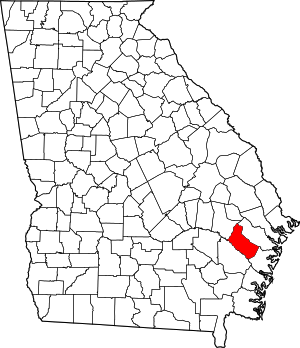 Map of Georgia highlighting Long County | |
| Unincorporated communities | ||
This article is issued from Wikipedia. The text is licensed under Creative Commons - Attribution - Sharealike. Additional terms may apply for the media files.