Thorngate, South Australia
Thorngate is an inner northern suburb of Adelaide, South Australia. It is located in the City of Prospect.
| Thorngate Adelaide, South Australia | |||||||||||||||
|---|---|---|---|---|---|---|---|---|---|---|---|---|---|---|---|
| Population | 180 (2006 census)[1] 177 (2001 Census)[2] | ||||||||||||||
| Postcode(s) | 5082[3] | ||||||||||||||
| Location | 3.3 km (2 mi) N of Adelaide city centre[3] | ||||||||||||||
| LGA(s) | City of Prospect | ||||||||||||||
| State electorate(s) | Adelaide (2011)[4] | ||||||||||||||
| Federal Division(s) | Adelaide (2011)[5] | ||||||||||||||
| |||||||||||||||
This small suburb is one of South Australia's most expensive. Although sales are rare, houses on Fitzroy Terrace and Churcher Street were valued well over $1 million in 2006.
History
Formerly part of Fitzroy, the suburb is thought to be named after the original grantee of that area, one John Batty Thorngate. Arriving from Gosport, Hampshire, Thorngate was granted his land in 1840.[6]
Geography
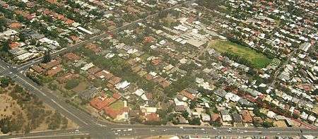
Thorngate is one of Adelaide's smallest suburbs. It is bounded to the north by Carter Street, to the south by Fitzroy Terrace, in the west by Prospect Road and the east by Main North Road. The only other streets in the suburb are Churcher Street and Thorngate Street.[7]
Demographics
The 2006 Census by the Australian Bureau of Statistics counted 180 persons in Thorngate on census night. Of these, half were female.[1]
The majority of residents (76.7%) are of Australian birth, with an additional 6.7% identifying Greece as their country of birth.[1]
The age distribution of Thorngate residents is similar to that of the greater Australian population. 64.4% of residents were over 25 years in 2006, compared to the Australian average of 66.5%; and 35.6% were younger than 25 years, compared to the Australian average of 33.5%.[1]
Politics
Thorngate is in the South Australian House of Assembly electoral district of Adelaide and the Australian House of Representatives division of Adelaide.
The local electoral booths tend to swing strongly to the Liberal Party, even though the electoral district to which Thorngate belongs is historically marginal or leaning to the Labor Party.
Facilities and attractions
A BP service station sits on the corner of Carter Street and Main North Road.[7]
Transportation
Roads
Thorngate is serviced by Main North Road and Prospect Road, which link the suburb to both Adelaide city centre and the northern suburbs.[7]
Public transport
Buses
The suburb is serviced by the following bus routes:[8]
- G10
- 221, 222
- 224, 226F, N224
- 225
- 228
- 229
- 209F
See also
References
- Australian Bureau of Statistics (25 October 2007). "Thorngate (State Suburb)". 2006 Census QuickStats. Retrieved 27 April 2011.
- Australian Bureau of Statistics (9 March 2006). "Thorngate (State Suburb)". 2001 Census QuickStats. Retrieved 27 April 2011.
- "Thorngate, South Australia (Adelaide)". Postcodes-Australia. Postcodes-Australia.com. Retrieved 27 April 2011.
- "Electoral Districts - Electoral District for the 2010 Election". Electoral Commission SA. Archived from the original on 22 August 2011. Retrieved 27 April 2011.
- "Find my electorate". Australian Electoral Commission. 15 April 2011. Archived from the original on 30 April 2011. Retrieved 27 April 2011.
- "Place Names of South Australia". The Manning Index of South Australian History. State Library of South Australia. Retrieved 27 April 2011.
- Adelaide and surrounds street directory (47th ed.). UBD. 2009. ISBN 978-0-7319-2336-6.
- "Public Transport in Adelaide". Adelaide Metro official website. Dept. for Transport, Energy and Infrastructure, Public Transport Division. 12 January 2011. Archived from the original on 26 April 2011. Retrieved 27 April 2011.
External links
- "City of Prospect". Official website. City of Prospect. Retrieved 27 April 2011.