Thirthahalli
Thirthahalli is a panchayat town located in the Shimoga district of the state of Karnataka, India. It lies on the bank of the river Tunga and is also the headquarters of the Thirthahalli Taluk of Shimoga district.
Thirthahalli | |
|---|---|
Taluk | |
 Tunga Bridge with Lightings during Theppotsava | |
 Thirthahalli Location in Karnataka, India | |
| Coordinates: 13.690°N 75.245°E | |
| Country | |
| State | Karnataka |
| District | Shimoga district |
| Region | Malenadu |
| Government | |
| • MLA | Araga Jnanendra |
| Area | |
| • Total | 5.91 km2 (2.28 sq mi) |
| Elevation 566 | 591 m (1,939 ft) |
| Population (2011[1]) | |
| • Total | 14,357 |
| • Density | 2,400/km2 (6,300/sq mi) |
| Languages | |
| • Official | Kannada |
| Languages | |
| Time zone | UTC+5:30 (IST) |
| PIN | 577 432 |
| Telephone code | 08181 |
| Vehicle registration | KA-14 |
| Website | www |
Geography
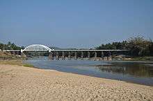
Bridge across the river Tunga at Thirthahalli
Thirthahalli is located at 13.7°N 75.23°E.[2] It has an average elevation of 591 metres (1938 feet).
Notable people
- Kuvempu - Kannada author and poet, Jnanapeetha and Padma Vibhushan awardee
- Shantaveri Gopala Gowda - Socialist Leader and Politician.
- U. R. Ananthamurthy- Contemporary writer, Novelist and critic, Jnanapeetha and Padma Bhushan awardee.
- Kadidal Manjappa- Politician and former Chief Minister of Karnataka
- Justice. M Rama Jois - Advocate and Chief Justice, Former Governor of Jharkhand and Bihar
- M. K. Indira, Kannada Novelist.
- Poornachandra Tejaswi- writer, environmentalist and son of kuvempu.
- Girish Kasaravalli- Multiple award winning Kannada Film Director, Padmashri awardee.
- Kimmane Rathnakar- Politician and former minister of Legislative assembly
- Araga Jnanendra- Politician and former chairman of Mysore Paper Mills.
- Diganth-Kannada film actor
Schools
- Tunga Mahavidyalaya
- Sahyadri Polytechnic
- Sevabharathi Higher Primary School
External links
| Wikimedia Commons has media related to Thirthahalli. |
This article is issued from Wikipedia. The text is licensed under Creative Commons - Attribution - Sharealike. Additional terms may apply for the media files.