Thenay, Loir-et-Cher
Thenay is a former commune of the Loir-et-Cher department in central France. On 1 January 2019, it was merged into the new commune Le Controis-en-Sologne.[2]
Thenay | |
|---|---|
Part of Le Controis-en-Sologne | |
Location of Thenay 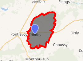
| |
 Thenay  Thenay | |
| Coordinates: 47°23′19″N 1°17′20″E | |
| Country | France |
| Region | Centre-Val de Loire |
| Department | Loir-et-Cher |
| Arrondissement | Romorantin-Lanthenay |
| Canton | Montrichard |
| Commune | Le Controis-en-Sologne |
| Area 1 | 20.03 km2 (7.73 sq mi) |
| Population (2017-01-01)[1] | 881 |
| • Density | 44/km2 (110/sq mi) |
| Time zone | UTC+01:00 (CET) |
| • Summer (DST) | UTC+02:00 (CEST) |
| Postal code | 41400 |
| Elevation | 74–116 m (243–381 ft) (avg. 100 m or 330 ft) |
| 1 French Land Register data, which excludes lakes, ponds, glaciers > 1 km2 (0.386 sq mi or 247 acres) and river estuaries. | |
Population
| Historical population | ||
|---|---|---|
| Year | Pop. | ±% |
| 1793 | 863 | — |
| 1806 | 761 | −11.8% |
| 1821 | 810 | +6.4% |
| 1831 | 846 | +4.4% |
| 1841 | 888 | +5.0% |
| 1851 | 962 | +8.3% |
| 1861 | 1,069 | +11.1% |
| 1872 | 984 | −8.0% |
| 1881 | 1,069 | +8.6% |
| 1891 | 1,119 | +4.7% |
| 1901 | 1,082 | −3.3% |
| 1911 | 1,047 | −3.2% |
| 1921 | 944 | −9.8% |
| 1931 | 907 | −3.9% |
| 1946 | 900 | −0.8% |
| 1954 | 850 | −5.6% |
| 1962 | 848 | −0.2% |
| 1968 | 903 | +6.5% |
| 1975 | 851 | −5.8% |
| 1982 | 773 | −9.2% |
| 1990 | 753 | −2.6% |
| 1999 | 803 | +6.6% |
| 2006 | 851 | +6.0% |
| 2015 | 870 | +2.2% |
References
- "Populations légales 2017". INSEE. Retrieved 6 January 2020.
- Arrêté préfectoral 26 November 2018 (in French)
| Wikimedia Commons has media related to Thenay (Loir-et-Cher). |
| Authority control |
|
|---|
This article is issued from Wikipedia. The text is licensed under Creative Commons - Attribution - Sharealike. Additional terms may apply for the media files.