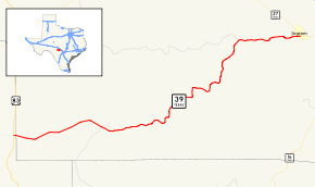
Texas State Highway 39
State Highway 39 (SH 39) is a state highway that runs primarily through the Texas Hill Country primarily in Kerr County.
| ||||
|---|---|---|---|---|
 | ||||
| Route information | ||||
| Maintained by TxDOT | ||||
| Length | 35.3 mi[1] (56.8 km) | |||
| Existed | before 1939–present | |||
| Major junctions | ||||
| West end | ||||
| East end | ||||
| Location | ||||
| Counties | Real, Kerr | |||
| Highway system | ||||
| ||||

History

On January 23, 1918, an intercounty highway was designated from Greenville to Decatur.[2] On August 19, 1918, the intercounty highway extended to Cooper.[3] SH 39 was originally proposed on January 21, 1919, as a route stretching from the Oklahoma border north of Paris to New Mexico, partially along an intercounty highway.[4] It was concurrent with SH 19 north of Cooper and with SH 18 west of Brownfield. On August 16, 1920, the section from McKinney to Decatur was cancelled and redesignated as an intercounty highway.[5] On December 19, 1921, the section from McKinney to Decatur was restored.[6] On August 21, 1923, its western terminus was moved to Jacksboro when the route west of Jacksboro had been renumbered as parts of SH 84, SH 18, and SH 24.[7] Construction had begun. The entire route had been renumbered as a part of SH 24 on June 24, 1931.[8]

On September 23, 1931, a designation on a proposed route from Medina to just north of Leakey was planned (but not designated yet).[9] On April 6, 1932, the proposed route was officially designated as SH 39.[10] On July 15, 1935, SH 39 was cancelled.[11] On February 18, 1936, it was designated on its present-day route.[12] On July 9, 1970, a proposed extension to I-10 was added, but this has not been constructed.
Junction list
| County | Location | mi | km | Destinations | Notes |
|---|---|---|---|---|---|
| Real | | Western terminus | |||
| Kerr | | ||||
| Hunt | |||||
| Ingram | Eastern terminus | ||||
| 1.000 mi = 1.609 km; 1.000 km = 0.621 mi | |||||
References
- Transportation Planning and Programming Division (n.d.). "State Highway No. 39". Highway Designation Files. Texas Department of Transportation. Retrieved July 21, 2018.
- (PDF) https://publicdocs.txdot.gov/minord/MinuteOrderDocLib/003676748.pdf. Missing or empty
|title=(help) - (PDF) https://publicdocs.txdot.gov/minord/MinuteOrderDocLib/003676771.pdf. Missing or empty
|title=(help) - (PDF) https://publicdocs.txdot.gov/minord/MinuteOrderDocLib/003676786.pdf. Missing or empty
|title=(help) - (PDF) https://publicdocs.txdot.gov/minord/MinuteOrderDocLib/003676835.pdf. Missing or empty
|title=(help) - (PDF) https://publicdocs.txdot.gov/minord/MinuteOrderDocLib/003676858.pdf. Missing or empty
|title=(help) - (PDF) https://publicdocs.txdot.gov/minord/MinuteOrderDocLib/003676878.pdf. Missing or empty
|title=(help) - (PDF) https://publicdocs.txdot.gov/minord/MinuteOrderDocLib/003673804.pdf. Missing or empty
|title=(help) - (PDF) https://publicdocs.txdot.gov/minord/MinuteOrderDocLib/003673806.pdf. Missing or empty
|title=(help) - (PDF) https://publicdocs.txdot.gov/minord/MinuteOrderDocLib/003673812.pdf. Missing or empty
|title=(help) - (PDF) https://publicdocs.txdot.gov/minord/MinuteOrderDocLib/003673871.pdf. Missing or empty
|title=(help) - (PDF) https://publicdocs.txdot.gov/minord/MinuteOrderDocLib/003673879.pdf. Missing or empty
|title=(help)