Texas State Highway 146
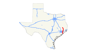
State Highway 146 (SH 146) is a north–south highway in southeastern Texas beginning in Livingston, starting at U.S. Highway 59 (US 59) (Future I‑69) and proceeds south to Liberty, where it meets US 90. It continues in Dayton at US 90 and proceeds south through Baytown, terminating at I‑45 near La Marque and Texas City. The Fred Hartman Bridge over the Houston Ship Channel carries SH 146 traffic.
| ||||
|---|---|---|---|---|
 | ||||
| Route information | ||||
| Maintained by TxDOT | ||||
| Length | 105.966 mi[1] (170.536 km) | |||
| Existed | 1930–present | |||
| Major junctions | ||||
| South end | ||||
| North end | ||||
| Highway system | ||||
| ||||

History
SH 146 was designated on March 19, 1930, from SH 6/US 75 northward to Texas City as a renumbering of SH 6A. On July 2, 1932, SH 146 extended north to Dayton.[2] On August 3, 1932, SH 146 extended north to Cleveland (the plan was to delete SH 132 when this extension was completed).[3] On September 22, 1932, this extension was canceled, and SH 146 was instead extended north to Livingston, replacing SH 132.[4] On December 16, 1967, SH 146 was relocated east of Liberty. On February 21, 1984, SH 146 extended south from SH 3 to I‑45. On March 28, 1996, SH 146 was relocated in Baytown replacing Loop 201. The old route of SH 146 was redesignated as Business State Highway 146-E.

Spur 201 was designated on December 17, 1941, from SH 146 in Black Duck Bay to Main Street.

On September 23, 1959, Spur 201 was redesignated as Loop 201 and was extended to SH 146 at McKinney Road. On October 22, 1976, Loop 201 was extended to SH 146 at Ferry Road. On March 28, 1996, Loop 201 was redesignated as part of SH 146
Business routes
SH 146 has two business routes.
La Porte Business Spur

Business State Highway 146-D (formerly Loop 410) is a business loop that runs from SH 146 in La Porte to Spur 501. The highway was designated on December 1, 1971 as Loop 410 from SH 146 east, north, and west to SH 146, and was marked as a business route of SH 146. On July 28, 1977, the section from SH 146 via Fairmont Parkway to Spur 501 was cancelled, and Loop 410 was rerouted replacing part of Spur 501 and all of Spur 498. Loop 410 was redesignated as Business State Highway 146-D on June 21, 1990.[5][6] On March 26, 2009, the section from Spur 501 via Broadway Street north to Main Street and west via Main Street to SH 146 was given to the city of La Porte.
The original Loop 410 was designated on October 5, 1960, replacing part of Loop 13 from I-410 and I-10 (which replaced the portion of Loop 13 from I-10 to US 90 as this portion of Loop 13 was upgraded to Interstate standards) to I-35. On July 31, 1969, Loop 410 was redesignated as an extension of I-410 as Loop 410 was upgraded to Interstate standards already and so that I-410 could become a full loop.
Baytown Business Loop
Business State Highway 146-E is a business loop that runs from SH 146 through Baytown to SH 146. On March 28, 1996, SH 146 was relocated in Baytown replacing Loop 201, and the old route of SH 146 was redesignated as Business State Highway 146-E.
Junction list
| County | Location | mi | km | Destinations | Notes |
|---|---|---|---|---|---|
| Galveston | Bayou Vista | I‑45 exit 7 southbound, 7A northbound; south end of SH 3 overlap. | |||
| Texas City | |||||
| Interchange; north end of SH 3 overlap | |||||
| South end of freeway | |||||
| North end of freeway | |||||
| Kemah | |||||
| Galveston–Harris county line | Kemah–Seabrook line | Bridge over Clear Lake/Clear Creek | |||
| Harris | Seabrook | Shipyard Drive, 10th Street | Interchange | ||
| | South end of freeway | ||||
| Pasadena | Red Bluff Road | ||||
| Port Road, New Port Road | |||||
| La Porte | Northbound access only | ||||
| Fairmont Parkway | |||||
| Barbours Cut Boulevard | Southbound exit and northbound entrance | ||||
| La Porte–Baytown line | Fred Hartman Bridge over Houston Ship Channel | ||||
| Baytown | South end of Loop 201 overlap; northbound exit and southbound entrance | ||||
| Missouri Street | |||||
| West Main Street | |||||
| J.B. Le Fevre Drive, West Texas Avenue | Southbound exit and northbound entrance | ||||
| Decker Drive | Signed at West Texas Avenue northbound and Garth Road southbound | ||||
| Garth Road | |||||
| North Main Street | |||||
| North end of Loop 201 overlap | |||||
| Harris–Chambers county line | North end of freeway | ||||
| Chambers | |||||
| Mont Belvieu | I-10 exit 797 | ||||
| Liberty | | ||||
| Dayton | South end of US 90 overlap | ||||
| Liberty | |||||
| North end of US 90 overlap | |||||
| | |||||
| Hardin | |||||
| Moss Hill | |||||
| Rye | |||||
| Polk | | ||||
| | |||||
| | |||||
| | |||||
| Livingston | |||||
| Northern terminus; US 59 is the future Interstate 69 | |||||
1.000 mi = 1.609 km; 1.000 km = 0.621 mi
| |||||
References
- Transportation Planning and Programming Division (n.d.). "State Highway No. 146". Highway Designation Files. Texas Department of Transportation. Retrieved July 8, 2018.
- (PDF) https://publicdocs.txdot.gov/minord/MinuteOrderDocLib/003673816.pdf. Missing or empty
|title=(help) - (PDF) https://publicdocs.txdot.gov/minord/MinuteOrderDocLib/003673820.pdf. Missing or empty
|title=(help) - (PDF) https://publicdocs.txdot.gov/minord/MinuteOrderDocLib/003673819.pdf. Missing or empty
|title=(help) - Texas Department of Transportation, Highway Designation File - State Highway Loop 410
- Texas Department of Transportation, Highway Designation File - Business State Highway 146-D