Tetonia, Idaho
Tetonia is a city in Teton County, Idaho, United States, about 50 miles (80 km) northeast of Idaho Falls, Idaho (center to center) and about 425 miles (684 km) northwest of Denver, Colorado. The population was 269 at the 2010 census.
Tetonia, Idaho | |
|---|---|
 Tetonia Post Office, October 2013 | |
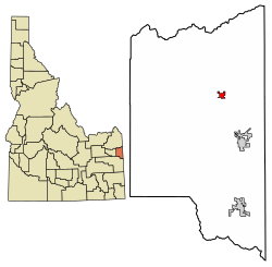 Location of Tetonia in Teton County, Idaho. | |
| Coordinates: 43°48′50″N 111°9′35″W | |
| Country | United States |
| State | Idaho |
| County | Teton |
| Area | |
| • Total | 0.56 sq mi (1.5 km2) |
| • Land | 0.56 sq mi (1.5 km2) |
| • Water | 0.00 sq mi (0.0 km2) |
| Elevation | 6,047 ft (1,843 m) |
| Population | |
| • Total | 269 |
| • Estimate (2018)[3] | 282 |
| • Density | 480/sq mi (190/km2) |
| Time zone | UTC-7 (Mountain (MST)) |
| • Summer (DST) | UTC-6 (MDT) |
| ZIP codes | 83424, 83452 |
| Area code(s) | 208, 986 |
| FIPS code | 16-80470 |
| GNIS feature ID | 0398229 |
| Website | tetoniaidaho |
Geography
According to the United States Census Bureau, the city has a total area of 0.57 square miles (1.48 km2), all land.[4] Tetonia is located at 43°48′50″N 111°9′35″W, in Teton County Idaho.
History
Demographics
| Historical population | |||
|---|---|---|---|
| Census | Pop. | %± | |
| 1950 | 232 | — | |
| 1960 | 194 | −16.4% | |
| 1970 | 176 | −9.3% | |
| 1980 | 191 | 8.5% | |
| 1990 | 132 | −30.9% | |
| 2000 | 247 | 87.1% | |
| 2010 | 269 | 8.9% | |
| Est. 2018 | 282 | [3] | 4.8% |
| U.S. Decennial Census[5] | |||
2010 census
As of the census[2] of 2010, there were 269 people, 95 households, and 62 families residing in the city. The population density was 471.9 inhabitants per square mile (182.2/km2). There were 122 housing units at an average density of 214.0 per square mile (82.6/km2). The racial makeup of the city was 92.2% White, 0.7% Native American, 6.3% from other races, and 0.7% from two or more races. Hispanic or Latino of any race were 10.8% of the population.
There were 95 households of which 46.3% had children under the age of 18 living with them, 49.5% were married couples living together, 11.6% had a female householder with no husband present, 4.2% had a male householder with no wife present, and 34.7% were non-families. 28.4% of all households were made up of individuals and 10.5% had someone living alone who was 65 years of age or older. The average household size was 2.83 and the average family size was 3.61.
The median age in the city was 35.1 years. 36.1% of residents were under the age of 18; 5.1% were between the ages of 18 and 24; 26.7% were from 25 to 44; 24.5% were from 45 to 64; and 7.4% were 65 years of age or older. The gender makeup of the city was 48.7% male and 51.3% female.
Gallery
 Teton Valley Idaho, USA
 Tetonia Idaho Store 1
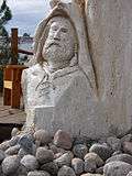 Tetonia Idaho Store Sculpture
 Tetonia Idaho Store 2
 Store in Tetonia Idaho
See also
References
- "2016 U.S. Gazetteer Files". United States Census Bureau. Retrieved Jul 26, 2017.
- "U.S. Census website". United States Census Bureau. Retrieved 2012-12-18.
- "Population and Housing Unit Estimates". Retrieved March 16, 2020.
- "US Gazetteer files 2010". United States Census Bureau. Archived from the original on 2012-01-25. Retrieved 2012-12-18.
- "Census of Population and Housing". Census.gov. Retrieved June 4, 2015.
External links
| Wikimedia Commons has media related to Tetonia, Idaho. |
Municipalities and communities of Teton County, Idaho, United States | ||
|---|---|---|
| Cities | Map of Idaho highlighting Teton County | |
| Unincorporated communities | ||
| Ghost town | ||
| Authority control |
|
|---|