Tenorio Volcano National Park
Tenorio Volcano National Park (Spanish: Parque Nacional Volcán Tenorio) is a National Park in the northern part of Costa Rica, which forms part of the Arenal Tempisque Conservation Area. The jewel of the National Park is the Tenorio Volcano, from which it receives its name. The volcano was made part of the National Park in 1995 and is located about 26 miles northeast from the town of Fortuna in the Guanacaste Province.
| Tenorio Volcano National Park | |
|---|---|
IUCN category II (national park) | |
 | |
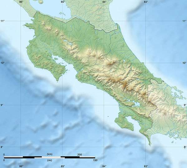 | |
| Location | Costa Rica |
| Coordinates | 10°40′23″N 85°0′54″W |
| Area | 129 km² |
| Established | 1976 |
| Governing body | National System of Conservation Areas (SINAC) |
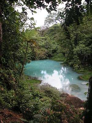
The Rio Celeste (Light Blue River) appears blue due to the emission of sulphur from the volcano and precipitation of calcium carbonate. Thermal springs and small geysers dot the area as do rivers, waterfalls, lagoons and places providing panoramic views. The upper area of the park is dominated by primary cloud forest, while the lower regions are carpeted with rain forest. The Tapir and the rarely seen Puma reside in the area.
There is a ranger station at the base of the volcano that provides visitors with basic information. The volcano's summit can be reached via the Lago Las Dantas Trail, which winds up the volcano and passes through forested terrain before eventually reaching the peak.[1]
References
- Stater, Adam. "The Tenorio Volcano".