Tell Qudadi
Tell Qudadi (Hebrew: תל כודאדי), also known as Tell esh-Shuna (Hebrew: תל א-שונה) is an ancient site located near the mouth of the Yarkon River and the Reading Power Station in the city of Tel Aviv, Israel.[1] It was discovered in 1934 by Jacob Ory and was excavated first by P. L. O. Guy in 1937 and then by Eleazar Sukenik, Shmuel Yeivin and Nahman Avigad in 1937-1938.[1] They discovered a fortress dated to the Iron Age. They believed it was an Israelite fortress built in the 10th or 9th centuries BCE and destroyed by the Neo-Assyrian Empire in the 8th century BCE. However, archaeologists Oren Tal and Alexander Fantalkin have reviewed the preliminary reports of the excavation, as well as its finds and concluded that the site was actually constructed in the 8th century during the time of the Assyrian rule and was abandoned ahead of the empire's withdrawal of the country during the late 7th century BCE.[1]
 Tell Qudadi on the foreground, (the British memorial can be seen in the middle of the mound) and the Reading Power Station in the background | |
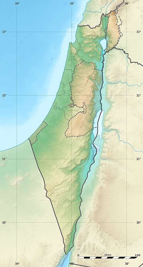 Tell Qudadi Shown within Israel | |
| Alternative name | Tell esh-Shuna |
|---|---|
| Location | |
| Region | Yarkon River basin, Israeli Coastal Plain |
| Coordinates | |
| Type | Fortress |
| History | |
| Cultures | Neo-Assyrian Empire |
| Site notes | |
| Excavation dates | 1937, 1938, 1941, 1966 |
| Archaeologists | Eleazar Sukenik, Shmuel Yeivin |
Besides the fortress, pottery from the Early Bronze Age, Persian, Byzantine and Early Arab periods was found in the site. Among the pottery found was a Greek jar from the island of Lesbos which is the earliest of its kind in the whole Mediterranean coast.[2]
A preservation project was carried out in 2007 by the Israel Antiquities Authority,[2] and today the site can be seen while walking on the Tel Aviv Promenade.[1]
Location
Tell Qudadi is located on the northern bank of the Yarkon River, just north of its estuary with the Mediterranean Sea. Today, it is within the municipal boundaries of the city of Tel Aviv. The site controls an historical trade route passing through the Israeli coastal plain, linking Egypt with the Levant. Being the widest river in the coastal plain, the Yarkon River served during some historical periods as a political, social and cultural border. Tell Qudadi controls the passage on the Yarkon's shallow water and allowed its rulers to monitor trade caravans and also trade ships. From the site, other ancient settlements along the Yarkon River could have been seen, including Giv‘at Beth HaMitbachaim, Tell Qasile, Tel Gerisa, Tel Zeton and possibly even Tel Afek.[3]
Discovery
Until the mid-20th-century Tell Qudadi was known as a sand hill, rising to a height of a couple of meters above sea level. An aerial photograph of the site carried out by the German air force during World War I in 1917 shows it was completely covered in sand and soil.[4] During Palestine campaign of World War I the mound was used as a military stronghold by the Turks.[1] After the British victory, a war monument was set up by the British, commemorating the battle of the crossing of the Yarkon River. This monument was made of an inscribed marble stone, which was imported from the site of Apollonia–Arsuf, some 12 kilometres (7.5 mi) to the north. Tell Qudadi was discovered for the first time in 1934 by Jacob Ory when he surveyed the region after it was reportedly robbed. It was declared a site of antiquities when it was listed in booklet of addenda to Mandatory antiquities sites.[5][1]
Excavations and date
A trial excavation was conducted in October 1937 on the site by P. L. O. Guy on behalf of the British School of Archaeology in Jerusalem. He discovered a wall from the time of the Persian (Achaemenid) rule of the region, in the 6th to 4th centuries BCE as well as Iron Age and Persian pottery. Salvage excavations were carried out by Eleazar Sukenik and Shmuel Yeivin of the Hebrew University of Jerusalem with the help of Nahman Avigad. The excavation lasted from November 1937 to March 1938 and was funded by Pinhas Rutenberg. Two fortress from the Iron Age, one built atop the ruins of the other, were discovered. The site was excavated again in 1941 as part of a preservation plan and in 1966 ahead of an expansion of the Reading Power Station.[6]
As mentioned above, the fortress has two archaeological phases. The first phase, which was securely dated to the late 8th century BCE by Tal and Fantalkin. The walls survived to a maximum height of 3 metres (9.8 ft) and were up to 7 metres (23 ft) wide. The eastern wall was preserved along 33 metres (108 ft) and the northern wall along 17 metres (56 ft). The rest of the walls were probably washed by the sea. The structure was founded on sandstones and its inner walls were made of mudbricks. The fortress had a central courtyard, accessed from the eastern wall. The second phase included a 4-metre-wide (13 ft) gate, accessed by a paved road. Two burnt layers were discovered, indicating that the fortress was violently destroyed.[7]
Additional pottery from different periods was discovered in the site in a layer of soil on top of the ruins including, the Early Bronze Age III,[8] Persian rule, the Byzantine Empire rule and the Early Arab period.
Dating

Yeivin and Avigad disagreed on the date of the construction of the first fortress. Yeivin maintained that it was established in the 10th century BCE, the time of the United Kingdom of Israel. Avigad asserted it was established in the 9th century, after the split into the Kingdom of Israel (Samaria) and Kingdom of Judah. As for the second fortress, the archaeologists claimed it was destroyed in the late 8th century, based on layers of destruction that could be seen inside it. The reason for the destruction was in their view part of the 732 BCE military campaign of the Assyrian king Tiglath-Pileser III in the region. The archaeologists also claimed to have found pottery from the 7th century, showing the site continued to be in use after the destruction. However, the final report of the excavation was never published and some of their assumptions were disputed by Archaeologists Oren Tal and Alexander Fantalkin in a published in study from 2009.[7]
Tal and Fantalkin have examined the notes written by these earlier archaeologists as well as the pottery they had found. They came to the conclusion that the site was not settled during the Israelite period, but no earlier than the late 8th century BCE (the Assyrian campaign took place in 732 BCE), more than a century after the original date given by Sukenik and Yeivin in the 1930s. Therefore, this fortress was built by the Assyrian rulers or their vassals. It was part of a chain of forts built by the Assyrians along the coast. Due to the absence of pottery characteristic of the end of the 7th century BCE, the abandonment of the fortress was dated to some time after 650 BCE, around the time of the Assyrian withdrawal of the country.[9] This view was further supported by a unique find: a Greek amphora (a type of jar used to store oil), from the island of Lesbos. It is the earliest known Lesbian ceramic work in the whole Mediterranean, which may have reached the site with a trade ship.[10]
References
- Shapira, Ran (2016-05-28). "Archaeologists Solve Mystery of 2,700-year-old Fortress in Tel Aviv". Haaretz. Retrieved 2018-02-18.
- "Tell Qudadi (Tell a-Shuni) - initial preservation". Conservation Department - Heritage Conservation in Israel (in Hebrew).
- Oren Tal; Alexander Fantalkin (2009). "Re-Discovering the Iron Age Fortress at Tell Qudadi in the Context of Neo-Assyrian Imperialistic Policies" (PDF). Palestine Exploration Quarterly. Palestine Exploration Fund. 141 (3): 189. doi:10.1179/003103209X12483454548121.
- Oren Tal and Alexander Fantalkin (2009). "An Iron Age IIB Fortress at Tell Qudadi: A Preliminary Study / מצודה מתקופת הברזל בתל קודאדי: מחקר ראשוני". Eretz-Israel: Archaeological, Historical and Geographical Studies / ארץ-ישראל: מחקרים בידיעת הארץ ועתיקותיה (in Hebrew). Israel Exploration Society. EPHRAIM STERN VOLUME: 192–205. JSTOR 23631324.
- Tal and Fantalkin 2009, p. 188-189.
- Tal and Fantalkin 2009, p. 189-190.
- Tal and Fantalkin 2009, p. 194-195.
- Ram Gophna; Yitzhak Paz (2011). "Tell Qudadi and Tel Gerisah: Two Early Bronze III Sites on the Yarkon River". Tel Aviv. 38: 42–51. doi:10.1179/033443510x12931017059260 – via ACADEMIA.
- Tal and Fantalkin 2009, p. 199.
- Tal and Fantalkin 2009, p. 198.
External links
