Te Kao
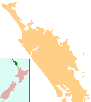
Te Kao is a district on the Aupouri Peninsula of Northland, New Zealand. State Highway 1 passes through the district. Cape Reinga is 46 km to the north, and Houhora is 24 km to the south. The Aupouri Forest and Ninety Mile Beach are to the west.[1][2]
Te Kao | |
|---|---|
 Te Kao | |
| Coordinates: 34°39′05″S 172°58′13″E | |
| Country | New Zealand |
| Region | Northland Region |
| District | Far North District |
The New Zealand Ministry for Culture and Heritage gives a translation of "the dried kūmara" for Te Kao.[3]
History and culture
The Te Aupōuri athlete Te Houtaewa started his legendary run along Ninety Mile Beach at Te Kao.[4]
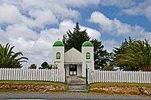
The local Pōtahi Marae is a traditional meeting ground for Te Aupōuri,[5] and includes the Waimirirangi|Waimirirangi or Haere-ki-te Rā meeting house.[6]
Education
Te Kura o Te Kao is a coeducational full primary (years 1-8) school with a roll of 31 students as of March 2020.[7][8] The school started as Te Kao Native School in 1881.[9]It became Te Kao Area School providing education up to seventh form until 1999, when it became a primary school.[10] The school celebrated its 125th anniversary on Labour Weekend, 2006.[11] From the start of 2019, it became a designated character school,[12] and will extend to include years 9 and 10 in 2020.[13]
Notes
- Peter Dowling (editor) (2004). Reed New Zealand Atlas. Reed Books. pp. map 2. ISBN 0-7900-0952-8.CS1 maint: extra text: authors list (link)
- Roger Smith, GeographX (2005). The Geographic Atlas of New Zealand. Robbie Burton. pp. map 15. ISBN 1-877333-20-4.
- "1000 Māori place names". New Zealand Ministry for Culture and Heritage. 6 August 2019.
- "Muriwhenua Tribes - Ancestors". Te Ara: The Encyclopedia of New Zealand.
- "Te Kāhui Māngai directory". tkm.govt.nz. Te Puni Kōkiri.
- "Māori Maps". maorimaps.com. Te Potiki National Trust.
- "New Zealand Schools Directory". New Zealand Ministry of Education. Retrieved 26 April 2020.
- Education Counts: Te Kura o Te Kao
- "Te Aupouri and the Crown: Deed of Settlement of Historical Claims" (PDF). 28 January 2012. p. 27.
- Creech, Wyatt (8 October 1998). "Te Kao Area School to Become Primary School". New Zealand Parliament.
- "School Reunion". maori.org.nz.
- Casey, Katrina (5 February 2018). "Designation of Te Kao School (1) as a Designated Character School". New Zealand Government.
- "Te Kura o Te Kao - 09/07/2019". Education Review Office. 9 July 2019.
- Parkes, W. F. (c. 1965). The Visitors' Guide to the Far North - Mangonui County (3rd ed.). p. 44.