Taylors Island, Maryland
Taylors Island is an unincorporated community and census-designated place in Dorchester County, Maryland, United States,[1] in the state's Eastern Shore region. The population was 173 at the 2010 census.[2] It is known for hunting, crabbing and fishing. Ridgeton Farm was listed on the National Register of Historic Places in 1977.[3] Bethlehem Methodist Episcopal Church and Grace Episcopal Church Complex were listed in 1979.[3]
Taylors Island, Maryland | |
|---|---|
 | |
 Taylors Island Location in Maryland  Taylors Island Taylors Island (the United States) | |
| Coordinates: 38°28′8″N 76°17′56″W | |
| Country | |
| State | |
| County | |
| Area | |
| • Total | 4.16 sq mi (10.78 km2) |
| • Land | 4.14 sq mi (10.73 km2) |
| • Water | 0.02 sq mi (0.05 km2) |
| Elevation | 3.0 ft (0.9 m) |
| Population (2010) | |
| • Total | 173 |
| • Density | 42/sq mi (16.1/km2) |
| Time zone | UTC−5 (Eastern (EST)) |
| • Summer (DST) | UTC−4 (EDT) |
| ZIP code | 21669 |
| Area code(s) | 410, 443, and 667 |
| FIPS code | 24-76925 |
| GNIS feature ID | 591395[1] |
Geography
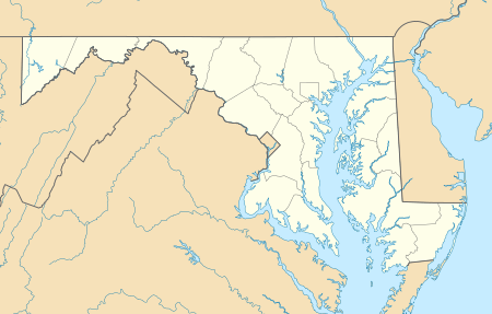
Taylors Island is in western Dorchester County on the eastern shore of Chesapeake Bay. It is separated from the mainland on the east by Slaughter Creek. Maryland Route 16 leads northeast from Taylors Island 16 miles (26 km) to Cambridge, the Dorchester County seat.
According to the United States Census Bureau, the Taylors Island CDP occupies the central, northern, and western parts of the island. The CDP has a total area of 4.2 square miles (10.8 km2), of which 0.02 square miles (0.05 km2), or 0.47%, is water.[2]
References
- "Taylors Island". Geographic Names Information System. United States Geological Survey.
- "Geographic Identifiers: 2010 Demographic Profile Data (G001): Taylors Island CDP, Maryland". U.S. Census Bureau, American Factfinder. Retrieved October 29, 2015.
- "National Register Information System". National Register of Historic Places. National Park Service. April 15, 2008.
External links
Municipalities and communities of Dorchester County, Maryland, United States | ||
|---|---|---|
| City | 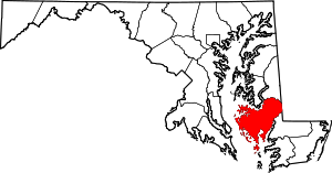 | |
| Towns | ||
| CDP | ||
| Other communities | ||
| Footnotes | ‡This populated place also has portions in an adjacent county or counties | |