Taulis
Taulis (Catalan: Teulís) is a commune in the Pyrénées-Orientales department in southern France.
Taulis Teulis | |
|---|---|
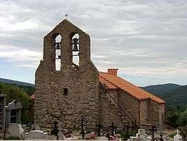 The parish church of Saint-Jean L'Évangéliste, in Taulis | |
Location of Taulis 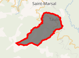
| |
 Taulis  Taulis | |
| Coordinates: 42°31′29″N 2°38′00″E | |
| Country | France |
| Region | Occitanie |
| Department | Pyrénées-Orientales |
| Arrondissement | Céret |
| Canton | Le Canigou |
| Intercommunality | Haut Vallespir |
| Government | |
| • Mayor (2001–2008) | Jean-Louis Portanier |
| Area 1 | 6.19 km2 (2.39 sq mi) |
| Population (2017-01-01)[1] | 52 |
| • Density | 8.4/km2 (22/sq mi) |
| Time zone | UTC+01:00 (CET) |
| • Summer (DST) | UTC+02:00 (CEST) |
| INSEE/Postal code | 66203 /66110 |
| Elevation | 340–1,360 m (1,120–4,460 ft) (avg. 550 m or 1,800 ft) |
| 1 French Land Register data, which excludes lakes, ponds, glaciers > 1 km2 (0.386 sq mi or 247 acres) and river estuaries. | |
Geography
Taulis is located in the canton of Le Canigou and in the arrondissement of Céret.
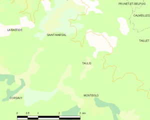
Map of Taulis and its surrounding communes
Population
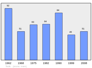
Population 1962-2008
References
- "Populations légales 2017". INSEE. Retrieved 6 January 2020.
| Wikimedia Commons has media related to Taulis. |
| Authority control |
|
|---|
This article is issued from Wikipedia. The text is licensed under Creative Commons - Attribution - Sharealike. Additional terms may apply for the media files.