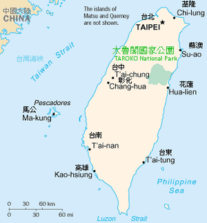
Taroko National Park
Taroko National Park (Chinese: 太魯閣國家公園; pinyin: Tàilǔgé Gúojiā Gōngyuán; Pe̍h-ōe-jī: Thài-ló͘-koh Kok-ka Kong-hn̂g) is one of the nine national parks in Taiwan and was named after the Taroko Gorge, the landmark gorge of the park carved by the Liwu River. The park spans Taichung Municipality, Nantou County, and Hualien County and is located at Xiulin Township, Hualien County, Taiwan.
| Taroko National Park | |
|---|---|
IUCN category II (national park) | |
 Tunnel of Nine Turns | |
 Map of Taroko national park | |
| Location | Taiwan |
| Nearest city | Xiulin, Hualien |
| Coordinates | 24°10′N 121°20′E |
| Area | 920 km2 (360 sq mi) |
| Established | 28 November 1986 |
History
This national park was originally established as the Tsugitaka-Taroko National Park (Japanese: 次高タロコ国立公園, Hepburn: Tsugitaka Taroko kokuritsu kōen) by the Governor-General of Taiwan on 12 December 1937 when Taiwan was part of the Empire of Japan. After the Empire of Japan's defeat in World War II, the Republic of China took over Taiwan in consequence. The ROC government subsequently abolished the park on 15 August 1945. It was not until 28 November 1986 that the park was reestablished.[1]
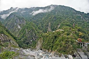
Taroko National Park covers an area of 92,000 hectares. It is located in Hualien County, Taichung City and Nantou County– and is home to unique geological and natural resources, including twenty seven peaks over 3000 meters (Baiyu, 100 Top Peaks in Taiwan) located in and around the Qilai and Nanhu Mountain ranges. The spectacular marble gorge of Taroko, the Qingshui Cliff rising high above the Pacific Ocean, the peaceful trail along the Shakadang River, and the cascading waterfalls of Baiyang trail are some of the treasures and delights of “earth and the heavens” that await visitors to the Park.
The rich and varied terrain that has nurtured an opulent plant and animal life in the Park is due in large part to the steep climb in altitude: from the Pacific Ocean on the east border of the Park to the majestic peaks of the Central Mountain Range that make up the Park’s western border one can go from sea level to well over 3000 meters in a day’s time. On the Central Cross-Island Highway(Provincial Highway 8) one can experience the changes in altitude while going from the Asian tropical deciduous forests to the high mountain pine and cedar forests as though traveling in a dream. The changes all pass one by within one short day and words cannot describe the exquisite beauty of this area, a beauty that has attracted people for countless years.
Origin of the name
According to the Xiulin Township Hall published “Truku Language Simplicity Dictionary” says “Truku” meanings “A living terrace which was surrounded (formed) by three valleys”.
The Truku people used to live in the upper stream of the Zhuoshui River where is located at Jinguan, Hezuo Village, Ren’ai Township, Nantou County region (Middle of Taiwan). Due to an increase in population, the lack of farmland and hunting grounds, about the end of the 18th Century, they found a vast hunting area east of the Central Mountain Range. And they started to migrate eastwards crossing over Mt. Qilai (Mt. Qilai: Truku language called ”Klbiyun”) to the Liwu River. They settled in the Taroko mountain region to raise their offspring. The Truku people live at the upper, middle and lower reaches of Liwu River areas are used to call “Taroko”. That is the origin of the name Taroko.
Geology
Taiwan was created through the collision of the Philippine and the Eurasian plates in what is known as the Penglai Orogeny. This movement occurred some four million years ago and is responsible for the formation of the Central Mountain Range that runs north-south through much of Taiwan. Even today the shift in tectonic plates continues and this area continues to rise a few millimeters every year.
Marble formations only revealed themselves after millions of years of erosion and continued uplifting. Calcium Carbonate remains accumulated some 230 million years ago. These deposits through time, pressure, and the elements were gradually lithified into limestone that in turn metamorphosed into marble. As Taiwan was uplifted from the pressures of the colliding plates, the erosive forces of weathering and water worked to carve out the gorges we see today.
Erosion by the river against the constantly elevating land combined with the heavy sub-tropical rains resulted in a rapid transformation of the landscape. Marble, which is relatively hard and resistant to erosion, nevertheless relented to these forces resulting in the unusually steep and narrow canyons. [2]
The gorge itself was carved into the marble by the erosive power of the Liwu River.[3]
Sights include:
- Tunnel of Nine Turns (九曲洞 Jiuqudong, pictured at right) (Opened in November 2017)
- Eternal Spring Shrine (pictured below)
- Yenzikou, Swallow Grotto Trail (燕子口)
- Jinheng Park (靳珩公園)
- Cimu Bridge, Motherly Devotion Bridge (慈母橋)
- Tianxiang
- Zhuilu Cliff (錐麓斷崖)
- Liufang Bridge (流芳橋)
- Dayuling (大禹嶺)
- Buluowan (布洛灣)
- Qingshui Cliffs (清水斷崖)
- Shakadang Trail
- Changuang Temple (禪光寺)
- Baiyang Trail (白楊步道)
Transportation
Taroko National Park is typically accessed from nearby Hualien City where various tours, buses and transport options are available. The closest train station to the park is actually the small, local Xincheng Station of the Taiwan Railways Administration, but there are very limited options to reach the park from there.
Gallery
 Xiangde Temple at Tianxiang
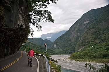 Bicycling uphill
 Bicyclists share narrow roads with motor vehicles
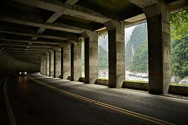 Rockfall Prevention Tunnel(明隧道)
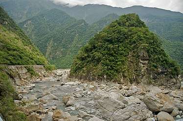 Gorge views
 Taroko Gorge at Swallow Grotto Trail
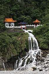 Eternal Spring Shrine, Taroko National Park, Hualien on the east coast.
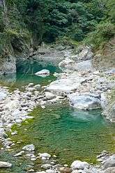 Shakadang River
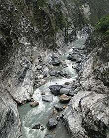 Liwu River
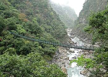 Zhuilu Suspension Bridge
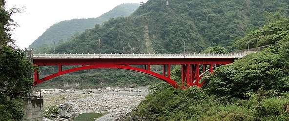 (Shakadang) Bridge of 100 Lions
 Changchun Bridge
.jpg) Zhuilu Suspension Bridge(East of Zhuilu Old Road)
Zhuilu Suspension Bridge(East of Zhuilu Old Road)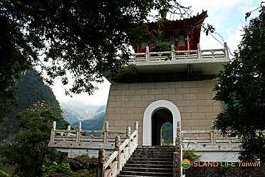 Bell Tower at Eternal Spring Shrine Trail
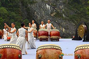 Taroko Music Festival
 Changuang Temple
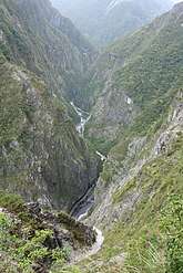 Taroko Gorge from Zhuilu Old Road
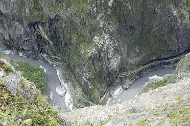 Zhuilu Tunnel from Zhuilu Old Road
See also
- List of national parks in Taiwan
References
- Wei-han, Chen (15 June 2017). "Mining companies to face make-up reviews: Cabinet". Taipei Times. Retrieved 15 June 2017.
- "Landform and Geology". Taroko National Park Official Website. Archived from the original on 2007-07-01. Retrieved 2007-07-04.
- Petley, D.N. (1998). "Geomorphological mapping for hazard assessment in a neotectonic terrain". The Geographical Journal. 164 (2): 183–201. doi:10.2307/3060369. JSTOR 3060369.