Tanintharyi
Tanintharyi or Taninthayi (widely known during the British occupation and since as Tenasserim) is a small town in Taninthayi Township, Myeik District, in the Tanintharyi Region of south-western Myanmar. It is the administrative seat for the township. The town is located on the Great Tenasserim River which eventually enters the sea at Myeik.[1][2] The town is located at the confluence of this river and a tributary known as the "Little Tenasserim River" which runs south.
ဏၚ်ကသဳ Tenasserim | |
|---|---|
Town | |
 ဏၚ်ကသဳ Location in Burma | |
| Coordinates: 12°5′N 99°1′E | |
| Country | |
| Region | |
| District | Myeik District |
| Township | Tanintharyi Township |
| Time zone | UTC+6.30 (MMT) |
The town is built on a hill slope on the site of an ancient city which, for hundreds of years, served as the principal port of Siam.[3] Ethnic Bamars (Burmans) (with Dawei and Myeik subgroups) are the majority community here. The hill people who are non-Buddhists are most numerous here. The majority of the population speak the Tavoyan dialect.[4][5][6]
Etymology
The town name has varied, often based on the nationality of the traveller. These variations include Tanaosi or Tannaw (Siamese); Tanah Sari (Malay); Tenanthari, Tanncthaice, Ta-nen-tkd-ri, and Tanang-sci (Burmese); and Ta-na-ssu-li-sen (Chinese).[7] Other sources have referred to it as: Thenasserim, Tenáscri, Tciiaçar, Tanater, Tarnassari, Tenazar, Tannzzari, Tanaçari, Tanaçary, Tanaçarim, Taunararin, Tanaçarij, Tcnaiarij, Tanacarim, Tanassarim, Tenassarim, Tenasari, Tanussarin, Tenascri, Dahnnsari, Tanaseri', Tenauri, Tanasserin, Tananarino, Tenassarim, Tenassere, Tanararij, Tanassaria, Tonazarin, and Denouservn.[8]
History
The town's importance as a trade partner depended on it serving as the starting-point on the western coast of Siam as an overland route to the capital, Ayuthia. In addition, it was a port at which smaller vessels could unload their cargoes, and thus avoid circumnavigating around the peninsula.[9] Trade links were strong with Siam who also controlled this territory and got tributes from Burma. Trading was done with them through Dawei and Myeik along the eastern hill ranges of Myanmar.
The town enjoyed a reputation for trade with European nations since the 17th century. In 1759, the Burmese conqueror Aloung-bhura (Moung-oung-zaya) invaded the town. He pillaged it the following year and further damaged it in 1765. By 1767, it was destroyed by Ayuthia, and in the town's fall, the seaport of Mergui was brought to commercial ruin.[9]
The Toungoo dynasty, which ruled this area in the 16th century, lost to the British during the three wars fought between 1824 and 1885; Rakhine and Thainthreyi came under the British who, thereafter, re-established the Burman Dynasty.[4][5]
Geography

Tanintharyi lies on the southern bank of the Great Tenasserim River, tucked away into a small peninsula, with the Great Tenasserim River to the north and west and the Little Tenasserim River to the east. Settlements close to Tanintharyi include Kadaw to the west, Mawtone across the river to the north-west and Bangyok to the north-east.[1] It is characterized by a narrow coastal zone flanked by mountains, and is situated between the Gulf of Martaban and Victoria Point, just north of the Equator. The coast land has a long maritime history of trade dealings with the rest of the world, particularly India on the Coromandel coast, Siam and the Middle East.[4][5]
Culture
Less than a mile from the present village stands and erected by the Siamese at the city's founding in 1383 AD is a large, roughly cut stone pillar weighing several tons which is said to have once been the original city centre.[10] Legend has it that a live woman was thrown into the hole where the pillar was planted and that she became the city's guardian angel.[10]
In earlier days, approximately 4 sq mi (10 km2) of the town were surrounded by a brick and mud wall. Though the wall has since been dismantled and the bricks repurposed within other buildings such as the jail, the wall's foundation can still be seen in certain places.[10] Its courthouse was erected on a hill above the village, and this is also the site of two ancient pagodas.[3]
In 1877, the population was approximately 666 inhabitants.[11] As of 1916, the village contained approximately 100 houses.[3]
Resources
The town's agricultural resources include the cultivation of rubber and fruit crops. Pearl farms are also established here by the Ministry of Mines.[5] Tanintharyi is located within the south-east Asian tin zone.[5]
References
- Google Maps (Map). Google.
|access-date=requires|url=(help) - Bing Maps (Map). Microsoft and Harris Corporation Earthstar Geographics LLC.
|access-date=requires|url=(help) - United States Hydrographic Office (1916). Bay of Bengal pilot: Bay of Bengal and the coasts of India and Siam, including the Nicobar and Andaman islands. Govt. Print. Office. p. 418. Retrieved USHydro. Check date values in:
|accessdate=(help) - Reid, Robert; Grosberg, Michael (2005). Myanmar (Burma). Lonely Planet. pp. 162–163. ISBN 1-74059-695-1. Retrieved 2010-11-15.
- Eur (2002). "Physical and Social Geography". Far East and Australasia 2003. Psychology Press. p. 859. ISBN 1-85743-133-2.
- Minahan, James (2002). "Tavoyans". Encyclopedia of the Stateless Nations: S-Z. Greenwood Publishing Group. p. 1863. ISBN 0-313-32384-4.
- Anderson, pp. 11–12
- Anderson, p. 11-12
- Anderson, John (1890). English intercourse with Siam in the seventeenth century. K. Paul, Trench, Trübner, & co., ltd. p. 5.
- Royal Scottish Geographical Society (1898). "South Tenasserim and the Mergui Archipelago". Scottish Geographical Magazine. 1898. 14: 453–454.CS1 maint: location (link)
- Hunter, Sir William Wilson (1881). The imperial gazetteer of India. 9. Trübner & Co. p. 25.
Capital: Dawei | ||
| Dawei District |  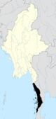 | |
| Kawthaung District |
| |
| Myeik District | ||
| Main cities and towns | ||