Tangutur
Tangutur is a town in Prakasam district of the Indian state of Andhra Pradesh. It is a mandal headquarters in Ongole revenue division. Nearby towns are Singarayakonda, Kandukur, Prakasam district, Kondapi and the nearest city will be Ongole. [1]
Tangutur | |
|---|---|
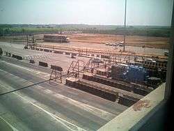 Tollgate on National Highway 16 at Tangutur, Prakasam district | |
.svg.png) Tangutur Location in Andhra Pradesh, India  Tangutur Tangutur (India) | |
| Coordinates: 15.35°N 80.05°E | |
| Country | India |
| State | Andhra Pradesh |
| District | Prakasam |
| Talukas | Tangutur |
| Population | |
| • Total | 27,652 |
| Languages | |
| • Official | Telugu |
| Time zone | UTC+5:30 (IST) |
| PIN | 523274 |
| Telephone code | 08592 |
| Vehicle registration | AP |
Geography
Tangutur is located at 15°20'26"N 80°2'4"E. It has an average elevation of 36 feet. The total area of the town was 3,760 hectares (9,300 acres).
Demographics
According to the 2011 Census of India, with total 7200 families, the total population of Tangutur was 27,652 comprising 13,674 males and 13,978 females. Tangutur has higher literacy rate compared to Andhra Pradesh. In 2011, literacy rate of Tangutur was 68.68% compared to 67.02% of Andhra Pradesh. In Tangutur Male literacy stands at 77.28% while female literacy rate was 60.34%.[2]
References
- "Prakasam District Mandals" (PDF). Census of India. pp. 159, 178. Retrieved 19 June 2015.
- "Sub District Information". census2011.co.in. Retrieved 24 April 2019.