Takum
Takum is a Local Government Area in Taraba State, Nigeria. Its headquarters are in the town of Takum, it is created out of Wukari local government in june1976, at 7°16′00″N 9°59′00″E. Takum borders the Republic of Cameroon in the south, Ussa Local Government to the west, Donga Local government to the north, District within Takum are Abuja, kwambai, jenuwa, Rogo, Dutse, Kashimbila, Bete, Chanchanji, Bika.
Ikam Mbarikam Ikam | |
|---|---|
LGA and town | |
| Takum | |
| Nickname(s): TTM | |
| Motto(s): Mbarikam | |
 Ikam Location in Nigeria | |
| Coordinates: 7°15′N 9°59′E | |
| Country | |
| State | Taraba State |
| Local Government Headquarters | Takum |
| Government | |
| • Local Government Chairman and the Head of the Local Government Council | Shiban Y. Tikari[1] |
| Area | |
| • Total | 2,503 km2 (966 sq mi) |
| Population (2006 census) | |
| • Total | 135,349 |
| Time zone | UTC+1 (WAT) |
| 3-digit postal code prefix | 671 |
| ISO 3166 code | NG.TA.TA |
Takum is the traditional headquarter of kuteb People, other tribes in Takum are Kpanzon, Chamba, Ichen, Hausa/Fulani, Tiv[2]
Takum is under the Traditional Leadership of Ukwe Takum.
It has an area of 2,503 km² and a population of 135,349 at the 2006 census.
The postal code of the area is 671.[3]
Languages
Takum is highly linguistically diverse, with more than a dozen distinct local languages (mostly Jukunoid languages and Southern Bantoid languages).[4]
- Bete language (in Bete town)
- Bukwen language
- Bukwen language
- Hõne language
- Jukun Takum language
- Kapya language (in Kapya village)
- Kpan language
- Kpati language [extinct]
- Kutep language
- Lufu language (in Lufu and Lufu Jauro)
- Mashi language
- Samba Leko language
- Tiv language
- Yukuben language
References
- "Taraba State Local Government Council Chairmen". Nigeria: Taraba State. Retrieved 11 February 2020.
- http://www.kuteb.tripod.com
- "Post Offices- with map of LGA". NIPOST. Archived from the original on 7 October 2009. Retrieved 20 October 2009.
- Languages of Nigeria (Ethnologue 22nd edition)
State capital: Jalingo | ||
| Local Government Areas | 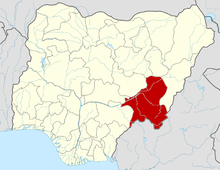 | |