T'ula Qullu
T'ula Qullu (Aymara t'ula wood, burning material, qullu mountain,[2] "wood mountain", also spelled Thola Khollu, Thola Kkollu)[1][3] or Suri Qullu (Aymara suri rhea,[4] "rhea mountain", also spelled Zuricollo)[5] is a 4,842-metre-high (15,886 ft) mountain in the Andes of Bolivia. It is situated in the La Paz Department, José Manuel Pando Province, Catacora Municipality, T'ula Qullu Canton.[3] T'ula Qullu lies near the border to Peru, between the Peruvian mountain Chila 5,184 m (17,008 ft) in the west and Sinijawi 5,068 m (16,627 ft) in the east, northwest of the Sirk'i volcano.[1][3]
| T'ula Qullu | |
|---|---|
| Suri Qullu | |
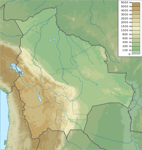 T'ula Qullu Location in Bolivia | |
| Highest point | |
| Elevation | 4,842 m (15,886 ft) [1] |
| Coordinates | 17°15′30″S 69°33′58″W |
| Geography | |
| Location | Bolivia, La Paz Department José Manuel Pando Province |
| Parent range | Andes |
See also
- Parina Quta
References
- Bolivian IGM map 1:50,000 Thola Kkollu 5642-II
- "Diccionario Quechua - Aymara al español". katari.org. Retrieved February 26, 2016.
- "Catacora". INE, Bolivia. Retrieved February 26, 2015.
- Radio San Gabriel, "Instituto Radiofonico de Promoción Aymara" (IRPA) 1993, Republicado por Instituto de las Lenguas y Literaturas Andinas-Amazónicas (ILLLA-A) 2011, Transcripción del Vocabulario de la Lengua Aymara, P. Ludovico Bertonio 1612 (Spanish-Aymara-Aymara-Spanish dictionary)
- escale.minedu.gob.pe - UGEL map of the Tarata Province (Tacna Region)
This article is issued from Wikipedia. The text is licensed under Creative Commons - Attribution - Sharealike. Additional terms may apply for the media files.