Temara
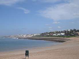
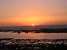
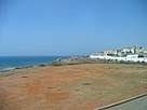
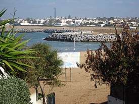
Temara (Arabic: تمارة; Berber languages: ⵜⵎⴰⵔⴰ) is a coastal city in Morocco.[2] It is located in the region of Rabat-Salé-Kénitra, directly south of Rabat on the Atlantic coast, in the suburban area of the capital. The city has 313,510 inhabitants as of 2014[1] and is the capital of Skhirate-Témara Prefecture. It is twinned with Saint Germain en Laye, France. The city has beaches and a small pleasure port.
Temara تمارة ⵜⵎⴰⵔⴰ | |
|---|---|
    | |
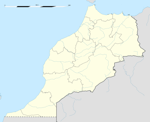 Temara Location in Morocco | |
| Coordinates: 33°55′36″N 6°54′44″W | |
| Country | |
| Region | Rabat-Salé-Kénitra |
| Prefecture | Skhirate-Témara |
| Population (2014)[1] | |
| • Total | 313,510 |
| • Rank | 12th in Morocco |
| Time zone | UTC+1 (CET) |
History
Temara was founded in the twelfth century (1130–1163) by Sultan Othman El Arfaoui, who built a mosque there. Five centuries later, Mulai Ismail built the current wall and made from Temara a ribat (casern) around Said mosque. Later, Mulay Abd ar-Rahman (1822–1859) and Mulay Abdul Aziz (1894–1908), completed (Kasbah of the Udayas) as religious and military camps.
Climate
Temara has a hot-summer Mediterranean climate (Köppen climate classification Csa). In winter there is more rainfall than in summer. The average annual temperature in Temara is 17.8 °C (64.0 °F). About 505 mm (19.88 in) of precipitation falls annually.
| Climate data for Temara | |||||||||||||
|---|---|---|---|---|---|---|---|---|---|---|---|---|---|
| Month | Jan | Feb | Mar | Apr | May | Jun | Jul | Aug | Sep | Oct | Nov | Dec | Year |
| Average high °C (°F) | 17.2 (63.0) |
18.4 (65.1) |
20.3 (68.5) |
21.8 (71.2) |
23.6 (74.5) |
26.0 (78.8) |
28.1 (82.6) |
28.8 (83.8) |
27.6 (81.7) |
25.4 (77.7) |
21.2 (70.2) |
18.4 (65.1) |
23.1 (73.5) |
| Average low °C (°F) | 7.3 (45.1) |
7.7 (45.9) |
9.3 (48.7) |
10.8 (51.4) |
13.1 (55.6) |
15.9 (60.6) |
17.6 (63.7) |
18.2 (64.8) |
16.9 (62.4) |
14.3 (57.7) |
10.9 (51.6) |
8.4 (47.1) |
12.5 (54.6) |
| Average precipitation mm (inches) | 75 (3.0) |
66 (2.6) |
61 (2.4) |
53 (2.1) |
21 (0.8) |
5 (0.2) |
0 (0) |
1 (0.0) |
7 (0.3) |
41 (1.6) |
74 (2.9) |
101 (4.0) |
505 (19.9) |
| Source: Climate-Data.org,Climate data | |||||||||||||
Economy
Temara is close to Morocco's two main cities, Rabat, the capital, and economic center Casablanca.
Two main zones share the essence of the industrial units in the city of Temara. The first is in the direction of Casablanca, and, with a total area of 120 hectares, extensible to 300 Ha work 55 industrial units in this zone, contains the more clean industry sectors (textiles, packaging, printing, food). The second industrial zone is at the other end of town, in the direction of Rabat. It is the industrial zone Attasnia, which, with a total of 20 hectares, contains 23 industrial units (such as textiles, electronics, chemicals).
People
The population was at first constituted by Zaer tribes and different tribes of Oudayas (Military groups from different regions of Morocco were established by the Sultan, as exchange of their Military service to the Sultan they had the right to cultivate the land). Now the population was diversified by all ethnicities in Morocco: Arabs and various Amazigh groups (Riffians, Chleuhs and Hassanis).
External links
- (in Arabic) Temara City
See also
References
- "POPULATION LÉGALE DES RÉGIONS, PROVINCES, PRÉFECTURES, MUNICIPALITÉS, ARRONDISSEMENTS ET COMMUNES DU ROYAUME D'APRÈS LES RÉSULTATS DU RGPH 2014" (in Arabic and French). High Commission for Planning, Morocco. 8 April 2015. Retrieved 29 September 2017.
- Temara Location information.
Capital: Rabat | |
| Provinces and Prefectures |
|
| Cities | |